uxbridge UB7 Postcodes
Spending a fortune on conveyancing?

Compare instant, low-cost online quotes from trusted conveyancing solicitors.
Backed by experts, our no-obligation service searches through the best conveyancing quotes on the market to save you time and money.
Uxbridge (UB7)
The UB7 postcode area is located in the Uxbridge postcode town region, within the county of Greater London, and contains a total of 950 individual postcodes.
There are 9 electoral wards in the UB7 postcode area, including Greenford, Hayes, Northolt, Southall, Uxbridge, West Drayton which come under the local authority of the Hillingdon Council.
Combining the whole postcode region, 16% of people in UB7 are classed as having an AB social grade, (i.e. 'white-collar' middle-upper class), compared to 27% across the UK.
This does not mean that the people of UB7 are poorer than other areas, but it may give an indication that there are areas of deprivation.
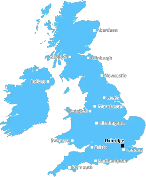
The UB7 postcode is located in the Uxbridge district of west-central London, in the UK. It covers the areas of Cowley, Yiewsley, West Drayton and Uxbridge itself, making it one of the most populous postcodes in Greater London. The postcode covers all of the western part of Hillingdon borough, bordering Hounslow and Heathrow Airport in some parts.
Reflecting the diversity of the district, UB7 is home to a wide range of people of different backgrounds and income levels. The area is a popular residential district and is also home to a large number of hospitals, businesses, colleges and more.
Connectivity in UB7 is very good due to the presence of 3 train stations (Uxbridge, West Drayton and Hillingdon) and numerous bus services. The Piccadilly and Metropolitan lines run through Uxbridge Tube Station, linking the area with Central London and the City.
The area also contains a number of parks and open spaces, such as Richard Jones Park, The Folly and Frays Park. There are several shopping centres, leisure facilities and tourist attractions, such as the London Motor Museum.
UB7 is a vibrant, cosmopolitan and multi-cultural area, where people from different cultures and backgrounds mix and mingle on a daily basis. It is a great place to live and work in, offering excellent access to work, leisure and entertainment. The area is also home to a number of prestigious companies such as Procter & Gamble, British Airways and Unilever, making it an attractive residential and business district.

Demographics
Greater London

UB7 is located in the county of Greater London, in England.
Greater London has a total population of 8,778,500, making it the 1st largest county in the UK.
Greater London has a total area of 606 square miles, and a population density of 5594 people per square kilometre. For comparison, Greater London has a density of 5,618 people/km2.
| Outward Code | UB7 |
| Postal Town | Uxbridge |
| MSOA Name | Hillingdon 031 |
| LSOA Name | Hillingdon 031B |
| County | Greater London |
| Region | Greater London |
| Country | England |
| Local Authority | Hillingdon |
| Area Classification | Urban with Major Conurbation |
UB7 Electoral Wards
The postal region of UB7, includes the local towns, villages, electoral wards and stations of:
Dig even deeper into the UB7 postcode by clicking on a postcode below:
Click on an outward postal code below for more information about the area. Each 'outward' postcode give you a comprehensive list of all postcodes within the outward code area (UB) and estimated address.
Click on an 'outward' code for more information. For example, the outward postcode page 'EC2M' will give you an alphabetical list covering all postcodes located in the region, from 'EC2M 1BB' through to 'EC2M 7YA'.
Chris H
Sunday, April 7, 2024
We don't have any views of UB7 right now. If you live in UB7 or have visited it, please help us to help others by telling others what you think of this neighbourhood.
Add your view of UB7
People need your local expertise. If you live in UB7 or have first-hand knowledge of the neighbourhood, please consider sharing your views. It's completely anonymous - all we ask is for your initials.
Please tell us what you like about the UB7 postcode area, what you don't like, and what it's like to live or work here.
| LOCAL AMENITIES | |
| FAMILY FRIENDLY | |
| PARKING | |
| GREEN SPACES |
From the Postcode Area blog

Deciphering Crime Rates - a Deep Dive Into UK Postcode Analysis
Ever wondered about the crime rate in your UK postcode? You're not alone. We've dug deep into the data, uncovering trends and patterns that'll make your head spin.

Death of the High Street?
The BBC reports that despite councils' attempts to kurb them, the UK's high streets have seen a huge growth in fast food outlets. Could this mark the death knell for the Great British high street, and what can we do about it to halt its decline?

Discrimination by Postcode
You really couldn't make it up, could you? Some of the country's most vulnerable people are missing out on their weekly £25 Cold Weather Payment, just because the system that's in operation is discriminating against them because payments are based on postcode, rather than geographic location.

The Redesign is Underway
Well, the current website was absolutely in dire need of a good redesign - from the ground up. So I set out to pull it all apart and get it up and running again to become the most comprehensive guide to every postcode in the UK. And it's been a long, tough job from start to finish - and quite possibly the biggest project I've ever undertaken.
SOCIAL GRADES
According to census records, 16% of people here have a social grade of AB (highest), compared to the national average of 27%.