twickenham TW5 Postcodes
Spending a fortune on conveyancing?

Compare instant, low-cost online quotes from trusted conveyancing solicitors.
Backed by experts, our no-obligation service searches through the best conveyancing quotes on the market to save you time and money.
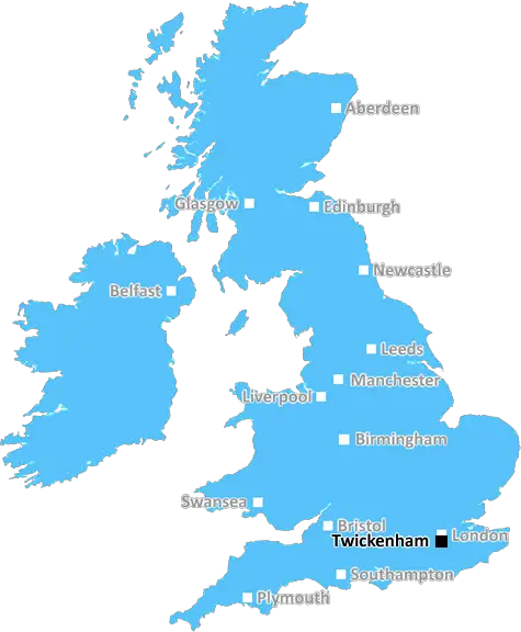
Twickenham (TW5)
The TW5 postcode area is located in the Twickenham postcode town region, within the county of Greater London, and contains a total of 687 individual postcodes.
There are 2 electoral wards in the TW5 postcode area, including Ashford, Brentford, Egham, Feltham, Hampton, Hounslow, Isleworth, Richmond, Shepperton, Staines, Sunbury-On-Thames, Teddington, Twickenham which come under the local authority of the Hounslow Council.
Combining the whole postcode region, 19% of people in TW5 are classed as having an AB social grade, (i.e. 'white-collar' middle-upper class), compared to 27% across the UK.
This does not mean that the people of TW5 are poorer than other areas, but it may give an indication that there are areas of deprivation.
TW5 is the postcode for the Twickenham district in West London. The area is bordered by Hounslow, Richmond, and Ealing. It is home to over 14,000 people and covers an approximate 8.4km squared.
The district of Twickenham is popular for its well-preserved Georgian architecture and parks, such as St Margarets Park, Bushy Park, Marble Hill Park and Crane Park. It is mostly comprised of family-oriented suburbs and vibrant commercial areas. The Great Chertsey Road, London Road and St Margarets Road are its main roads.
TW5 is home to a range of attractions. Twickenham Stadium, which is a rugby stadium, is the largest facility � it is known as the �Home of English Rugby'. Twickenham Film Studios, nestled on the St Margarets Road, is the world's oldest continuously working studio. Twickenham Museum is located at 25 The Embankment and is the community centre for the local history and culture of Twickenham.
The main shopping areas of the district are in the St Margarets Centre and in a smaller area around The Plaza. This area is packed with restaurants, bars, pubs, supermarkets, banks, estate agents and other small business.
The schools in the area include St Margarets Nursery, Waldegrave Girls' School, Nelson Primary School, St James Primary School, and Twickenham Academy.
Transport links in the TW5 postcode are excellent, with the area served by two railway stations - St Margarets and Whitton, and multiple bus routes. It is also just a short commute away from Heathrow Airport.
The area is a treasure trove of culture, art, and history and its natural environment makes it an ideal place to live. It is a great spot for families and visitors alike, with plenty of reasons to visit.

Demographics
Greater London

TW5 is located in the county of Greater London, in England.
Greater London has a total population of 8,778,500, making it the 1st largest county in the UK.
Greater London has a total area of 606 square miles, and a population density of 5594 people per square kilometre. For comparison, Greater London has a density of 5,618 people/km2.
| Outward Code | TW5 |
| Postal Town | Twickenham |
| MSOA Name | Hounslow 011 |
| LSOA Name | Hounslow 011C |
| County | Greater London |
| Region | Greater London |
| Country | England |
| Local Authority | Hounslow |
| Area Classification | Urban with Major Conurbation |
TW5 Electoral Wards
The postal region of TW5, includes the local towns, villages, electoral wards and stations of:
Dig even deeper into the TW5 postcode by clicking on a postcode below:
Click on an outward postal code below for more information about the area. Each 'outward' postcode give you a comprehensive list of all postcodes within the outward code area (TW) and estimated address.
Click on an 'outward' code for more information. For example, the outward postcode page 'EC2M' will give you an alphabetical list covering all postcodes located in the region, from 'EC2M 1BB' through to 'EC2M 7YA'.
Chris H
Sunday, April 7, 2024
We don't have any views of TW5 right now. If you live in TW5 or have visited it, please help us to help others by telling others what you think of this neighbourhood.
Add your view of TW5
People need your local expertise. If you live in TW5 or have first-hand knowledge of the neighbourhood, please consider sharing your views. It's completely anonymous - all we ask is for your initials.
Please tell us what you like about the TW5 postcode area, what you don't like, and what it's like to live or work here.
| LOCAL AMENITIES | |
| FAMILY FRIENDLY | |
| PARKING | |
| GREEN SPACES |
From the Postcode Area blog

Deciphering Crime Rates - a Deep Dive Into UK Postcode Analysis
Ever wondered about the crime rate in your UK postcode? You're not alone. We've dug deep into the data, uncovering trends and patterns that'll make your head spin.

Death of the High Street?
The BBC reports that despite councils' attempts to kurb them, the UK's high streets have seen a huge growth in fast food outlets. Could this mark the death knell for the Great British high street, and what can we do about it to halt its decline?

Discrimination by Postcode
You really couldn't make it up, could you? Some of the country's most vulnerable people are missing out on their weekly £25 Cold Weather Payment, just because the system that's in operation is discriminating against them because payments are based on postcode, rather than geographic location.

The Redesign is Underway
Well, the current website was absolutely in dire need of a good redesign - from the ground up. So I set out to pull it all apart and get it up and running again to become the most comprehensive guide to every postcode in the UK. And it's been a long, tough job from start to finish - and quite possibly the biggest project I've ever undertaken.
SOCIAL GRADES
According to census records, 19% of people here have a social grade of AB (highest), compared to the national average of 27%.