truro TR21 Postcodes
Spending a fortune on conveyancing?

Compare instant, low-cost online quotes from trusted conveyancing solicitors.
Backed by experts, our no-obligation service searches through the best conveyancing quotes on the market to save you time and money.
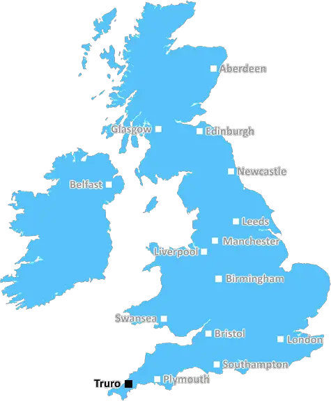
Truro (TR21)
The TR21 postcode area is located in the Truro postcode town region, within the county of Cornwall, and contains a total of 101 individual postcodes.
There are 9 electoral wards in the TR21 postcode area, including Camborne, Falmouth, Hayle, Helston, Isles Of Scilly, Marazion, Newquay, Penryn, Penzance, Perranporth, Redruth, St Agnes, St Columb, St Ives, Truro which come under the local authority of the Cornwall,Isles of Scilly Council.
Combining the whole postcode region, 14% of people in TR21 are classed as having an AB social grade, (i.e. 'white-collar' middle-upper class), compared to 27% across the UK.
This does not mean that the people of TR21 are poorer than other areas, but it may give an indication that there are areas of deprivation.
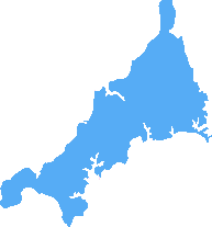
TR21 is a postcode district covering areas of north-west Cornwall, including the town of St Just in Penwith and the villages of Mulfra, Pendeen, Treen, Zennor, Boswednack, Bosigran, and Sennen.
The area to the north and west of the district borders the Atlantic Ocean, with spectacular coastal scenery, while its south and east is much more rural and tranquil, with traditional farming villages, in an area known as regarded an Area of Outstanding Natural Beauty and is home to a number of Cornish Historical Sites.
The TR21 postcode is host to a number of holiday parks and resorts, which offer spectacular views and easy access to sand-swept beaches and rugged coastal paths. Along the coast, visitors will find golden sandy beaches popular with surfers, while further inland, there is a unique variety of flora and fauna, together with a range of activities including walking, cycling and watersports.
The postcoded area is also home to some of the highest tourist attractions in Cornwall, including Land's End and the Minack Theatre. Other tourist spots includes the Eden Project, the Geevor Tin Mine, the Tate St Ives and the Barbara Hepworth Museum.
TR21 also has a great selection of restaurants, inns, pubs and cafes, as well as shops and boutique stores. It is also a great base for exploring all of Cornwall. There are even a number of art galleries and galleries devoted to mining history.
The postcode district is served by several bus services, the Penzance to St Just railway line, and airports in Newquay and Land's End. Car parking is available in most villages and towns, and there are several National Trust car parks. Visitors by sea can use the Penzance Harbour.
TR21 is a wonderful part of Cornwall; it is home to stunning scenery and beautiful local villages, and is the perfect place to soak up the Cornish culture and explore the local area.

Demographics

Cornwall
TR21 is located in the county of Cornwall, in England.
Cornwall has a total population of 556,000, making it the 40th largest county in the UK.
Cornwall has a total area of 1375 square miles, and a population density of 156 people per square kilometre. For comparison, Greater London has a density of 5,618 people/km2.
| Outward Code | TR21 |
| Postal Town | Truro |
| MSOA Name | Cornwall 068 |
| LSOA Name | Cornwall 068A |
| County | Cornwall |
| Region | Cornwall |
| Country | England |
| Local Authority | Cornwall,Isles of Scilly |
| Area Classification | Mainly Rural (rural including hub towns >=80%) |
TR21 Electoral Wards
The postal region of TR21, includes the local towns, villages, electoral wards and stations of:
Dig even deeper into the TR21 postcode by clicking on a postcode below:
Click on an outward postal code below for more information about the area. Each 'outward' postcode give you a comprehensive list of all postcodes within the outward code area (TR) and estimated address.
Click on an 'outward' code for more information. For example, the outward postcode page 'EC2M' will give you an alphabetical list covering all postcodes located in the region, from 'EC2M 1BB' through to 'EC2M 7YA'.
Chris H
Sunday, April 7, 2024
We don't have any views of TR21 right now. If you live in TR21 or have visited it, please help us to help others by telling others what you think of this neighbourhood.
Add your view of TR21
People need your local expertise. If you live in TR21 or have first-hand knowledge of the neighbourhood, please consider sharing your views. It's completely anonymous - all we ask is for your initials.
Please tell us what you like about the TR21 postcode area, what you don't like, and what it's like to live or work here.
| LOCAL AMENITIES | |
| FAMILY FRIENDLY | |
| PARKING | |
| GREEN SPACES |
From the Postcode Area blog

Deciphering Crime Rates - a Deep Dive Into UK Postcode Analysis
Ever wondered about the crime rate in your UK postcode? You're not alone. We've dug deep into the data, uncovering trends and patterns that'll make your head spin.

Death of the High Street?
The BBC reports that despite councils' attempts to kurb them, the UK's high streets have seen a huge growth in fast food outlets. Could this mark the death knell for the Great British high street, and what can we do about it to halt its decline?

Discrimination by Postcode
You really couldn't make it up, could you? Some of the country's most vulnerable people are missing out on their weekly £25 Cold Weather Payment, just because the system that's in operation is discriminating against them because payments are based on postcode, rather than geographic location.

The Redesign is Underway
Well, the current website was absolutely in dire need of a good redesign - from the ground up. So I set out to pull it all apart and get it up and running again to become the most comprehensive guide to every postcode in the UK. And it's been a long, tough job from start to finish - and quite possibly the biggest project I've ever undertaken.
SOCIAL GRADES
According to census records, 14% of people here have a social grade of AB (highest), compared to the national average of 27%.