tonbridge TN25 Postcodes
Spending a fortune on conveyancing?

Compare instant, low-cost online quotes from trusted conveyancing solicitors.
Backed by experts, our no-obligation service searches through the best conveyancing quotes on the market to save you time and money.
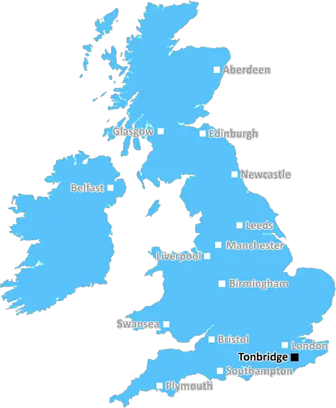
Tonbridge (TN25)
The TN25 postcode area is located in the Tonbridge postcode town region, within the county of Kent, and contains a total of 804 individual postcodes.
There are 118 electoral wards in the TN25 postcode area, including Ashford, Battle, Bexhill-On-Sea, Cranbrook, Crowborough, Edenbridge, Etchingham, Hartfield, Hastings, Heathfield, Mayfield, New Romney, Robertsbridge, Romney Marsh, Rye, Sevenoaks, St Leonards-On-Sea, Tenterden, Tonbridge, Tunbridge Wells, Uckfield, Wadhurst, Westerham, Winchelsea which come under the local authority of the Ashford Council.
Combining the whole postcode region, 30% of people in TN25 are classed as having an AB social grade, (i.e. 'white-collar' middle-upper class), compared to 27% across the UK.
This does not mean that the people of TN25 are wealthier - or higher class - than average, but it can be an indication that the area may be prospering and desirable to live in.
TN25 is a postcode district in Tonbridge district in Kent, England, located approximately 12 miles south east of Maidstone and 12 miles south west of Gravesend. It covers parts of West and East Mailing, Chartfield, Five Oak Green, and Laddingford.
The TN25 postcode includes the towns of Headcorn, Langley, Tudeley and Royal Tunbridge Wells. It also covers the outskirts of the village of Staplehurst, where it meets the postcode district of TN12. Generally, TN25 covers the north and south of the River Teise, running through Maidstone and Tunbridge Wells, as well as some of the surrounding villages.
TN25 is predominantly a rural postcode district, with many small farms, woodlands, and green areas. It contains many delightful rural villages that have grown up since the Middle Ages. These villages, together with fields of rolling Kentish countryside, are some of the highlights of this area.
The TN25 postcode includes many popular tourist attractions, such as Hever Castle, which was the childhood home of Anne Boleyn and is now owned by the Astor family. The area is also popular for its rolling hills, which are linked by chalk roads. In addition, the postcode district includes Kent Wildlife Trust reserves at Chiddingstone and Riverhill, as well as many sites of Special Scientific Interest (SSSIs).
The TN25 postcode also includes many historical landmarks, such as the ruins of Aldington Castle, Selhurst Castle, and the ancient church of St. Mary in Boughton Malherbe. In addition, it covers the impressive Kent and East Sussex Railway, which offers steam train rides through the picturesque countryside.
TheTN25 postcode is an attractive combination of rural villages, stunning countryside, history and culture. It is a popular destination for tourists from all over the world, who enjoy its natural beauty and fascinating attractions.

Demographics

Kent

TN25 is located in the county of Kent, in England.
Kent has a total population of 1,820,400, making it the 6th largest county in the UK.
Kent has a total area of 1443 square miles, and a population density of 486 people per square kilometre. For comparison, Greater London has a density of 5,618 people/km2.
| Outward Code | TN25 |
| Postal Town | Tonbridge |
| MSOA Name | Ashford 001 |
| LSOA Name | Ashford 001F |
| County | Kent |
| Region | Kent |
| Country | England |
| Local Authority | Ashford |
| Area Classification | Urban with Significant Rural (rural including hub towns 26-49%) |
TN25 Electoral Wards
The postal region of TN25, includes the local towns, villages, electoral wards and stations of:
Dig even deeper into the TN25 postcode by clicking on a postcode below:
Click on an outward postal code below for more information about the area. Each 'outward' postcode give you a comprehensive list of all postcodes within the outward code area (TN) and estimated address.
Click on an 'outward' code for more information. For example, the outward postcode page 'EC2M' will give you an alphabetical list covering all postcodes located in the region, from 'EC2M 1BB' through to 'EC2M 7YA'.
Chris H
Monday, April 8, 2024
We don't have any views of TN25 right now. If you live in TN25 or have visited it, please help us to help others by telling others what you think of this neighbourhood.
Add your view of TN25
People need your local expertise. If you live in TN25 or have first-hand knowledge of the neighbourhood, please consider sharing your views. It's completely anonymous - all we ask is for your initials.
Please tell us what you like about the TN25 postcode area, what you don't like, and what it's like to live or work here.
| LOCAL AMENITIES | |
| FAMILY FRIENDLY | |
| PARKING | |
| GREEN SPACES |
Local News Kent
Confusion as one of Kent's most historic areas rebranded the West End'
The rebranding of one of the county's most historic areas as the West End has divided opinion - with some people left baffled.
Kent OnlineSurrey strikes 32.2m deal to buy offices from cash-strapped Woking Council
Surrey County Council will move staff into Victoria Gate building, formerly let to McLaren, later this year.
Property WeekCare home pulls out of Kent asylum-seeker deal
The Sheppey property will no longer open as a temporary home for asylum-seeking children.
BBC NewsRoad sealed off after body discovered
Emergency crews were called this morning after concerns for a man's welfare.
Kent OnlineYASA to move UK HQ to Bicester Motion Innovation Quarter
TheMercedes-Benz subsidiary will relocate its teams to the Bicester site in 2026
Property WeekHomes England acquires Worthing site to deliver 250 homes
The acquisition forms part of the body's plans to regenerate challenging brownfield areas.
Property WeekBradford City 1-0 Gillingham
Gillingham's play-off hopes take another dent with a second defeat in five days in Yorkshire.
BBC NewsPortsmouth NHS trust takes offices at Lakeside North Harbour
The trust has signed a 10-year lease for space at the business park.
Property WeekFrom the Postcode Area blog

Deciphering Crime Rates - a Deep Dive Into UK Postcode Analysis
Ever wondered about the crime rate in your UK postcode? You're not alone. We've dug deep into the data, uncovering trends and patterns that'll make your head spin.

Death of the High Street?
The BBC reports that despite councils' attempts to kurb them, the UK's high streets have seen a huge growth in fast food outlets. Could this mark the death knell for the Great British high street, and what can we do about it to halt its decline?

Discrimination by Postcode
You really couldn't make it up, could you? Some of the country's most vulnerable people are missing out on their weekly £25 Cold Weather Payment, just because the system that's in operation is discriminating against them because payments are based on postcode, rather than geographic location.

The Redesign is Underway
Well, the current website was absolutely in dire need of a good redesign - from the ground up. So I set out to pull it all apart and get it up and running again to become the most comprehensive guide to every postcode in the UK. And it's been a long, tough job from start to finish - and quite possibly the biggest project I've ever undertaken.
SOCIAL GRADES
According to census records, 30% of people here have a social grade of AB (highest), compared to the national average of 27%.