tonbridge TN21 Postcodes
Spending a fortune on conveyancing?

Compare instant, low-cost online quotes from trusted conveyancing solicitors.
Backed by experts, our no-obligation service searches through the best conveyancing quotes on the market to save you time and money.
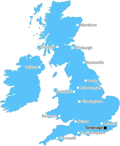
Tonbridge (TN21)
The TN21 postcode area is located in the Tonbridge postcode town region, within the county of East Sussex, and contains a total of 932 individual postcodes.
There are 56 electoral wards in the TN21 postcode area, including Ashford, Battle, Bexhill-On-Sea, Cranbrook, Crowborough, Edenbridge, Etchingham, Hartfield, Hastings, Heathfield, Mayfield, New Romney, Robertsbridge, Romney Marsh, Rye, Sevenoaks, St Leonards-On-Sea, Tenterden, Tonbridge, Tunbridge Wells, Uckfield, Wadhurst, Westerham, Winchelsea which come under the local authority of the Wealden Council.
Combining the whole postcode region, 30% of people in TN21 are classed as having an AB social grade, (i.e. 'white-collar' middle-upper class), compared to 27% across the UK.
This does not mean that the people of TN21 are wealthier - or higher class - than average, but it can be an indication that the area may be prospering and desirable to live in.
The TN21 postcode is located in the Tonbridge district of Kent in the UK. The postcode covers several small towns and villages, including Ticehurst, Flimwell, Wittersham, Smarden, Frittenden, Stonegate and Salehurst. Parts of Lamberhurst, Goudhurst and Horsmonden also fall into this postcode area.
The main settlement in the TN21 postcode area is Ticehurst. The village has a rural feel and is popular with those looking for a quiet life in the countryside. It has a population of around 3,500 people.
Nearby is the town of Tonbridge, home of the TN21 postcode. It is a popular destination for those looking to explore the rolling hills of the Kent countryside. It is a beautiful town full of historic buildings, shops, cafes and bars. The town also boasts many outdoor activities such as walking and cycling trails, and canoeing and kayaking on the River Medway.
The postcode area has a rich history, with evidence of Iron Age settlements and a Roman fort at Stonegate. There are also many beautiful churches to explore, including St Mary's Church in Ticehurst, which dates back to the 12th century.
TN21 is well connected to the rest of the UK, thanks to road links such as the A21, A228 and M25. There are several train stations in the area, including Paddock Wood, Headcorn, West Malling and Tonbridge. Additionally, Ashford International Airport is only a 30-minute drive away.
The outdoor activities available and its location make TN21 a popular place for holidaymakers and visitors of all ages. There are a numerous tea rooms, pubs and restaurants, as well as many picturesque nature trails suitable for any level of fitness. For shoppers, there are plenty of independent stores, antique shops and markets.
Those living in the TN21 postcode are also well served by their local schools. There are several primary schools including Flimwell Primary, Ticehurst and Flimwell Church of England Primary, St Mary's Catholic Primary, and the independent Ticehurst Village Academy. For secondary education, the area is served by the Weald of Kent Grammar School, as well as Hillview School and St Gregory's Catholic School, both of which are comprehensive schools.

Demographics

East Sussex

TN21 is located in the county of East Sussex, in England.
East Sussex has a total population of 837,000, making it the 29th largest county in the UK.
East Sussex has a total area of 692 square miles, and a population density of 467 people per square kilometre. For comparison, Greater London has a density of 5,618 people/km2.
| Outward Code | TN21 |
| Postal Town | Tonbridge |
| MSOA Name | Wealden 010 |
| LSOA Name | Wealden 010D |
| County | East Sussex |
| Region | East Sussex |
| Country | England |
| Local Authority | Wealden |
| Area Classification | Mainly Rural (rural including hub towns >=80%) |
TN21 Electoral Wards
The postal region of TN21, includes the local towns, villages, electoral wards and stations of:
Dig even deeper into the TN21 postcode by clicking on a postcode below:
Click on an outward postal code below for more information about the area. Each 'outward' postcode give you a comprehensive list of all postcodes within the outward code area (TN) and estimated address.
Click on an 'outward' code for more information. For example, the outward postcode page 'EC2M' will give you an alphabetical list covering all postcodes located in the region, from 'EC2M 1BB' through to 'EC2M 7YA'.
Chris H
Sunday, April 7, 2024
We don't have any views of TN21 right now. If you live in TN21 or have visited it, please help us to help others by telling others what you think of this neighbourhood.
Add your view of TN21
People need your local expertise. If you live in TN21 or have first-hand knowledge of the neighbourhood, please consider sharing your views. It's completely anonymous - all we ask is for your initials.
Please tell us what you like about the TN21 postcode area, what you don't like, and what it's like to live or work here.
| LOCAL AMENITIES | |
| FAMILY FRIENDLY | |
| PARKING | |
| GREEN SPACES |
Local News Sussex
Which South East trains will run on strike day?
Train drivers across the South East will walk out on Monday, with very few trains running.
BBC NewsArsenal beat Brighton to move top of Premier League
Arsenal maintained their pursuit of a first Premier League title for 20 years as they moved top of the table with an impressive away victory over Brighton.
BBC NewsSussex opener Clark signs two-year extension
Sussex opener Tom Clark signs a two-year contract extension with the club.
BBC NewsEverything you need to know about Brighton Marathon
About 13,000 participants are expected to take part in the Brighton Marathon on Sunday.
BBC NewsMansfield Town 1-4 Crawley Town
Crawley coast to a powerful statement 4-1 victory at promotion rivals Mansfield.
BBC NewsConcert marks 50 years since Abba Eurovision win
A total of five Eurovision winners will perform at Brighton Dome to celebrate Abba's victory.
BBC NewsLandslip disrupts trains to Brighton
Southern Rail says engineers are investigating the incident between Hassocks and Burgess Hill.
BBC NewsCritical incident remains in place at hospital
St Richard's Hospital in Chichester suspended visiting on Friday due to a norovirus outbreak.
BBC NewsFrom the Postcode Area blog

Deciphering Crime Rates - a Deep Dive Into UK Postcode Analysis
Ever wondered about the crime rate in your UK postcode? You're not alone. We've dug deep into the data, uncovering trends and patterns that'll make your head spin.

Death of the High Street?
The BBC reports that despite councils' attempts to kurb them, the UK's high streets have seen a huge growth in fast food outlets. Could this mark the death knell for the Great British high street, and what can we do about it to halt its decline?

Discrimination by Postcode
You really couldn't make it up, could you? Some of the country's most vulnerable people are missing out on their weekly £25 Cold Weather Payment, just because the system that's in operation is discriminating against them because payments are based on postcode, rather than geographic location.

The Redesign is Underway
Well, the current website was absolutely in dire need of a good redesign - from the ground up. So I set out to pull it all apart and get it up and running again to become the most comprehensive guide to every postcode in the UK. And it's been a long, tough job from start to finish - and quite possibly the biggest project I've ever undertaken.
SOCIAL GRADES
According to census records, 30% of people here have a social grade of AB (highest), compared to the national average of 27%.