telford TF8 Postcodes
Spending a fortune on conveyancing?

Compare instant, low-cost online quotes from trusted conveyancing solicitors.
Backed by experts, our no-obligation service searches through the best conveyancing quotes on the market to save you time and money.
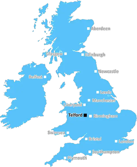
Telford (TF8)
The TF8 postcode area is located in the Telford postcode town region, within the county of Shropshire, and contains a total of 208 individual postcodes.
There are 19 electoral wards in the TF8 postcode area, including Broseley, Market Drayton, Much Wenlock, Newport, Shifnal, Telford which come under the local authority of the Telford and Wrekin Council.
Combining the whole postcode region, 25% of people in TF8 are classed as having an AB social grade, (i.e. 'white-collar' middle-upper class), compared to 27% across the UK.
This does not mean that the people of TF8 are poorer than other areas, but it may give an indication that there are areas of deprivation.
The TF8 postcode covers two distinct geographical areas in the Telford district of the West Midlands county. The first area is the town of Donnington, which is situated to the east of the M54 motorway and is the most urbanised area in the postcode region. Donnington is home to a number of parks, including Donnington Park and Woods, and is also the site of the 13th-century Donnington Castle.
In addition to the residential and commercial development located in and around Donnington, the TF8 postcode also encompasses a large village to the south, namely Tibberton. This sprawling village has a long history, and is home to several historic churches, including the St Mary's Church, which is part of the Dawley Magna heritage trail, as well as the Grade II listed Tibberton Hall.
The TF8 postcode area is primarily rural, but is still well connected to the rest of the region with the M54 running through its centre and well-maintained bus routes operated by the Shropshire County Council connecting Donnington to other local towns and cities. The nearest railway station, Telford Central, offers regular services to both Shrewsbury and Birmingham.
In terms of amenities, Donnington and Tibberton each boast a range of shops, pubs, restaurants and takeaways, as well as pubs and hotels. The area is also home to two primary schools, Donnington C of E Primary School and Tibberton Primary School. Further education and technical courses are available at the nearby Telford College of Arts & Technology.
The TF8 postcode is also home to a number of places of natural beauty. The Ironbridge Gorge Museums are located within its boundaries, as is the Scar Rocks National Nature Reserve. Other well-known local attractions include The Wrekin and the Wrekin Hill RSPB Reserve. With its mix of rural and urban activities, TF8 is an ideal postcode for anyone seeking a well-balanced lifestyle.

Demographics
Shropshire

TF8 is located in the county of Shropshire, in England.
Shropshire has a total population of 486,300, making it the 42nd largest county in the UK.
Shropshire has a total area of 1346 square miles, and a population density of 139 people per square kilometre. For comparison, Greater London has a density of 5,618 people/km2.
| Outward Code | TF8 |
| Postal Town | Telford |
| MSOA Name | Telford and Wrekin 010 |
| LSOA Name | Telford and Wrekin 010B |
| County | Shropshire |
| Region | Shropshire |
| Country | England |
| Local Authority | Telford and Wrekin |
| Area Classification | Urban with City and Town |
TF8 Electoral Wards
The postal region of TF8, includes the local towns, villages, electoral wards and stations of:
Dig even deeper into the TF8 postcode by clicking on a postcode below:
Click on an outward postal code below for more information about the area. Each 'outward' postcode give you a comprehensive list of all postcodes within the outward code area (TF) and estimated address.
Click on an 'outward' code for more information. For example, the outward postcode page 'EC2M' will give you an alphabetical list covering all postcodes located in the region, from 'EC2M 1BB' through to 'EC2M 7YA'.
Chris H
Wednesday, April 17, 2024
We don't have any views of TF8 right now. If you live in TF8 or have visited it, please help us to help others by telling others what you think of this neighbourhood.
Add your view of TF8
People need your local expertise. If you live in TF8 or have first-hand knowledge of the neighbourhood, please consider sharing your views. It's completely anonymous - all we ask is for your initials.
Please tell us what you like about the TF8 postcode area, what you don't like, and what it's like to live or work here.
| LOCAL AMENITIES | |
| FAMILY FRIENDLY | |
| PARKING | |
| GREEN SPACES |
Local News Shropshire
Could there be a gold rush in Much Wenlock?
A large gold nugget was found by a metal detectorist in Shropshire.
BBC NewsMan wanted to abduct boy to sell drugs, police say
Macauley Jones, 28, pleads guilty to child abduction and drugs supply after a police investigation.
BBC NewsWet weather threatening flower event
Shropshire Petals says there has not been enough dry weather to plant flowers for visitors to see.
BBC NewsPortsmouth 3-1 Shrewsbury Town
Colby Bishop's double helps a below-par Portsmouth beat Shrewsbury Town to move another step closer to promotion.
BBC NewsLive clean, run dirty
Bishop's Castle's Alan Bateson has turned his life around trail running in Shropshire.
BBC NewsMorgan in 33-strong GB swimming squad for Paris
Freya Anderson is picked in Team GB's swimming squad for the Olympics, alongside the likes of Olympic champions Adam Peaty and Tom Dean.
BBC NewsLudlow estate 'making residents ill'
Social housing residents in Shropshire say refurbishment project is making them ill.
BBC NewsTown's pop-up library service expanded
Library provision has been relocated from Whitchurch Civic Centre due to Raac.
BBC NewsFrom the Postcode Area blog

Deciphering Crime Rates - a Deep Dive Into UK Postcode Analysis
Ever wondered about the crime rate in your UK postcode? You're not alone. We've dug deep into the data, uncovering trends and patterns that'll make your head spin.

Death of the High Street?
The BBC reports that despite councils' attempts to kurb them, the UK's high streets have seen a huge growth in fast food outlets. Could this mark the death knell for the Great British high street, and what can we do about it to halt its decline?

Discrimination by Postcode
You really couldn't make it up, could you? Some of the country's most vulnerable people are missing out on their weekly £25 Cold Weather Payment, just because the system that's in operation is discriminating against them because payments are based on postcode, rather than geographic location.

The Redesign is Underway
Well, the current website was absolutely in dire need of a good redesign - from the ground up. So I set out to pull it all apart and get it up and running again to become the most comprehensive guide to every postcode in the UK. And it's been a long, tough job from start to finish - and quite possibly the biggest project I've ever undertaken.
SOCIAL GRADES
According to census records, 25% of people here have a social grade of AB (highest), compared to the national average of 27%.