telford TF10 Postcodes
Spending a fortune on conveyancing?

Compare instant, low-cost online quotes from trusted conveyancing solicitors.
Backed by experts, our no-obligation service searches through the best conveyancing quotes on the market to save you time and money.
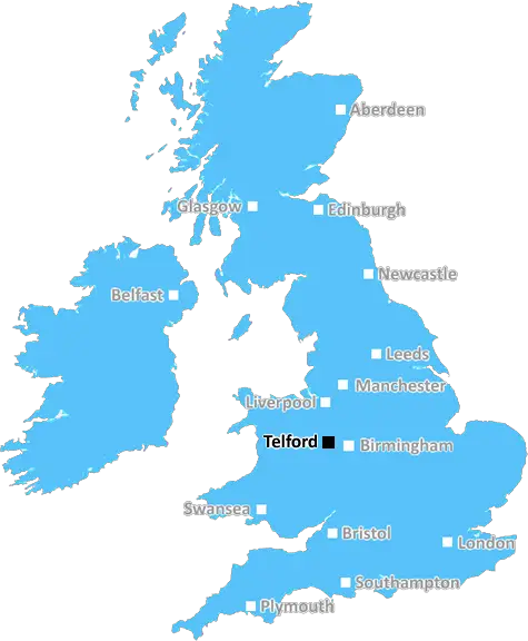
Telford (TF10)
The TF10 postcode area is located in the Telford postcode town region, within the county of Shropshire, and contains a total of 741 individual postcodes.
There are 76 electoral wards in the TF10 postcode area, including Broseley, Market Drayton, Much Wenlock, Newport, Shifnal, Telford which come under the local authority of the Telford and Wrekin Council.
Combining the whole postcode region, 28% of people in TF10 are classed as having an AB social grade, (i.e. 'white-collar' middle-upper class), compared to 27% across the UK.
This does not mean that the people of TF10 are wealthier - or higher class - than average, but it can be an indication that the area may be prospering and desirable to live in.
TF10 is a postcode in the Telford district of Shropshire, England. The postcode covers the town of Madeley, as well as small settlements such as Heath Hill, Ironbridge, and Coalbrookdale. It is withing reach of Telford Town Centre, Ironbridge Gorge, and the Wrekin Hill Country Park.
TF10 postcode is located in the West Midlands region, which is a major centre of industry and commerce and is home to a number of Shropshire's engineering, manufacturing and IT companies. The area is well served by good road and rail links and is close to the M54 motorway, as well as the A442 and A5 roads. The postcode also has easy access to Birmingham, Stoke on Trent and Shrewsbury.
The TF10 postcode has an active community with a range of local shops, eateries and businesses. The local landscape is varied and includes a mix of self-built estates and traditional terraces as well as suburban housing. There are a number of parks and playgrounds including Coalport Playground, Holroyd Park, and Horsehay and Lightmoor Village playing fields.
The postcode has access to a range of primary and secondary schools including Madeley High School, Walton High School, and Ercall Wood Technology College. In addition, there is also a college � Telford College of Arts and Technology � located within the area.
Local employment opportunities are provided by the Shropshire Business Park, which is home to a number of national companies and specialist SMEs, as well as two major distribution centres. Other well-known enterprises based in the TF10 area include the Wrekin Retail Park, Shropshire Karting, and Churnside Industrial Estate.
The postcode also offers many of its own leisure and recreational facilities. For sports fans, there is a sports centre, football pitches and a well-maintained golf club � Walcot Golf Course � all found within the area. Madeley Wood Park has different leisure amenities on offer such as a playground, fishing lake, and outdoor gym. In addition, the Ironbridge Gorge World Heritage site is also located nearby.
TheTF10 postcode is a vibrant and active neighbourhood offering employment and education opportunities, a range of leisure activities, and plenty of shops, caf�s, pubs and restaurants to suit all tastes.

Demographics
Shropshire

TF10 is located in the county of Shropshire, in England.
Shropshire has a total population of 486,300, making it the 42nd largest county in the UK.
Shropshire has a total area of 1346 square miles, and a population density of 139 people per square kilometre. For comparison, Greater London has a density of 5,618 people/km2.
| Outward Code | TF10 |
| Postal Town | Telford |
| MSOA Name | Telford and Wrekin 003 |
| LSOA Name | Telford and Wrekin 003D |
| County | Shropshire |
| Region | Shropshire |
| Country | England |
| Local Authority | Telford and Wrekin |
| Area Classification | Urban with City and Town |
TF10 Electoral Wards
The postal region of TF10, includes the local towns, villages, electoral wards and stations of:
Dig even deeper into the TF10 postcode by clicking on a postcode below:
Click on an outward postal code below for more information about the area. Each 'outward' postcode give you a comprehensive list of all postcodes within the outward code area (TF) and estimated address.
Click on an 'outward' code for more information. For example, the outward postcode page 'EC2M' will give you an alphabetical list covering all postcodes located in the region, from 'EC2M 1BB' through to 'EC2M 7YA'.
Chris H
Saturday, April 6, 2024
We don't have any views of TF10 right now. If you live in TF10 or have visited it, please help us to help others by telling others what you think of this neighbourhood.
Add your view of TF10
People need your local expertise. If you live in TF10 or have first-hand knowledge of the neighbourhood, please consider sharing your views. It's completely anonymous - all we ask is for your initials.
Please tell us what you like about the TF10 postcode area, what you don't like, and what it's like to live or work here.
| LOCAL AMENITIES | |
| FAMILY FRIENDLY | |
| PARKING | |
| GREEN SPACES |
Local News Shropshire
How rain is affecting farms and businesses
Parts of the Midlands saw double the average rainfall for March, and April is not looking any better yet.
BBC NewsInpatient beds to reopen at community hospital
The decision comes after a campaign to retain services since the temporary closure of the beds.
BBC NewsLottery winners complete 25-year racecourse quest
Elaine and Derek Thompson have visited all 59 racecourses in the UK.
BBC NewsShrewsbury Town 1-1 Oxford United
Shrewsbury Town earn a draw with League One play-off hopefuls Oxford thanks to Jack Price's stunning late strike.
BBC NewsWoman raising Sepsis awareness after grandad's death
Kellie Green used to be a nurse but now teaches first aid classes to help people recognise symptoms.
BBC NewsSticky situation for Shropshire Mud Run
Organiser Simon MacDonald explains why they need a new venue.
BBC NewsOlympic-bound swimmer felt pure relief after record
Oliver Morgan broke the British 100m backstroke record to qualify for Paris 2024.
BBC NewsTfW not involved in strike action, operator says
Work is being carried out on overhead wires and the lack of service is not due to strikes, TfW says.
BBC NewsFrom the Postcode Area blog

Deciphering Crime Rates - a Deep Dive Into UK Postcode Analysis
Ever wondered about the crime rate in your UK postcode? You're not alone. We've dug deep into the data, uncovering trends and patterns that'll make your head spin.

Death of the High Street?
The BBC reports that despite councils' attempts to kurb them, the UK's high streets have seen a huge growth in fast food outlets. Could this mark the death knell for the Great British high street, and what can we do about it to halt its decline?

Discrimination by Postcode
You really couldn't make it up, could you? Some of the country's most vulnerable people are missing out on their weekly £25 Cold Weather Payment, just because the system that's in operation is discriminating against them because payments are based on postcode, rather than geographic location.

The Redesign is Underway
Well, the current website was absolutely in dire need of a good redesign - from the ground up. So I set out to pull it all apart and get it up and running again to become the most comprehensive guide to every postcode in the UK. And it's been a long, tough job from start to finish - and quite possibly the biggest project I've ever undertaken.
SOCIAL GRADES
According to census records, 28% of people here have a social grade of AB (highest), compared to the national average of 27%.