swansea SA47 Postcodes
Spending a fortune on conveyancing?

Compare instant, low-cost online quotes from trusted conveyancing solicitors.
Backed by experts, our no-obligation service searches through the best conveyancing quotes on the market to save you time and money.
Swansea (SA47)
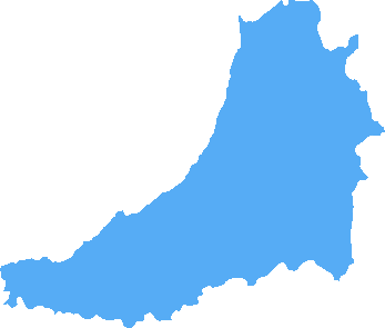
The SA47 postcode area is located in the Swansea postcode town region, within the county of Ceredigion, and contains a total of 76 individual postcodes.
There are 4 electoral wards in the SA47 postcode area, including Aberaeron, Ammanford, Boncath, Burry Port, Cardigan, Carmarthen, Clarbeston Road, Clynderwen, Crymych, Ferryside, Fishguard, Glogue, Goodwick, Haverfordwest, Kidwelly, Kilgetty, Lampeter, Llanarth, Llandeilo, Llandovery, Llandysul, Llanelli, Llanfyrnach, Llangadog, Llanwrda, Llanybydder, Milford Haven, Narberth, Neath, New Quay, Newcastle Emlyn, Newport, Pembroke, Pembroke Dock, Pencader, Port Talbot, Saundersfoot, Swansea, Tenby, Whitland which come under the local authority of the Ceredigion Council.
Combining the whole postcode region, 19% of people in SA47 are classed as having an AB social grade, (i.e. 'white-collar' middle-upper class), compared to 27% across the UK.
This does not mean that the people of SA47 are poorer than other areas, but it may give an indication that there are areas of deprivation.
The SA47 postcode is located in the Swansea district of South West Wales, within the UK. It covers the historic market town of Cardigan and its surrounding villages and hamlets, including Blaenporth, Blaenpenal, Cilgerran, Crymych, Felindre, Llanfyrnach, Llanfallteg, Penparcau, Rhoshill, Trereife and Ystwyth.
Cardigan is an ancient town situated on a hill overlooking the Teifi estuary, and dates back to the 11th century when it served as a stronghold of the Welsh prince Gruffydd ap Rhys. It has a long history of maritime trading � the harbour was the major destination for goods and materials from Ireland, France, Portugal and Spain � as well as a number of well-known attractions such as the 12th century Cilgerran Castle, the Gwbert Gardens, the Teifi Marshes National Nature Reserve and the Cardigan River and Estuary Walk.
The SA47 postcode also covers several villages and hamlets, including Blaenporth which has a sandy beach and views over Cardigan to the nearby peaks of Allt Seren and Allt Peng; Blaenpenal, a picturesque settlement of 19th century cottages and farms situated at the head of the Teifi valley; Cilgerran with its Norman Motte overlooking the River Teifi; Crymych which is home to the largest Welsh-language college in Wales; and Felindre which is known for its cider apples and waterfalls.
Additionally, the SA47 postcode encompasses the villages of Llanfyrnach, a largely rural community consisting of several farms; Llanfallteg, situated in the highlands of the River Teifi and with the ruins of a 12th century Norman castle; Penparcau, a former woollen weaving centre; Rhoshill, set along the Northern slopes of the Teifi valley; Trereife, the birthplace of Sir John Rogers; and Ystwyth, an ancient settlement close to the Camarthenshire border.
Each of the villages and hamlets within the SA47 postcode offer something different, from the sandy beaches and castles of Cardigan to the waterfalls and walking trails of the Teifi Valley. These picturesque towns and villages are ideal for days out, local attractions, cycling and fishing, and make for a unique and enjoyable experience for anyone visiting the area.

Demographics

Ceredigion
SA47 is located in the county of Ceredigion, in Wales.
Ceredigion has a total population of 74,100, making it the 19th largest county in the UK.
Ceredigion has a total area of 688 square miles, and a population density of 41 people per square kilometre. For comparison, Greater London has a density of 5,618 people/km2.

| Outward Code | SA47 |
| Postal Town | Swansea |
| MSOA Name | Ceredigion 007 |
| LSOA Name | Ceredigion 007A |
| County | Ceredigion |
| Region | Ceredigion |
| Country | Wales |
| Local Authority | Ceredigion |
| Area Classification | Unclassified |
SA47 Electoral Wards
The postal region of SA47, includes the local towns, villages, electoral wards and stations of:
Dig even deeper into the SA47 postcode by clicking on a postcode below:
Click on an outward postal code below for more information about the area. Each 'outward' postcode give you a comprehensive list of all postcodes within the outward code area (SA) and estimated address.
Click on an 'outward' code for more information. For example, the outward postcode page 'EC2M' will give you an alphabetical list covering all postcodes located in the region, from 'EC2M 1BB' through to 'EC2M 7YA'.
Chris H
Tuesday, April 16, 2024
We don't have any views of SA47 right now. If you live in SA47 or have visited it, please help us to help others by telling others what you think of this neighbourhood.
Add your view of SA47
People need your local expertise. If you live in SA47 or have first-hand knowledge of the neighbourhood, please consider sharing your views. It's completely anonymous - all we ask is for your initials.
Please tell us what you like about the SA47 postcode area, what you don't like, and what it's like to live or work here.
| LOCAL AMENITIES | |
| FAMILY FRIENDLY | |
| PARKING | |
| GREEN SPACES |
From the Postcode Area blog

Deciphering Crime Rates - a Deep Dive Into UK Postcode Analysis
Ever wondered about the crime rate in your UK postcode? You're not alone. We've dug deep into the data, uncovering trends and patterns that'll make your head spin.

Death of the High Street?
The BBC reports that despite councils' attempts to kurb them, the UK's high streets have seen a huge growth in fast food outlets. Could this mark the death knell for the Great British high street, and what can we do about it to halt its decline?

Discrimination by Postcode
You really couldn't make it up, could you? Some of the country's most vulnerable people are missing out on their weekly £25 Cold Weather Payment, just because the system that's in operation is discriminating against them because payments are based on postcode, rather than geographic location.

The Redesign is Underway
Well, the current website was absolutely in dire need of a good redesign - from the ground up. So I set out to pull it all apart and get it up and running again to become the most comprehensive guide to every postcode in the UK. And it's been a long, tough job from start to finish - and quite possibly the biggest project I've ever undertaken.
SOCIAL GRADES
According to census records, 19% of people here have a social grade of AB (highest), compared to the national average of 27%.