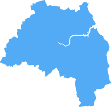
sunderland SR3 Postcodes
Spending a fortune on conveyancing?

Compare instant, low-cost online quotes from trusted conveyancing solicitors.
Backed by experts, our no-obligation service searches through the best conveyancing quotes on the market to save you time and money.
Sunderland (SR3)
The SR3 postcode area is located in the Sunderland postcode town region, within the county of Tyne and Wear, and contains a total of 1077 individual postcodes.
There are 21 electoral wards in the SR3 postcode area, including Peterlee, Seaham, Sunderland which come under the local authority of the Sunderland Council.
Combining the whole postcode region, 14% of people in SR3 are classed as having an AB social grade, (i.e. 'white-collar' middle-upper class), compared to 27% across the UK.
This does not mean that the people of SR3 are poorer than other areas, but it may give an indication that there are areas of deprivation.
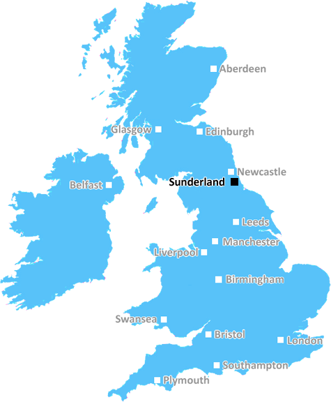
The SR3 postcode is located in the East of Sunderland, a district of the city of Sunderland in Tyne and Wear in the North East of England. It stretches from the edge of the Monkwearmouth area down to the Wearside industrial estate, and then along the south side of the Tyne. It is primarily residential with the area being populated by various types of housing, including private and council-owned homes. The area could be considered largely working class, with many of the residents working in nearby industries, with some low-level service sectors present too. SR3 links to both the A19 and A1231 which provide easy access to neighbouring cities such as Newcastle and Durham. The postcode is located close to the St Peter's area, a vibrant commercial and residential district, with various shops, restaurants, bars, and cafes.
The SR3 postcode is served by two local Primary Schools, St Lukes and St Ignatius, with a secondary school, St Aidan's, located towards the south of the postcode. The nearest hospital is City Hospital Sunderland which is located on the edge of the area. The postcode is located close to the Monkwearmouth railway station, which provides direct services to Newcastle and Middlesbrough, as well as indirect services to London and beyond.
The area provides a variety of recreation activities such as local parks and sports centres with nearby attractions including the National Glass Centre, and St Peter's Church. The area has good public transport links both in and out of the city with regular bus services including the Number 1 and the Number 12 which run between Sunderland City Centre and the SR3 postcode. Additionally, the Metro runs from Sunderland Station East up to South Shields nearby. Finally, the nearby park-and-ride can provide easy access to Sunderland city centre.

Demographics

Tyne and Wear
SR3 is located in the county of Tyne and Wear, in England.
Tyne and Wear has a total population of 1,128,800, making it the 16th largest county in the UK.
Tyne and Wear has a total area of 210 square miles, and a population density of 2090 people per square kilometre. For comparison, Greater London has a density of 5,618 people/km2.
| Outward Code | SR3 |
| Postal Town | Sunderland |
| MSOA Name | Sunderland 031 |
| LSOA Name | Sunderland 031B |
| County | Tyne and Wear |
| Region | Tyne and Wear |
| Country | England |
| Local Authority | Sunderland |
| Area Classification | Urban with Major Conurbation |
SR3 Electoral Wards
The postal region of SR3, includes the local towns, villages, electoral wards and stations of:
Dig even deeper into the SR3 postcode by clicking on a postcode below:
Click on an outward postal code below for more information about the area. Each 'outward' postcode give you a comprehensive list of all postcodes within the outward code area (SR) and estimated address.
Click on an 'outward' code for more information. For example, the outward postcode page 'EC2M' will give you an alphabetical list covering all postcodes located in the region, from 'EC2M 1BB' through to 'EC2M 7YA'.
Chris H
Monday, April 8, 2024
We don't have any views of SR3 right now. If you live in SR3 or have visited it, please help us to help others by telling others what you think of this neighbourhood.
Add your view of SR3
People need your local expertise. If you live in SR3 or have first-hand knowledge of the neighbourhood, please consider sharing your views. It's completely anonymous - all we ask is for your initials.
Please tell us what you like about the SR3 postcode area, what you don't like, and what it's like to live or work here.
| LOCAL AMENITIES | |
| FAMILY FRIENDLY | |
| PARKING | |
| GREEN SPACES |
Local News County Durham
Northumberland joiner creates model of Del Boy's flat
A joiner from Northumberland has recreated a mini version ofDelBoyTrotter's flat from Only Fools and Horses, complete with his weird bed and the drinks bar which is synonymous with the show.
Northern EchoThe rise and fall of the Kings Cinema in Bishop Auckland
THE Kings Cinema was once one of Bishop Auckland's four town centre cinemas, and it had a very chequered career but, the last time The Northern Echo was invited inside its dereliction, there were stil&hellip
Northern EchoBBC iPlayer users issued final warning ahead of app shut down
The BBC will fully close its iPlayer Downloads app on all PC and Macs on Monday (April 8) meaning users will no longer be able to watch content offline.
Northern EchoSpecialist markets coming to these 11 County Durham centres
New markets ranging from street food to Christmas markets will be coming to locations across County Durham.
Northern EchoResidents shock as Stockton investigation begins overnight
Residents reacted with shock when they woke up this morning in Parkfield Way, Stockton, to find the police and CSI
Northern EchoLiberal Democrat Tees Valley candidate targets poverty
Election day is coming soon in May and The Northern Echo has spoken to Simon Thorley, Liberal Democrat candidate for Tees Valley Mayor.
Northern EchoProtest over sale of The Magnet, Grangetown, goes smoothly
Cleveland Police have confirmed that a protest over the sale of The Magnet, in Grangetown, has happened without incident
Northern EchoWhy Yorkshire was once divided into ridings
ON Easter Monday, a sign sprang up on the southern footing of Croft bridge welcoming people to the Historic North Riding of Yorkshire.
Northern EchoFrom the Postcode Area blog

Deciphering Crime Rates - a Deep Dive Into UK Postcode Analysis
Ever wondered about the crime rate in your UK postcode? You're not alone. We've dug deep into the data, uncovering trends and patterns that'll make your head spin.

Death of the High Street?
The BBC reports that despite councils' attempts to kurb them, the UK's high streets have seen a huge growth in fast food outlets. Could this mark the death knell for the Great British high street, and what can we do about it to halt its decline?

Discrimination by Postcode
You really couldn't make it up, could you? Some of the country's most vulnerable people are missing out on their weekly £25 Cold Weather Payment, just because the system that's in operation is discriminating against them because payments are based on postcode, rather than geographic location.

The Redesign is Underway
Well, the current website was absolutely in dire need of a good redesign - from the ground up. So I set out to pull it all apart and get it up and running again to become the most comprehensive guide to every postcode in the UK. And it's been a long, tough job from start to finish - and quite possibly the biggest project I've ever undertaken.
SOCIAL GRADES
According to census records, 14% of people here have a social grade of AB (highest), compared to the national average of 27%.