sunderland SR1 Postcodes
Spending a fortune on conveyancing?

Compare instant, low-cost online quotes from trusted conveyancing solicitors.
Backed by experts, our no-obligation service searches through the best conveyancing quotes on the market to save you time and money.
Sunderland (SR1)
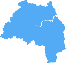
The SR1 postcode area is located in the Sunderland postcode town region, within the county of Tyne and Wear, and contains a total of 668 individual postcodes.
There are 2 electoral wards in the SR1 postcode area, including Peterlee, Seaham, Sunderland which come under the local authority of the Sunderland Council.
Combining the whole postcode region, 11% of people in SR1 are classed as having an AB social grade, (i.e. 'white-collar' middle-upper class), compared to 27% across the UK.
This does not mean that the people of SR1 are poorer than other areas, but it may give an indication that there are areas of deprivation.
SR1 postcode is a postcode district located in the northeastern part of Sunderland in Tyne and Wear, England. It is located to the north of the city centre, near the River Wear and also covers parts of the East End neighbourhood as well as some of the easternmost parts of the city's urban core.
SR1 postcode district covers a large and diverse area, ranging from the densely populated inner city suburbs of East End, to the more residential areas in Millfield and Plains Farm, and the more rural communities of Doxford Park and South Hylton. It is home to many historic landmarks, such as the Angel of the North, the National Glass Centre, and the St. Peter's Church ruins.
The SR1 postcode area has high levels of social and economic deprivation, with income levels here significantly lower than the national average, influenced partly by the past and continuing impact of deindustrialisation, which has often pushed poverty-stricken families to the limits of the local economy.
Public transport links within the SR1 postcode district are limited, but recently the area has seen much investment in new infrastructure. There's been the building of new cycle routes, the erection of new bus stops, and the opening of a new Metrolink station in Sunderland city centre, which provides vital access to local services and further afield.
The SR1 CCG (Clinical Commissioning Group) plays a major role in providing healthcare services to the local community. The CCG serves a population of around 52,000 people, covering areas such as the East End, Doxford Park, Plains Farm, and Millfield.
Education is also very important in the SR1 postcode, with the East End area taking particular pride in providing excellent learning experiences to the local children. East End Community School, Oxclose Community Academy, Pennywell Primary School, The Venerable Bede Church of England Aided Primary School to name a few, have all obtained excellent results at a national level in recent years, and continue to be valuable educational resources for the local community.
The area has a vibrant cultural offering, with the Sunderland Music, Arts and Culture Trust (SMACT) based in East End, and many other cultural attractions which attract thousands of people. The area also has an increasing nightlife scene, with many pubs and bars opening in the more central parts of town, for both locals and visitors alike.

Demographics

Tyne and Wear
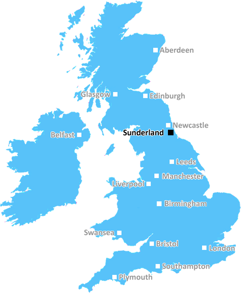
SR1 is located in the county of Tyne and Wear, in England.
Tyne and Wear has a total population of 1,128,800, making it the 16th largest county in the UK.
Tyne and Wear has a total area of 210 square miles, and a population density of 2090 people per square kilometre. For comparison, Greater London has a density of 5,618 people/km2.
| Outward Code | SR1 |
| Postal Town | Sunderland |
| MSOA Name | Sunderland 013 |
| LSOA Name | Sunderland 013B |
| County | Tyne and Wear |
| Region | Tyne and Wear |
| Country | England |
| Local Authority | Sunderland |
| Area Classification | Urban with Major Conurbation |
SR1 Electoral Wards
The postal region of SR1, includes the local towns, villages, electoral wards and stations of:
Dig even deeper into the SR1 postcode by clicking on a postcode below:
Click on an outward postal code below for more information about the area. Each 'outward' postcode give you a comprehensive list of all postcodes within the outward code area (SR) and estimated address.
Click on an 'outward' code for more information. For example, the outward postcode page 'EC2M' will give you an alphabetical list covering all postcodes located in the region, from 'EC2M 1BB' through to 'EC2M 7YA'.
Chris H
Saturday, April 6, 2024
We don't have any views of SR1 right now. If you live in SR1 or have visited it, please help us to help others by telling others what you think of this neighbourhood.
Add your view of SR1
People need your local expertise. If you live in SR1 or have first-hand knowledge of the neighbourhood, please consider sharing your views. It's completely anonymous - all we ask is for your initials.
Please tell us what you like about the SR1 postcode area, what you don't like, and what it's like to live or work here.
| LOCAL AMENITIES | |
| FAMILY FRIENDLY | |
| PARKING | |
| GREEN SPACES |
Local News County Durham
Lamb killed in barn fire in Manfield village near Darlington
Emergency services were called to Manfield village at about 11.17pm, following reports of an agricultural fire in a barn containing livestock.
Northern EchoRichard Holden MP will not contest Blaydon and Consett seat
A Consett county councillor has been selected to stand as a parliamentary candidate in a new North East seat which encompasses her town.
Northern EchoDarlington business thriving after retweet by Theo Paphitis
Darlington based business Rainbow Dandelion Crochet gets a Twitter boost from Theo Paphitis.
Northern EchoHarbour Porpoise stranded on Seaham shoreline rescued
A stranded porpoise was saved after rapid responses from a quick-thinking member of the public and volunteer medics on Seaham's shore
Northern EchoPolice seize illegal cigarettes and vapes in Gateshead loft
Police have seized tens of thousands of illegal cigarettes and vapes from Bensham in Gateshead
Northern EchoBlyth man visits all the railway stations in UK in six weeks
A railway nut from Blyth has travelled to almost every train station in the UK - in just six weeks.
Northern EchoA19 slip road to be closed until summer for improvement works
A busy A19 exit slip road onto the B1404 Seaton Lane, near Seaham, will close from Thursday 18 April and reopen in the summer.
Northern EchoFull list of Stockton, Yarm and Billingham resurfacing works
Stockton Borough Council have released a full list of resurfacing works planned to take place across Stockton, Yarm and Billingham until March 2025
Northern EchoFrom the Postcode Area blog

Deciphering Crime Rates - a Deep Dive Into UK Postcode Analysis
Ever wondered about the crime rate in your UK postcode? You're not alone. We've dug deep into the data, uncovering trends and patterns that'll make your head spin.

Death of the High Street?
The BBC reports that despite councils' attempts to kurb them, the UK's high streets have seen a huge growth in fast food outlets. Could this mark the death knell for the Great British high street, and what can we do about it to halt its decline?

Discrimination by Postcode
You really couldn't make it up, could you? Some of the country's most vulnerable people are missing out on their weekly £25 Cold Weather Payment, just because the system that's in operation is discriminating against them because payments are based on postcode, rather than geographic location.

The Redesign is Underway
Well, the current website was absolutely in dire need of a good redesign - from the ground up. So I set out to pull it all apart and get it up and running again to become the most comprehensive guide to every postcode in the UK. And it's been a long, tough job from start to finish - and quite possibly the biggest project I've ever undertaken.
SOCIAL GRADES
According to census records, 11% of people here have a social grade of AB (highest), compared to the national average of 27%.