stoke-on-trent ST5 Postcodes
Spending a fortune on conveyancing?

Compare instant, low-cost online quotes from trusted conveyancing solicitors.
Backed by experts, our no-obligation service searches through the best conveyancing quotes on the market to save you time and money.
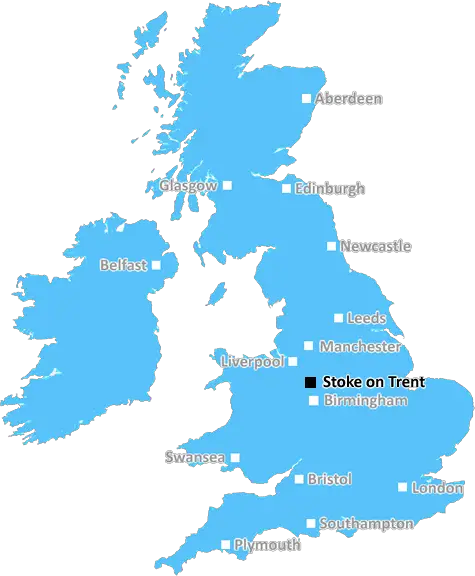
Stoke On Trent (ST5)
The ST5 postcode area is located in the Stoke On Trent postcode town region, within the county of Staffordshire, and contains a total of 2520 individual postcodes.
There are 84 electoral wards in the ST5 postcode area, including Leek, Newcastle, Stafford, Stoke-On-Trent, Stone, Uttoxeter which come under the local authority of the Newcastle-under-Lyme Council.
Combining the whole postcode region, 20% of people in ST5 are classed as having an AB social grade, (i.e. 'white-collar' middle-upper class), compared to 27% across the UK.
This does not mean that the people of ST5 are poorer than other areas, but it may give an indication that there are areas of deprivation.
The ST5 postcode covers an area located in the north of the Stoke-on-Trent district, spanning from parts of Silverdale to the south-east, Apesford and May Bank to the south-west and parts of Actsley to the north-west.
ST5 is a popular residential area with a mixture of housing types, from terraced houses to modern family homes. Property prices in ST5 are typically lower than other areas of Stoke-on-Trent, making ST5 a good location for first-time buyers.
ST5 has several schools, including Abbey Hulton Primary School, Park-Hall Academy primary and secondary schools, Apesford and May Bank primary schools and Silverdale Secondary School. The University of Keele is also easily accessible from this area.
The area has access to a range of shops, stores, pubs and restaurants, as well as other amenities such as a library, leisure centre and post office. There is also a range of local parks and open spaces, providing visitors with plenty of opportunity to enjoy the outdoors.
ST5 has good transport links, with four bus routes operating in the area. The nearest train station is located at Longport, around two miles away, with regular services to Newcastle-under-Lyme, Crewe and Stoke-On-Trent. The A500 provides easy access to towns and cities in Staffordshire, as well as further afield.
With attractive countryside, good transport links and a selection of local amenities, ST5 postcode is a popular residential area of the Stoke-on-Trent district. It is a desirable area to live and work, offering excellent value for money on property prices and a great range of services, shops and leisure opportunities.

Demographics

Staffordshire

ST5 is located in the county of Staffordshire, in England.
Staffordshire has a total population of 1,120,300, making it the 17th largest county in the UK.
Staffordshire has a total area of 1047 square miles, and a population density of 412 people per square kilometre. For comparison, Greater London has a density of 5,618 people/km2.
| Outward Code | ST5 |
| Postal Town | Stoke On Trent |
| MSOA Name | Newcastle-under-Lyme 008 |
| LSOA Name | Newcastle-under-Lyme 008B |
| County | Staffordshire |
| Region | Staffordshire |
| Country | England |
| Local Authority | Newcastle-under-Lyme |
| Area Classification | Urban with City and Town |
ST5 Electoral Wards
The postal region of ST5, includes the local towns, villages, electoral wards and stations of:
Dig even deeper into the ST5 postcode by clicking on a postcode below:
Click on an outward postal code below for more information about the area. Each 'outward' postcode give you a comprehensive list of all postcodes within the outward code area (ST) and estimated address.
Click on an 'outward' code for more information. For example, the outward postcode page 'EC2M' will give you an alphabetical list covering all postcodes located in the region, from 'EC2M 1BB' through to 'EC2M 7YA'.
SH, stoke-on-trent
Wednesday, April 24, 2019
ST54BZ is a lovely area. It's very quite, there's very little crime, the views over the city are lovely and there's a nature reserve just around the corner. The country is two or three minutes in the car in one direction and the town in the same distance in the other. It's a very easy place to commute from too as the motorway is close by but not two close to be a problem. Trentham Estate is a couple of minutes away and Alton Towers is no more than half an hour away. It's very nice living here.
Add your view of ST5
People need your local expertise. If you live in ST5 or have first-hand knowledge of the neighbourhood, please consider sharing your views. It's completely anonymous - all we ask is for your initials.
Please tell us what you like about the ST5 postcode area, what you don't like, and what it's like to live or work here.
| LOCAL AMENITIES | |
| FAMILY FRIENDLY | |
| PARKING | |
| GREEN SPACES |
Local News Staffordshire
Highways improvements to start in Lichfield next week
A major highways improvements scheme in Lichfield will start on Monday 25 March.
Staffordshire County CouncilPeople urged to give the gift of independence this Mothers Day
This Mother's Day, Staffordshire County Council is urging people to explore a world of thoughtful and practical gift ideas, through its assistive technology campaign.
Staffordshire County CouncilFurniture restoration and manufacturing business cuts carbon and costs with backing of county council programme
An established furniture restoration and manufacturing company is making savings in the region of 35,000 annually and reducing its carbon footprint thanks to a county council programme.
Staffordshire County CouncilStaffordshire and Stoke On Trent to celebrate English Tourism Week
People are being reminded about the many great attractions and locations just waiting to be explored in Staffordshire and Stoke-on-Trent as part of the county's celebrations for English Tourism Week.
Staffordshire County CouncilHistoric puppet collection to take centre stage in new history centre
Puppets from a unique collection of over 1,000 historic puppets will be amongst the exhibits in the new Staffordshire History Centre, being funded by The National Lottery Heritage Fund.
Staffordshire County CouncilGet to know the West Midlands Podcast Club
Meet Rachael Botfield, from Bromsgrove, who shares top tips for getting started.
BBC NewsCorrie star Colson Smith dines in Burslem curry house
And Robbie Benson, from The Hitmix, was at India Cottage too!
Stoke SentinelMajor highways improvement scheme to start in Newcastle
A major highways improvements scheme on the A34 Talke Road in Newcastle is due to start on Monday 11 March.
Staffordshire County CouncilFrom the Postcode Area blog

Deciphering Crime Rates - a Deep Dive Into UK Postcode Analysis
Ever wondered about the crime rate in your UK postcode? You're not alone. We've dug deep into the data, uncovering trends and patterns that'll make your head spin.

Death of the High Street?
The BBC reports that despite councils' attempts to kurb them, the UK's high streets have seen a huge growth in fast food outlets. Could this mark the death knell for the Great British high street, and what can we do about it to halt its decline?

Discrimination by Postcode
You really couldn't make it up, could you? Some of the country's most vulnerable people are missing out on their weekly £25 Cold Weather Payment, just because the system that's in operation is discriminating against them because payments are based on postcode, rather than geographic location.

The Redesign is Underway
Well, the current website was absolutely in dire need of a good redesign - from the ground up. So I set out to pull it all apart and get it up and running again to become the most comprehensive guide to every postcode in the UK. And it's been a long, tough job from start to finish - and quite possibly the biggest project I've ever undertaken.
SOCIAL GRADES
According to census records, 20% of people here have a social grade of AB (highest), compared to the national average of 27%.