stoke-on-trent ST21 Postcodes
Spending a fortune on conveyancing?

Compare instant, low-cost online quotes from trusted conveyancing solicitors.
Backed by experts, our no-obligation service searches through the best conveyancing quotes on the market to save you time and money.
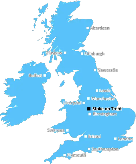
Stoke On Trent (ST21)
The ST21 postcode area is located in the Stoke On Trent postcode town region, within the county of Staffordshire, and contains a total of 245 individual postcodes.
There are 72 electoral wards in the ST21 postcode area, including Leek, Newcastle, Stafford, Stoke-On-Trent, Stone, Uttoxeter which come under the local authority of the Stafford Council.
Combining the whole postcode region, 34% of people in ST21 are classed as having an AB social grade, (i.e. 'white-collar' middle-upper class), compared to 27% across the UK.
This does not mean that the people of ST21 are wealthier - or higher class - than average, but it can be an indication that the area may be prospering and desirable to live in.
ST21 is a postcode located in the ceremonial county of Staffordshire, England. It encompasses the Town of Stone, Staffs and parts of the historic Borough of Stafford and the Staffordshire Moorlands. The postcode district includes all or part of the following localities: Stone Urban District, Betley Civil Parish, Moddershall Civil Parish, Fulford Civil Parish, Wetleyrocks Civil Parish and Tittensor Civil Parish. It is located to the south east of Stoke-on-Trent, the county town, and is 8 miles away from Alton Towers theme park.
The area of ST21 postcode is typically rural and is served by road links to the nearby cities of Stoke-on-Trent and Stafford. It is a largely residential area with a selection of rural pubs and restaurants. The postcode district is located close to National Trust properties, such as Shugborough Hall and Ilam Park. The Trent and Mersey Canal runs through the middle of the district. Stone Retail Park is located in the area, offering stores such as Homebase, Next, Argos, Wickes and Halfords. Sporting venues in the area include Stone Golf Club, Stone Soccer Centre, and Stone Cricket Club.
The postcode district has a plethora of primary and secondary schools within its boundaries. Chetwynd Junior School, Stone St. Michael's C of E Primary School, Our Lady's Catholic Primary School, Stone Church of England Academy, Hillside Primary School and Tittensor St. Ninian's C of E Primary School are just a few of these educational institutions. Post 16 education options consist of Haywood Sixth Form Academy and ACS Sixth Form.
Public transport options consist of bus routes from main towns such as Stafford, Uttoxeter, Stoke-on-Trent, and Stone. The nearest railway stations are Stoke-on-Trent, Stone, Wolverhampton and Lichfield, which provide direct links across the UK. The nearest airports are Manchester Airport, East Midlands Airport, and Birmingham Airport.
It is an historical area, home to many former coal-mining sites, as well as a memorial to miners who lost their lives in a terrible mining accident at Hill Ridware Colliery in 1967. The Birchenwood Heritage Centre and Nature Reserve, the Star Inn, an old coaching inn in Hilderstone, and the Cheadle Brewery, the oldest brew-house in Staffordshire, can all also be found in the ST21 postcode.

Demographics

Staffordshire

ST21 is located in the county of Staffordshire, in England.
Staffordshire has a total population of 1,120,300, making it the 17th largest county in the UK.
Staffordshire has a total area of 1047 square miles, and a population density of 412 people per square kilometre. For comparison, Greater London has a density of 5,618 people/km2.
| Outward Code | ST21 |
| Postal Town | Stoke On Trent |
| MSOA Name | Stafford 005 |
| LSOA Name | Stafford 005A |
| County | Staffordshire |
| Region | Staffordshire |
| Country | England |
| Local Authority | Stafford |
| Area Classification | Urban with Significant Rural (rural including hub towns 26-49%) |
ST21 Electoral Wards
The postal region of ST21, includes the local towns, villages, electoral wards and stations of:
Dig even deeper into the ST21 postcode by clicking on a postcode below:
Click on an outward postal code below for more information about the area. Each 'outward' postcode give you a comprehensive list of all postcodes within the outward code area (ST) and estimated address.
Click on an 'outward' code for more information. For example, the outward postcode page 'EC2M' will give you an alphabetical list covering all postcodes located in the region, from 'EC2M 1BB' through to 'EC2M 7YA'.
Chris H
Sunday, April 7, 2024
We don't have any views of ST21 right now. If you live in ST21 or have visited it, please help us to help others by telling others what you think of this neighbourhood.
Add your view of ST21
People need your local expertise. If you live in ST21 or have first-hand knowledge of the neighbourhood, please consider sharing your views. It's completely anonymous - all we ask is for your initials.
Please tell us what you like about the ST21 postcode area, what you don't like, and what it's like to live or work here.
| LOCAL AMENITIES | |
| FAMILY FRIENDLY | |
| PARKING | |
| GREEN SPACES |
Local News Staffordshire
Major resurfacing works completed in Newcastle-Under-Lyme
The A53 carriageway, at Baldwins Gate, has been completely resurfaced, thanks to a 220,000 highways investment.
Staffordshire County CouncilFarm shop and caf plan for derelict North Staffordshire pub hit by delays
The plans had been recommended for refusal by planning officers at Staffordshire Moorlands District Council
Stoke SentinelNHS trust declares critical incident amid 'extreme pressures'
University Hospitals of North Midlands NHS Trust reports A&Es to be experiencing highest demand.
BBC NewsImprovements at major Staffordshire transport gateway progresses with new traffic arrangements
A scheme bringing major improvements to a key Staffordshire gateway junction is progressing well, with new traffic management introduced from next week.
Staffordshire County CouncilStaffordshire Adult Learning and Skills Festival opens doors to free learning opportunities
People looking to develop their skills and increase their opportunities are being urged to find out more about the extensive range of learning options open to them at a free series of drop-in events r&hellip
Staffordshire County CouncilMajor road improvement scheme set for completion
A major road improvement scheme to the north of Stafford will be completed on Sunday March 24.
Staffordshire County CouncilStoke-on-Trent asylum seeker, 31, who sneaked into UK in lorry found dead
Iraqi Gailan Matloob had been living in Normacot under a fake name
Stoke SentinelRedevelopment plan for library after grant win
Staffordshire County Council successfully bid for 199,000 from the Arts Council England to revamp Wombourne library.
Staffordshire County CouncilFrom the Postcode Area blog

Deciphering Crime Rates - a Deep Dive Into UK Postcode Analysis
Ever wondered about the crime rate in your UK postcode? You're not alone. We've dug deep into the data, uncovering trends and patterns that'll make your head spin.

Death of the High Street?
The BBC reports that despite councils' attempts to kurb them, the UK's high streets have seen a huge growth in fast food outlets. Could this mark the death knell for the Great British high street, and what can we do about it to halt its decline?

Discrimination by Postcode
You really couldn't make it up, could you? Some of the country's most vulnerable people are missing out on their weekly £25 Cold Weather Payment, just because the system that's in operation is discriminating against them because payments are based on postcode, rather than geographic location.

The Redesign is Underway
Well, the current website was absolutely in dire need of a good redesign - from the ground up. So I set out to pull it all apart and get it up and running again to become the most comprehensive guide to every postcode in the UK. And it's been a long, tough job from start to finish - and quite possibly the biggest project I've ever undertaken.
SOCIAL GRADES
According to census records, 34% of people here have a social grade of AB (highest), compared to the national average of 27%.