stoke-on-trent ST12 Postcodes
Spending a fortune on conveyancing?

Compare instant, low-cost online quotes from trusted conveyancing solicitors.
Backed by experts, our no-obligation service searches through the best conveyancing quotes on the market to save you time and money.
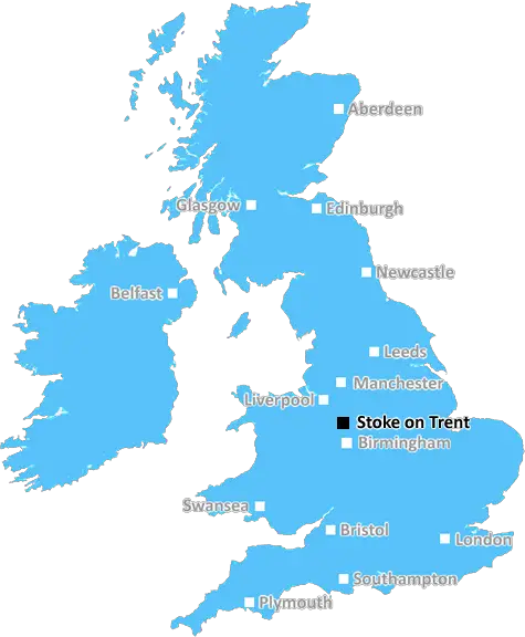
Stoke On Trent (ST12)
The ST12 postcode area is located in the Stoke On Trent postcode town region, within the county of Staffordshire, and contains a total of 134 individual postcodes.
There are 5 electoral wards in the ST12 postcode area, including Leek, Newcastle, Stafford, Stoke-On-Trent, Stone, Uttoxeter which come under the local authority of the Stafford Council.
Combining the whole postcode region, 26% of people in ST12 are classed as having an AB social grade, (i.e. 'white-collar' middle-upper class), compared to 27% across the UK.
This does not mean that the people of ST12 are poorer than other areas, but it may give an indication that there are areas of deprivation.
ST12 postcode is situated in the Stoke-on-Trent district in the West Midlands region of England. The postcode includes towns and villages such as Alsagers Bank, Barthomley, Bramshall, Blythe Bridge, Checkley, Forsbrook, Mow Cop, Oakhanger, Penkridge, Stanley and Weston.
The postcode area has a population of around 18,876 as of the 2021 Census, making it the 108th most populous postcode area in the United Kingdom. It also covers an area of around 80km2.
The ST12 postcode is a popular destination for leisure activities, with its many attractions and parks such as Trentham Gardens, Alton Towers and Biddulph Grange. There are a number of sports facilities in the area, including football and hockey clubs, and golf courses. There are also a number of Heritage Sites located in the area, thanks to its impressive historical, cultural and archaeological sites.
The area also offers excellent transport links, with easy access to major cities such as Manchester, Birmingham, Liverpool, Leeds and Sheffield. The nearest rail and bus stations are situated in nearby Longton, Stoke, Hanley and Sandbach. There are also airports nearby, such as Manchester Airport and Liverpool John Lennon Airport.
The area is served by two main hospitals and a number of smaller clinics, surgeries and health centres. There are also many pharmacies located throughout the area, as well as dentists, opticians and other medical centres.
The area provides a number of education opportunities, with well-respected local schools and academies. There are also a number of further and higher education options, including notable universities such as Keele University, Staffordshire University and Stafford College.
The postcode offers a wide selection of shops, restaurants, caf�s, and bars. The area is also home to a variety of arts and culture venues, such as theatres, cinemas and music venues.
ST12 is an area rich in history, culture and nature, and is a vibrant and welcoming place to live.

Demographics

Staffordshire

ST12 is located in the county of Staffordshire, in England.
Staffordshire has a total population of 1,120,300, making it the 17th largest county in the UK.
Staffordshire has a total area of 1047 square miles, and a population density of 412 people per square kilometre. For comparison, Greater London has a density of 5,618 people/km2.
| Outward Code | ST12 |
| Postal Town | Stoke On Trent |
| MSOA Name | Stafford 002 |
| LSOA Name | Stafford 002B |
| County | Staffordshire |
| Region | Staffordshire |
| Country | England |
| Local Authority | Stafford |
| Area Classification | Urban with Significant Rural (rural including hub towns 26-49%) |
ST12 Electoral Wards
The postal region of ST12, includes the local towns, villages, electoral wards and stations of:
Dig even deeper into the ST12 postcode by clicking on a postcode below:
Click on an outward postal code below for more information about the area. Each 'outward' postcode give you a comprehensive list of all postcodes within the outward code area (ST) and estimated address.
Click on an 'outward' code for more information. For example, the outward postcode page 'EC2M' will give you an alphabetical list covering all postcodes located in the region, from 'EC2M 1BB' through to 'EC2M 7YA'.
Chris H
Sunday, April 14, 2024
We don't have any views of ST12 right now. If you live in ST12 or have visited it, please help us to help others by telling others what you think of this neighbourhood.
Add your view of ST12
People need your local expertise. If you live in ST12 or have first-hand knowledge of the neighbourhood, please consider sharing your views. It's completely anonymous - all we ask is for your initials.
Please tell us what you like about the ST12 postcode area, what you don't like, and what it's like to live or work here.
| LOCAL AMENITIES | |
| FAMILY FRIENDLY | |
| PARKING | |
| GREEN SPACES |
Local News Staffordshire
Stevenage 1-2 Burton Albion
Tom Hamer scores the vital goal in a 2-1 victory against 10-man Stevenage to move Burton three points clear of relegation.
BBC NewsTeacher sees former band's music finally go online
Mark Sykes says his old bandmates stayed up to see the tracks go online 17 years after being recorded.
BBC NewsMajor resurfacing works completed in Newcastle-Under-Lyme
The A53 carriageway, at Baldwins Gate, has been completely resurfaced, thanks to a 220,000 highways investment.
Staffordshire County CouncilMajor highways improvement scheme to start in Newcastle
A major highways improvements scheme on the A34 Talke Road in Newcastle is due to start on Monday 11 March.
Staffordshire County CouncilMachete-wielding gang storm house in three-on-one attack
Staffordshire Police descended on Romney Avenue, in Chesterton, this morning
Stoke SentinelPlanning approval granted for top grade electric vehicle charging facility at i54
Planning approval has been granted for a GRIDSERVE Electric Forecourt at i54 South Staffordshire.
Staffordshire County CouncilParking permit increase after price freeze
A 12-month permit for all Staffordshire County Council's country park car parks will rise by 2 to 38, the equivalent of half a penny a day, after being frozen for five years.
Staffordshire County CouncilCity school rated inadequate by Ofsted inspectors
Ofsted highlights concerns including pupils' behaviour leaving others feeling unsafe.
BBC NewsFrom the Postcode Area blog

Deciphering Crime Rates - a Deep Dive Into UK Postcode Analysis
Ever wondered about the crime rate in your UK postcode? You're not alone. We've dug deep into the data, uncovering trends and patterns that'll make your head spin.

Death of the High Street?
The BBC reports that despite councils' attempts to kurb them, the UK's high streets have seen a huge growth in fast food outlets. Could this mark the death knell for the Great British high street, and what can we do about it to halt its decline?

Discrimination by Postcode
You really couldn't make it up, could you? Some of the country's most vulnerable people are missing out on their weekly £25 Cold Weather Payment, just because the system that's in operation is discriminating against them because payments are based on postcode, rather than geographic location.

The Redesign is Underway
Well, the current website was absolutely in dire need of a good redesign - from the ground up. So I set out to pull it all apart and get it up and running again to become the most comprehensive guide to every postcode in the UK. And it's been a long, tough job from start to finish - and quite possibly the biggest project I've ever undertaken.
SOCIAL GRADES
According to census records, 26% of people here have a social grade of AB (highest), compared to the national average of 27%.