slough SL2 Postcodes
Spending a fortune on conveyancing?

Compare instant, low-cost online quotes from trusted conveyancing solicitors.
Backed by experts, our no-obligation service searches through the best conveyancing quotes on the market to save you time and money.
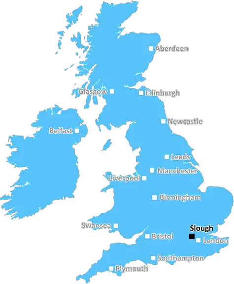
Slough (SL2)
The SL2 postcode area is located in the Slough postcode town region, within the county of Berkshire, and contains a total of 1522 individual postcodes.
There are 22 electoral wards in the SL2 postcode area, including Ascot, Bourne End, Gerrards Cross, Iver, Maidenhead, Marlow, Slough, Windsor which come under the local authority of the Slough Council.
Combining the whole postcode region, 22% of people in SL2 are classed as having an AB social grade, (i.e. 'white-collar' middle-upper class), compared to 27% across the UK.
This does not mean that the people of SL2 are poorer than other areas, but it may give an indication that there are areas of deprivation.
SL2, or Slough Town, is a town and post town in the Borough of Slough, located in the ceremonial county of Berkshire. It is located 18 miles (29 km) to the west of central London and 6 miles (10 km) north of Windsor. The town has a population estimated in 2021 to be 128,120. It has traditionally been a market town and has served as a major centre for trade and industry throughout its history.
The town was first recorded in 1196 as Slo, and it is thought to have been named from the word Slo/sloe, a black-thorn shrub that was once common in the area.
SL2 is a postcode district covering the central area of Slough Town, mainly covering the area bounded by the A4, the M4, and the A355. The postcode district has the post town of Slough, and it covers an area of 2.5 miles (4.1 km).
The postcode district includes the major areas of Cippenham, Upton, Britwell, Wexham, Chalvey and Haymill. The Royal Borough of Windsor and Maidenhead border the postcode district to the west. In the south, the district is bounded by the M4 motorway and the A355. The eastern boundary is formed by the M4 and Slough Retail Park, while the northern boundary is formed by the A4 Bath Road.
Slough Town is known for its commercial importance and is home to several international companies. Among these are ITV broadcasting centre, as well as offices for Global Sanofi, Unilever and General Electric. The town is also a major centre for higher education, with the University of West London acting as the main hub of education.
Slough Town has a range of leisure activities, from its shopping centres and bars to parks and woods. It is home to several parks, such as St Bernard's Park, Cippenham Green and Salt Hill Park. In addition, Burnham Beeches Country Park, a site of natural beauty, is also located close by. The town also has a range of cinemas and theatres, including The Curve Theatre and Cineworld.
Slough Town has major transport connections to other parts of the country. The town is served by two railway stations: Slough and Langley. Both stations are served by Great Western Railway whilst Langley is also served by Crossrail, connecting the town to Paddington Station in London in minutes. The town has several other public transport connections, including bus and coach services from local providers. It is also close to London Heathrow Airport.

Demographics

Berkshire

SL2 is located in the county of Berkshire, in England.
Berkshire has a total population of 896,800, making it the 24th largest county in the UK.
Berkshire has a total area of 487 square miles, and a population density of 710 people per square kilometre. For comparison, Greater London has a density of 5,618 people/km2.
| Outward Code | SL2 |
| Postal Town | Slough |
| MSOA Name | Slough 002 |
| LSOA Name | Slough 002A |
| County | Berkshire |
| Region | Berkshire |
| Country | England |
| Local Authority | Slough |
| Area Classification | Urban with City and Town |
SL2 Electoral Wards
The postal region of SL2, includes the local towns, villages, electoral wards and stations of:
Dig even deeper into the SL2 postcode by clicking on a postcode below:
Click on an outward postal code below for more information about the area. Each 'outward' postcode give you a comprehensive list of all postcodes within the outward code area (SL) and estimated address.
Click on an 'outward' code for more information. For example, the outward postcode page 'EC2M' will give you an alphabetical list covering all postcodes located in the region, from 'EC2M 1BB' through to 'EC2M 7YA'.
Chris H
Monday, April 8, 2024
We don't have any views of SL2 right now. If you live in SL2 or have visited it, please help us to help others by telling others what you think of this neighbourhood.
Add your view of SL2
People need your local expertise. If you live in SL2 or have first-hand knowledge of the neighbourhood, please consider sharing your views. It's completely anonymous - all we ask is for your initials.
Please tell us what you like about the SL2 postcode area, what you don't like, and what it's like to live or work here.
| LOCAL AMENITIES | |
| FAMILY FRIENDLY | |
| PARKING | |
| GREEN SPACES |
Local News Buckinghamshire
Johnson & Johnson signs lease at Tempo in Maidenhead
The pharmaceuticals giantwill move staff from its Thames Valley campuses in High Wycombe and Pinewood to the L&G-owned building.
Property WeekRegal London signs Epson UK for 30,000 sq ft pre-let at Watford scheme
The grade-A The Clarendon Works office scheme will open in Q3.
Property WeekSellar gets green light for Hertfordshire media facility
The developer has designed the scheme to appeal to the media sector, as well as being appropriate for logistics, warehousing and data centre uses.
Property WeekGreencore secures 30m investment to support sustainable development
The funding will support the developer's plans to build up to 10,000 low-carbon homes.
Property WeekFormer Luton Town manager Kinnear dies aged 77
Former Wimbledon and Newcastle United manager Joe Kinnear dies at the age of 77, his family announces.
BBC NewsRunning 5k every day while fasting during Ramadan
Bilal Hussain took on the challenge to raise money for Luton Food Bank.
BBC NewsThree arrests after spate of armed robberies
Staff say they were threatened with a gun at four businesses in Luton, Bedford and Dunstable.
BBC NewsStarbucks partner signs lease at Prologis Park Hemel Hempstead
Food Service Logisticshas agreed a 15-year lease at the161,134 sq ftdistribution centre.
Property WeekFrom the Postcode Area blog

Deciphering Crime Rates - a Deep Dive Into UK Postcode Analysis
Ever wondered about the crime rate in your UK postcode? You're not alone. We've dug deep into the data, uncovering trends and patterns that'll make your head spin.

Death of the High Street?
The BBC reports that despite councils' attempts to kurb them, the UK's high streets have seen a huge growth in fast food outlets. Could this mark the death knell for the Great British high street, and what can we do about it to halt its decline?

Discrimination by Postcode
You really couldn't make it up, could you? Some of the country's most vulnerable people are missing out on their weekly £25 Cold Weather Payment, just because the system that's in operation is discriminating against them because payments are based on postcode, rather than geographic location.

The Redesign is Underway
Well, the current website was absolutely in dire need of a good redesign - from the ground up. So I set out to pull it all apart and get it up and running again to become the most comprehensive guide to every postcode in the UK. And it's been a long, tough job from start to finish - and quite possibly the biggest project I've ever undertaken.
SOCIAL GRADES
According to census records, 22% of people here have a social grade of AB (highest), compared to the national average of 27%.