slough SL0 Postcodes
Spending a fortune on conveyancing?

Compare instant, low-cost online quotes from trusted conveyancing solicitors.
Backed by experts, our no-obligation service searches through the best conveyancing quotes on the market to save you time and money.
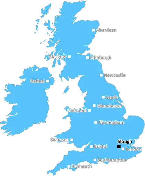
Slough (SL0)
The SL0 postcode area is located in the Slough postcode town region, within the county of Buckinghamshire, and contains a total of 528 individual postcodes.
There are 9 electoral wards in the SL0 postcode area, including Ascot, Bourne End, Gerrards Cross, Iver, Maidenhead, Marlow, Slough, Windsor which come under the local authority of the South Bucks Council.
Combining the whole postcode region, 29% of people in SL0 are classed as having an AB social grade, (i.e. 'white-collar' middle-upper class), compared to 27% across the UK.
This does not mean that the people of SL0 are wealthier - or higher class - than average, but it can be an indication that the area may be prospering and desirable to live in.
The SL0 postcode is situated in the Slough district of Berkshire, England. It covers a large area of Slough, including the town centre and its surrounding villages. The postcode is split into parts to cover different localities, including SL0 0, SL0 1 and SL0 9.
The postcode area is mainly residential, consisting of modern housing developments and traditionally built dwellings. It is home to some of the largest employers in the area, such as Procter & Gamble and Slough Trading Estate. It also includes a variety of retail outlets, eateries, entertainment venues and leisure activities.
SL0 postcode is served by a variety of transport links, including bus routes, train stations and motorway networks. The M4 is easily accessible, providing direct links to London and other locations. Bus services cover the whole of the postcode area, and there are several train services available from the nearby towns of Maidenhead and Windsor.
Given its proximity to Heathrow airport, the SL0 postcode is popular with businesses looking for convenience when commuting to and from London, with the area having one of the fastest insurance companies in the UK, making it a great place for start-up businesses.
The SL0 postcode area is home to many excellent schools and is well connected to higher education with good transport links to Brunel University, a few miles away in Uxbridge. It also has a number of high quality primary schools, private schools, special schools, and adult education providers for the local population.
Slough is an ethnically diverse area, with many people from all over the world choosing to make the SL0 postcode their home. It is a vibrant cosmopolitan area, with many activities arranged for both adults and children locally.
The SL0 postcode is well known for its outstanding leisure facilities, with numerous sports and leisure centres as well as golf courses, swimming pools and spas for visitors and residents to enjoy. There is plenty to do all year round, with a range of events and activities held in the local area.
Slough has much to offer residents and visitors, with a blend of cultures, excellent transport links and great attractions. The SL0 postcode area is the perfect place for a diverse community to live, work, and play.

Demographics

Buckinghamshire

SL0 is located in the county of Buckinghamshire, in England.
Buckinghamshire has a total population of 799,200, making it the 30th largest county in the UK.
Buckinghamshire has a total area of 723 square miles, and a population density of 426 people per square kilometre. For comparison, Greater London has a density of 5,618 people/km2.
| Outward Code | SL0 |
| Postal Town | Slough |
| MSOA Name | South Bucks 008 |
| LSOA Name | South Bucks 008E |
| County | Buckinghamshire |
| Region | Buckinghamshire |
| Country | England |
| Local Authority | South Bucks |
| Area Classification | Urban with Significant Rural (rural including hub towns 26-49%) |
SL0 Electoral Wards
The postal region of SL0, includes the local towns, villages, electoral wards and stations of:
Dig even deeper into the SL0 postcode by clicking on a postcode below:
Click on an outward postal code below for more information about the area. Each 'outward' postcode give you a comprehensive list of all postcodes within the outward code area (SL) and estimated address.
Click on an 'outward' code for more information. For example, the outward postcode page 'EC2M' will give you an alphabetical list covering all postcodes located in the region, from 'EC2M 1BB' through to 'EC2M 7YA'.
R.S, slough
Tuesday, June 4, 2019
It has got friendly people who have the time to acknowledge you that you are new in the area. Also the shops like dominos, chicken shop and restaurants are close proximity.
Add your view of SL0
People need your local expertise. If you live in SL0 or have first-hand knowledge of the neighbourhood, please consider sharing your views. It's completely anonymous - all we ask is for your initials.
Please tell us what you like about the SL0 postcode area, what you don't like, and what it's like to live or work here.
| LOCAL AMENITIES | |
| FAMILY FRIENDLY | |
| PARKING | |
| GREEN SPACES |
Local News Buckinghamshire
Exeter City 1-0 Stevenage
Exeter move into the top half of the League One table with a 1-0 win that dented Stevenage's hopes of making the play-offs.
BBC NewsSurrey strikes 32.2m deal to buy offices from cash-strapped Woking Council
Surrey County Council will move staff into Victoria Gate building, formerly let to McLaren, later this year.
Property WeekAbri and Vistry partner to develop 1,500 homes in West Sussex
The 50/50 joint venture will develop the scheme on a former airfield site in Arundel.
Property WeekPlaces for People acquires Rosewood Housing
The affordable homes provider was previously owned by housing developer Inland Homes.
Property WeekHotel refugees 'gone by end of June', says MP
MP Andrew Selous says the Home Office has terminated its contract with the hotel.
BBC NewsUniversal begins public meetings for UK theme park
The company says the public engagement does not mean the proposal is confirmed.
BBC NewsRegal London signs Epson UK for 30,000 sq ft pre-let at Watford scheme
The grade-A The Clarendon Works office scheme will open in Q3.
Property WeekHomes England acquires Worthing site to deliver 250 homes
The acquisition forms part of the body's plans to regenerate challenging brownfield areas.
Property WeekFrom the Postcode Area blog

Deciphering Crime Rates - a Deep Dive Into UK Postcode Analysis
Ever wondered about the crime rate in your UK postcode? You're not alone. We've dug deep into the data, uncovering trends and patterns that'll make your head spin.

Death of the High Street?
The BBC reports that despite councils' attempts to kurb them, the UK's high streets have seen a huge growth in fast food outlets. Could this mark the death knell for the Great British high street, and what can we do about it to halt its decline?

Discrimination by Postcode
You really couldn't make it up, could you? Some of the country's most vulnerable people are missing out on their weekly £25 Cold Weather Payment, just because the system that's in operation is discriminating against them because payments are based on postcode, rather than geographic location.

The Redesign is Underway
Well, the current website was absolutely in dire need of a good redesign - from the ground up. So I set out to pull it all apart and get it up and running again to become the most comprehensive guide to every postcode in the UK. And it's been a long, tough job from start to finish - and quite possibly the biggest project I've ever undertaken.
SOCIAL GRADES
According to census records, 29% of people here have a social grade of AB (highest), compared to the national average of 27%.