shrewsbury SY21 Postcodes
Spending a fortune on conveyancing?

Compare instant, low-cost online quotes from trusted conveyancing solicitors.
Backed by experts, our no-obligation service searches through the best conveyancing quotes on the market to save you time and money.
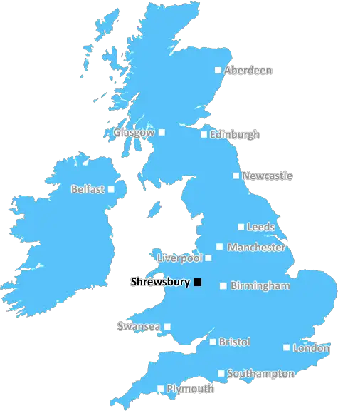
Shrewsbury (SY21)
The SY21 postcode area is located in the Shrewsbury postcode town region, within the county of Powys, and contains a total of 1017 individual postcodes.
There are 133 electoral wards in the SY21 postcode area, including Aberystwyth, Bishops Castle, Borth, Bow Street, Bucknell, Caersws, Church Stretton, Craven Arms, Ellesmere, Llanbrynmair, Llandinam, Llanfechain, Llanfyllin, Llanidloes, Llanon, Llanrhystud, Llansantffraid, Llanymynech, Ludlow, Lydbury North, Machynlleth, Malpas, Meifod, Montgomery, Newtown, Oswestry, Shrewsbury, Talybont, Tregaron, Welshpool, Whitchurch, Ystrad Meurig which come under the local authority of the Powys Council.
Combining the whole postcode region, 19% of people in SY21 are classed as having an AB social grade, (i.e. 'white-collar' middle-upper class), compared to 27% across the UK.
This does not mean that the people of SY21 are poorer than other areas, but it may give an indication that there are areas of deprivation.
SY21 is a postcode district in the Shrewsbury post town, covering the north east of Shropshire in England. It includes the north and east of the town of Shrewsbury itself, as well as the villages of Acton Scott, Bishton, Cardeston, Coalbrookdale, Donnington, Monkmoor, Much Wenlock, Sychdyn, and Woore, and the hamlet of Brookside. It was created in 1974 and is in the Shrewsbury post town which is part of the Shropshire region.
The SY21 postcode covers an area of approximately 153 square miles and has a population of over 75,000. It is a largely rural area, with a number of small villages and hamlets, and so the agriculture is fundamental to the local economy. There is a variety of businesses including retail, hospitality, health and social care, and manufacturing. There are also a number of small local businesses in the area.
The main town in the postcode district is Shrewsbury which is the county town of Shropshire. It is an attractive market town with some of its buildings dating back to medieval times and is surrounded by the Severn Valley and lovely countryside. Shrewsbury has a lot to offer visitors and locals alike, including a variety of restaurants, caf�s, and bars, and an array of leisure activities, such as a theatre, galleries, museums, and the historic Quarry park.
The SY21 postcode district is served by a number of transport links, including the Shrewsbury railway station and Shrewsbury Airport. It is connected to other towns and cities in the region through a network of roads, railways, and the M54 motorway. Additionally, there is a local bus network with routes connecting the different villages and towns in the area.
Shrewsbury itself has a strong educational reputation with two well-regarded universities, Harper Adams University and Shrewsbury Sixth Form College. The area also has numerous primary and secondary schools to cater for different levels and abilities. It is also home to the National Trust's Attingham Park, a Grade I listed country estate with a variety of educational activities and events, as well as being home to a herd of red deer which roam free in the park.

Demographics
Powys

SY21 is located in the county of Powys, in Wales.
Powys has a total population of 132,200, making it the 11th largest county in the UK.
Powys has a total area of 2000 square miles, and a population density of 25 people per square kilometre. For comparison, Greater London has a density of 5,618 people/km2.
| Outward Code | SY21 |
| Postal Town | Shrewsbury |
| MSOA Name | Powys 006 |
| LSOA Name | Powys 006B |
| County | Powys |
| Region | Powys |
| Country | Wales |
| Local Authority | Powys |
| Area Classification | Unclassified |
SY21 Electoral Wards
The postal region of SY21, includes the local towns, villages, electoral wards and stations of:
Dig even deeper into the SY21 postcode by clicking on a postcode below:
Click on an outward postal code below for more information about the area. Each 'outward' postcode give you a comprehensive list of all postcodes within the outward code area (SY) and estimated address.
Click on an 'outward' code for more information. For example, the outward postcode page 'EC2M' will give you an alphabetical list covering all postcodes located in the region, from 'EC2M 1BB' through to 'EC2M 7YA'.
Chris H
Sunday, April 7, 2024
We don't have any views of SY21 right now. If you live in SY21 or have visited it, please help us to help others by telling others what you think of this neighbourhood.
Add your view of SY21
People need your local expertise. If you live in SY21 or have first-hand knowledge of the neighbourhood, please consider sharing your views. It's completely anonymous - all we ask is for your initials.
Please tell us what you like about the SY21 postcode area, what you don't like, and what it's like to live or work here.
| LOCAL AMENITIES | |
| FAMILY FRIENDLY | |
| PARKING | |
| GREEN SPACES |
From the Postcode Area blog

Deciphering Crime Rates - a Deep Dive Into UK Postcode Analysis
Ever wondered about the crime rate in your UK postcode? You're not alone. We've dug deep into the data, uncovering trends and patterns that'll make your head spin.

Death of the High Street?
The BBC reports that despite councils' attempts to kurb them, the UK's high streets have seen a huge growth in fast food outlets. Could this mark the death knell for the Great British high street, and what can we do about it to halt its decline?

Discrimination by Postcode
You really couldn't make it up, could you? Some of the country's most vulnerable people are missing out on their weekly £25 Cold Weather Payment, just because the system that's in operation is discriminating against them because payments are based on postcode, rather than geographic location.

The Redesign is Underway
Well, the current website was absolutely in dire need of a good redesign - from the ground up. So I set out to pull it all apart and get it up and running again to become the most comprehensive guide to every postcode in the UK. And it's been a long, tough job from start to finish - and quite possibly the biggest project I've ever undertaken.
SOCIAL GRADES
According to census records, 19% of people here have a social grade of AB (highest), compared to the national average of 27%.