sheffield S33 Postcodes
Spending a fortune on conveyancing?

Compare instant, low-cost online quotes from trusted conveyancing solicitors.
Backed by experts, our no-obligation service searches through the best conveyancing quotes on the market to save you time and money.
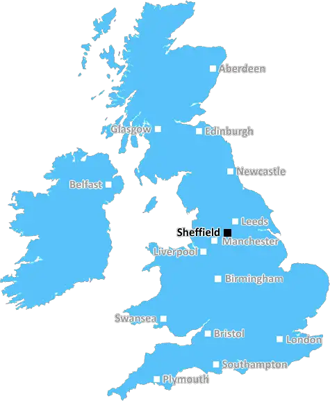
Sheffield (S33)
The S33 postcode area is located in the Sheffield postcode town region, within the county of Derbyshire, and contains a total of 206 individual postcodes.
There are 23 electoral wards in the S33 postcode area, including Barnsley, Chesterfield, Dronfield, Hope Valley, Mexborough, Rotherham, Sheffield, Worksop which come under the local authority of the High Peak Council.
Combining the whole postcode region, 31% of people in S33 are classed as having an AB social grade, (i.e. 'white-collar' middle-upper class), compared to 27% across the UK.
This does not mean that the people of S33 are wealthier - or higher class - than average, but it can be an indication that the area may be prospering and desirable to live in.
The S33 postcode covers an extensive area in the south-eastern part of Sheffield, stretching from Holme Hall and Badger Hill in the east, then south to Midhope, Far Green, Padfield, Simmondley and Charlesworth, before turning west to extend to Haigh, Ladysmith, Simmondley and Birtles.
Holme Hall is a home to many middle-class families who enjoy the calm atmosphere of the area. The local community is filled with a mix of original cottages and modern homes. Midhope is popular for its pockets of rural countryside, boasting stunning views of the Peak District. The towns of Padfield and Simmondley contain multiple substantial homes, most of which are built around the old industrial heritage.
Charlesworth is a hamlet of well-spaced housing with extensive views of the Pennine hills and is home to interesting local amenities such as Charlesworth Cricket Club, with many local pubs, restaurants and shops in the surrounding area. Haigh, with its classic industrial heritage linked to the coal mining industry, is still home to a large number of industrial businesses and is also the site of Haigh Country Park and Haigh Hall Wood.
Ladysmith is a small village near Charlesworth, containing a small collection of quaint cottages and businesses. The village has managed to retain its rural charm, with a strong presence of wildlife around the area. Simmondley is an affluent village with a large population and surrounded by countryside. Birtles has similarly not grown much, and is home to numerous distinctive cottages and businesses.
Although it is part of the Sheffield conurbation, the S33 postcode retains a village atmosphere with numerous pockets of beauty and diversity exemplified by its natural landscapes.

Demographics

Derbyshire

S33 is located in the county of Derbyshire, in England.
Derbyshire has a total population of 1,042,000, making it the 20th largest county in the UK.
Derbyshire has a total area of 1013 square miles, and a population density of 396 people per square kilometre. For comparison, Greater London has a density of 5,618 people/km2.
| Outward Code | S33 |
| Postal Town | Sheffield |
| MSOA Name | High Peak 013 |
| LSOA Name | High Peak 013A |
| County | Derbyshire |
| Region | Derbyshire |
| Country | England |
| Local Authority | High Peak |
| Area Classification | Largely Rural (rural including hub towns 50-79%) |
S33 Electoral Wards
The postal region of S33, includes the local towns, villages, electoral wards and stations of:
Dig even deeper into the S33 postcode by clicking on a postcode below:
Click on an outward postal code below for more information about the area. Each 'outward' postcode give you a comprehensive list of all postcodes within the outward code area (S) and estimated address.
Click on an 'outward' code for more information. For example, the outward postcode page 'EC2M' will give you an alphabetical list covering all postcodes located in the region, from 'EC2M 1BB' through to 'EC2M 7YA'.
Chris H
Sunday, April 7, 2024
We don't have any views of S33 right now. If you live in S33 or have visited it, please help us to help others by telling others what you think of this neighbourhood.
Add your view of S33
People need your local expertise. If you live in S33 or have first-hand knowledge of the neighbourhood, please consider sharing your views. It's completely anonymous - all we ask is for your initials.
Please tell us what you like about the S33 postcode area, what you don't like, and what it's like to live or work here.
| LOCAL AMENITIES | |
| FAMILY FRIENDLY | |
| PARKING | |
| GREEN SPACES |
Local News Derbyshire
Pubs issued with warnings over underage gaming
Police cadets were sent to play pub machines to see if they were challenged despite being underage.
BBC NewsPoundland store to close six months after opening
The chain has said it will 'do all it can' to help workers find a new job.
BBC NewsTonnes of soil used to contain chemical spill
The spill - of a chemical which can be an irritant if it gets on skin - was spotted on Wednesday.
BBC NewsCosy cottage near Derbyshire town with 'UK's best high street' up for sale
The quaint house looks like it belongs in a fairytale
Derby TelegraphPatel wants 'belief' & 'aggression' at Derbyshire
All-rounder Samit Patel wants to help bring greater belief to Derbyshire and promises an aggressive brand of cricket.
BBC NewsPlans to tighten shared home rules put to public
Residents are concerned too many shared homes creates problems like parking and fly-tipping.
BBC News'Missed opportunities' to save baby at Royal Derby Hospital during critical seven hour period
Baby Ethan Blackwell died nearly three years ago after a catalogue of errors in his care
Derby TelegraphDerbyshire man stabbed Costa worker a dozen times after being told he couldn't charge vape
Daren Laken attacked hotel staff, stole knives and poured wine over a computer during the rampage
Derby TelegraphFrom the Postcode Area blog

Deciphering Crime Rates - a Deep Dive Into UK Postcode Analysis
Ever wondered about the crime rate in your UK postcode? You're not alone. We've dug deep into the data, uncovering trends and patterns that'll make your head spin.

Death of the High Street?
The BBC reports that despite councils' attempts to kurb them, the UK's high streets have seen a huge growth in fast food outlets. Could this mark the death knell for the Great British high street, and what can we do about it to halt its decline?

Discrimination by Postcode
You really couldn't make it up, could you? Some of the country's most vulnerable people are missing out on their weekly £25 Cold Weather Payment, just because the system that's in operation is discriminating against them because payments are based on postcode, rather than geographic location.

The Redesign is Underway
Well, the current website was absolutely in dire need of a good redesign - from the ground up. So I set out to pull it all apart and get it up and running again to become the most comprehensive guide to every postcode in the UK. And it's been a long, tough job from start to finish - and quite possibly the biggest project I've ever undertaken.
SOCIAL GRADES
According to census records, 31% of people here have a social grade of AB (highest), compared to the national average of 27%.