romford RM5 Postcodes
Spending a fortune on conveyancing?

Compare instant, low-cost online quotes from trusted conveyancing solicitors.
Backed by experts, our no-obligation service searches through the best conveyancing quotes on the market to save you time and money.
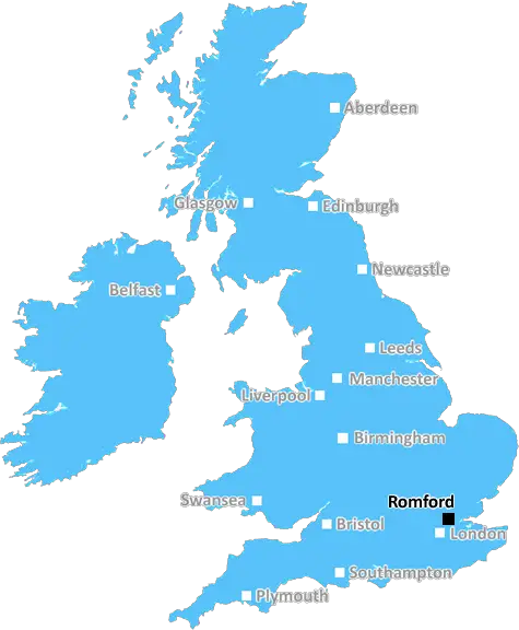
Romford (RM5)
The RM5 postcode area is located in the Romford postcode town region, within the county of Greater London, and contains a total of 478 individual postcodes.
There are 3 electoral wards in the RM5 postcode area, including Dagenham, Grays, Hornchurch, Purfleet, Rainham, Romford, South Ockendon, Tilbury, Upminster which come under the local authority of the Havering Council.
Combining the whole postcode region, 14% of people in RM5 are classed as having an AB social grade, (i.e. 'white-collar' middle-upper class), compared to 27% across the UK.
This does not mean that the people of RM5 are poorer than other areas, but it may give an indication that there are areas of deprivation.
The RM5 postcode covers a large area in east London, in the London Borough of Havering - comprising the suburbs of Collier Row, Chase Cross, Gidea Park, South Hornchurch and Emerson Park. It is within the London Metropolitan Police Borough of Havering.
The population of the area is mainly white-British with a growing cohort of other ethnicities. Living standards are considered higher than the London metropolitan area average, although many areas have experienced notable increases in the cost of renting or buying a home.
In terms of transport, the RM5 area is easily accessible via the A12 and M25 roads, whilst there are numerous bus routes which serve the postcode. Upminster railway station is also within the RM5 catchment area, providing direct links to London's financial district as well as onward travel.
Shops and services are plentiful within the area, including the Collier Row shopping centre, two large supermarkets and numerous cafes, pubs and restaurants. Popular attractions include the Mounted Police Stables, and the outdoor leisure area at Raphael Park.
Education is well serviced by a range of primary schools, secondary schools and independent schools, as well as a specialist college. There are also further educational institutions located within the catchment area.
Notable landmarks include the historic church of St Lawrence, which dates back to the 15th century, and the construction of a life-sized replica of the famous Grimaldi airship at the Havering Museum.
The RM5 area supports a wide range of activities, from sport and leisure, to culture, education and retail. For residents, the area provides an excellent lifestyle, offering a balance of urban and suburban living, convenient access to London's extensive amenities, and ample space for outdoor pursuits.

Demographics

Greater London

RM5 is located in the county of Greater London, in England.
Greater London has a total population of 8,778,500, making it the 1st largest county in the UK.
Greater London has a total area of 606 square miles, and a population density of 5594 people per square kilometre. For comparison, Greater London has a density of 5,618 people/km2.
| Outward Code | RM5 |
| Postal Town | Romford |
| MSOA Name | Havering 005 |
| LSOA Name | Havering 005D |
| County | Greater London |
| Region | Greater London |
| Country | England |
| Local Authority | Havering |
| Area Classification | Urban with Major Conurbation |
RM5 Electoral Wards
The postal region of RM5, includes the local towns, villages, electoral wards and stations of:
Dig even deeper into the RM5 postcode by clicking on a postcode below:
Click on an outward postal code below for more information about the area. Each 'outward' postcode give you a comprehensive list of all postcodes within the outward code area (RM) and estimated address.
Click on an 'outward' code for more information. For example, the outward postcode page 'EC2M' will give you an alphabetical list covering all postcodes located in the region, from 'EC2M 1BB' through to 'EC2M 7YA'.
Chris H
Sunday, April 7, 2024
We don't have any views of RM5 right now. If you live in RM5 or have visited it, please help us to help others by telling others what you think of this neighbourhood.
Add your view of RM5
People need your local expertise. If you live in RM5 or have first-hand knowledge of the neighbourhood, please consider sharing your views. It's completely anonymous - all we ask is for your initials.
Please tell us what you like about the RM5 postcode area, what you don't like, and what it's like to live or work here.
| LOCAL AMENITIES | |
| FAMILY FRIENDLY | |
| PARKING | |
| GREEN SPACES |
Local News Essex
c2c: no Monday trains as commuters set to face disruption
Members ofAslefat 16 train operators, including c2c, are staging three one-day strikes between April 5 and 8
The EchoColchester nurse has 2,500 e-bike stolen from McDonald's
Jo Pearson, 46, had her Specialized Turbo Como 3.0 e-bike stolen from outside McDonald's in Colchester on Monday evening.
Daily GazetteGosfield School unveils George Fisher Netball Academy
A CELEBRATED athlete will spearhead a new sporting initiative at a school.
Daily GazetteWeston Homes gets go-ahead for 33m resi scheme in Epping
The project will see the development of 62 homes and almost five acres of open space.
Property WeekMorrisons, Asda, Magnum recalls and 'do not eat' warnings
Food recalls have been issued at Asda and Morrisons after products were found to contain a disease-causing bacteria linked to meningitis
Daily GazetteRegal London signs Epson UK for 30,000 sq ft pre-let at Watford scheme
The grade-A The Clarendon Works office scheme will open in Q3.
Property WeekLuton Airport operating company buys hangars of collapsed airline Monarch
Hangars can accommodate wide body jets up to the size of a Boeing 767.
Property WeekPolice confirm missing Colchester woman, 38, has been found
Helen May, 38, from Colchester, is currently missing and was last seen yesterday, April 4
Daily GazetteFrom the Postcode Area blog

Deciphering Crime Rates - a Deep Dive Into UK Postcode Analysis
Ever wondered about the crime rate in your UK postcode? You're not alone. We've dug deep into the data, uncovering trends and patterns that'll make your head spin.

Death of the High Street?
The BBC reports that despite councils' attempts to kurb them, the UK's high streets have seen a huge growth in fast food outlets. Could this mark the death knell for the Great British high street, and what can we do about it to halt its decline?

Discrimination by Postcode
You really couldn't make it up, could you? Some of the country's most vulnerable people are missing out on their weekly £25 Cold Weather Payment, just because the system that's in operation is discriminating against them because payments are based on postcode, rather than geographic location.

The Redesign is Underway
Well, the current website was absolutely in dire need of a good redesign - from the ground up. So I set out to pull it all apart and get it up and running again to become the most comprehensive guide to every postcode in the UK. And it's been a long, tough job from start to finish - and quite possibly the biggest project I've ever undertaken.
SOCIAL GRADES
According to census records, 14% of people here have a social grade of AB (highest), compared to the national average of 27%.