romford RM19 Postcodes
Spending a fortune on conveyancing?

Compare instant, low-cost online quotes from trusted conveyancing solicitors.
Backed by experts, our no-obligation service searches through the best conveyancing quotes on the market to save you time and money.
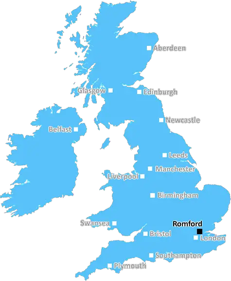
Romford (RM19)
The RM19 postcode area is located in the Romford postcode town region, within the county of Essex, and contains a total of 178 individual postcodes.
There are 5 electoral wards in the RM19 postcode area, including Dagenham, Grays, Hornchurch, Purfleet, Rainham, Romford, South Ockendon, Tilbury, Upminster which come under the local authority of the Thurrock Council.
Combining the whole postcode region, 16% of people in RM19 are classed as having an AB social grade, (i.e. 'white-collar' middle-upper class), compared to 27% across the UK.
This does not mean that the people of RM19 are poorer than other areas, but it may give an indication that there are areas of deprivation.
The RM19 postcode is located in the Romford district in East London. It lies within the local authority area of the London Borough of Havering and the post towns of Romford and Dagenham.
RM19 is a medium-sized postcode district that covers a large area of the borough. This postcode district includes parts of the Becontree Heath, Marks Gate, Goodmayes and Chadwell Heath neighbourhoods.
The RM19 postcode offers many of the benefits and amenities of living in East London in a surrounding of beautiful parks and open countryside. Amenities within the postcode district include schools, transport links, leisure facilities, shops, supermarkets, post offices, public parks and places of worship.
The postcode district is well serviced by transport links both by rail and bus. There are several bus routes passing through the area and two railway stations, Gidea Park and Romford.
Residents and visitors of RM19 can take advantage of the local leisure facilities, which include sports and social clubs, a large children's play area, an open air cafe/bar and a skate park.
For those looking to take a shopping trip, there are a variety of supermarkets, high street stores, smaller shops and retail parks located within the postcode district.
The area has a very diverse culture, with a mix of people from different backgrounds and countries, making it a very vibrant and cosmopolitan area. It is a very active area and has plenty of things to do for people of all ages.
TheRM19 postcode district is an attractive location with a variety of amenities, great transport links and plenty of attractions to explore. It is a wonderful area to live, work and visit.

Demographics

Essex

RM19 is located in the county of Essex, in England.
Essex has a total population of 1,802,200, making it the 7th largest county in the UK.
Essex has a total area of 1417 square miles, and a population density of 491 people per square kilometre. For comparison, Greater London has a density of 5,618 people/km2.
| Outward Code | RM19 |
| Postal Town | Romford |
| MSOA Name | Thurrock 016 |
| LSOA Name | Thurrock 016B |
| County | Essex |
| Region | Essex |
| Country | England |
| Local Authority | Thurrock |
| Area Classification | Urban with Major Conurbation |
RM19 Electoral Wards
The postal region of RM19, includes the local towns, villages, electoral wards and stations of:
Dig even deeper into the RM19 postcode by clicking on a postcode below:
Click on an outward postal code below for more information about the area. Each 'outward' postcode give you a comprehensive list of all postcodes within the outward code area (RM) and estimated address.
Click on an 'outward' code for more information. For example, the outward postcode page 'EC2M' will give you an alphabetical list covering all postcodes located in the region, from 'EC2M 1BB' through to 'EC2M 7YA'.
Chris H
Wednesday, April 17, 2024
We don't have any views of RM19 right now. If you live in RM19 or have visited it, please help us to help others by telling others what you think of this neighbourhood.
Add your view of RM19
People need your local expertise. If you live in RM19 or have first-hand knowledge of the neighbourhood, please consider sharing your views. It's completely anonymous - all we ask is for your initials.
Please tell us what you like about the RM19 postcode area, what you don't like, and what it's like to live or work here.
| LOCAL AMENITIES | |
| FAMILY FRIENDLY | |
| PARKING | |
| GREEN SPACES |
Local News Essex
Haart opens new property centre helping clients find homes in Harlow
The UK's largest independent estate agent, haart, has opened a huge new state-of-the-art Property Centre in Harlow.
Daily GazetteBenfleet Manor Court part of roof ripped off by winds
The top floor of Manor Court flats, in Manor Road, Benfleet, was evacuated yesterday as residents were told by firefighters the building was not safe to stay in
The EchoTT Group sells BT's old Southampton offices to consortium
BT's former Friary House office building has permission for residential conversion under permitted development rights.
Property WeekEssex Way disruption due to gas leak repair lights
Motorists in Benfleet are facing severe disruption due to three-way traffic lights that have been set up in Essex Way to control traffic while gas leak repairs continue.
The EchoEssex weather warning: Power cuts and train delays
The windy weather came after the Met Office issued a yellow weather warning covering the whole of Essex, which remains in place until 10pm today.
Daily GazettePolice warning to Ford Fiesta owners after spike in car thefts
The warning comes after a Ford Fiesta was stolen and recovered by officers from Essex Police
Essex LiveWhat are the symptoms of meningitis and how do you get it?
See the main symptoms and bacterial and viral meningitis, how you can catch it and if you can recover from it, according to the NHS.
The EchoHavens hospices call for more support as demand grows
DEMAND for hospice care in south Essex is growing as rising food and staff bills put services under severe pressure.
The EchoFrom the Postcode Area blog

Deciphering Crime Rates - a Deep Dive Into UK Postcode Analysis
Ever wondered about the crime rate in your UK postcode? You're not alone. We've dug deep into the data, uncovering trends and patterns that'll make your head spin.

Death of the High Street?
The BBC reports that despite councils' attempts to kurb them, the UK's high streets have seen a huge growth in fast food outlets. Could this mark the death knell for the Great British high street, and what can we do about it to halt its decline?

Discrimination by Postcode
You really couldn't make it up, could you? Some of the country's most vulnerable people are missing out on their weekly £25 Cold Weather Payment, just because the system that's in operation is discriminating against them because payments are based on postcode, rather than geographic location.

The Redesign is Underway
Well, the current website was absolutely in dire need of a good redesign - from the ground up. So I set out to pull it all apart and get it up and running again to become the most comprehensive guide to every postcode in the UK. And it's been a long, tough job from start to finish - and quite possibly the biggest project I've ever undertaken.
SOCIAL GRADES
According to census records, 16% of people here have a social grade of AB (highest), compared to the national average of 27%.