redhill RH17 Postcodes
Spending a fortune on conveyancing?

Compare instant, low-cost online quotes from trusted conveyancing solicitors.
Backed by experts, our no-obligation service searches through the best conveyancing quotes on the market to save you time and money.
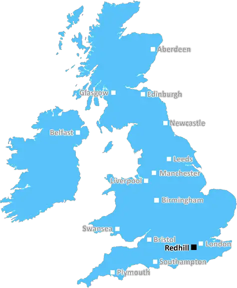
Redhill (RH17)
The RH17 postcode area is located in the Redhill postcode town region, within the county of West Sussex, and contains a total of 872 individual postcodes.
There are 65 electoral wards in the RH17 postcode area, including Betchworth, Billingshurst, Burgess Hill, Crawley, Dorking, East Grinstead, Forest Row, Gatwick, Godstone, Haywards Heath, Horley, Horsham, Lingfield, Oxted, Pulborough, Redhill, Reigate which come under the local authority of the Mid Sussex Council.
Combining the whole postcode region, 39% of people in RH17 are classed as having an AB social grade, (i.e. 'white-collar' middle-upper class), compared to 27% across the UK.
This does not mean that the people of RH17 are wealthier - or higher class - than average, but it can be an indication that the area may be prospering and desirable to live in.
RH17 postcode in the Redhill district of the UK covers a large area from Reigate to Haywards Heath and from Horsham to East Grinstead. The district includes a number of diverse residential and rural towns, villages and hamlets, including Nutfield, Crawley Down, Copthorne, Kingscote, Ansty, Leigh, Sharpethorne and Woldingham.
The RH17 postcode contains some of the most sought after residential areas in the area. It includes the popular village of Nutfield which is home to Nutfield Priory Hotel and Spa, a grand and historic hotel with spa and gardens. Copthorne is also found in RH17 and is known for its country pubs, eateries and green space. This area also comprises some of the best commuter villages outside of London, as well as several golf courses.
Public transport is well served in the area, with a number of regular trains running to London Bridge, Victoria, East Grinstead and Tunbridge Wells. Frequent buses serve East Grinstead, Crawley, Horsham, Burgess Hill and Oxted. The closest major airports are Gatwick and Heathrow, and there are a number of smaller airports within easy reach such as Biggin Hill, Redhill Aerodrome and London City Airport.
The surrounding countryside of RH17 is fascinating and varied, and it's easy to explore the rolling hills of the Changebridge Common, some of the North and South Downs, nearby forests and freshwater nature reserves. There are also a number of National Trust properties nearby, such as Wakehurst Place and Nymans.
As for leisure activities, RH17 postcode offers a little something for all tastes. Alongside the pub-and-grub experience of Crawley Down, the area has an array of independent cafes, cinemas, bowling alleys, theatres, galleries, sports centres and country parks. There are also numerous walking and cycling routes throughout the district, making it a top destination for outdoor enthusiasts.

Demographics

West Sussex

RH17 is located in the county of West Sussex, in England.
West Sussex has a total population of 843,800, making it the 28th largest county in the UK.
West Sussex has a total area of 770 square miles, and a population density of 423 people per square kilometre. For comparison, Greater London has a density of 5,618 people/km2.
| Outward Code | RH17 |
| Postal Town | Redhill |
| MSOA Name | Mid Sussex 008 |
| LSOA Name | Mid Sussex 008B |
| County | West Sussex |
| Region | West Sussex |
| Country | England |
| Local Authority | Mid Sussex |
| Area Classification | Urban with City and Town |
RH17 Electoral Wards
The postal region of RH17, includes the local towns, villages, electoral wards and stations of:
Dig even deeper into the RH17 postcode by clicking on a postcode below:
Click on an outward postal code below for more information about the area. Each 'outward' postcode give you a comprehensive list of all postcodes within the outward code area (RH) and estimated address.
Click on an 'outward' code for more information. For example, the outward postcode page 'EC2M' will give you an alphabetical list covering all postcodes located in the region, from 'EC2M 1BB' through to 'EC2M 7YA'.
Chris H
Monday, April 8, 2024
We don't have any views of RH17 right now. If you live in RH17 or have visited it, please help us to help others by telling others what you think of this neighbourhood.
Add your view of RH17
People need your local expertise. If you live in RH17 or have first-hand knowledge of the neighbourhood, please consider sharing your views. It's completely anonymous - all we ask is for your initials.
Please tell us what you like about the RH17 postcode area, what you don't like, and what it's like to live or work here.
| LOCAL AMENITIES | |
| FAMILY FRIENDLY | |
| PARKING | |
| GREEN SPACES |
Local News Sussex
Former Brighton player Kinnear dies aged 77
Former Wimbledon and Newcastle United manager Joe Kinnear dies at the age of 77, his family announces.
BBC NewsProcter leads Northants batting effort at Sussex
Northamptonshire battle to 292-7 on the second day of their County Championship game against Sussex.
BBC NewsBrighton Marathon runners cross the finish line
Three-time London Marathon winner Paula Radcliffe signalled the start of the event on Sunday.
BBC News'Hardest Geezer' Cook completes run across Africa
Almost one year after starting, Russ Cook - more widely known as the Hardest Geezer - completes his challenge to run the length of Africa.
BBC NewsTeenage driver dies after car goes into ditch
Police are appealing for witnesses to a fatal traffic incident on Wartling Road, Pevensey, on Friday.
BBC NewsArsenal beat Brighton to move top of Premier League
Arsenal maintained their pursuit of a first Premier League title for 20 years as they moved top of the table with an impressive away victory over Brighton.
BBC NewsCritical incident at hospital stood down
Visiting at Chichester's St Richard's Hospital remains suspended following a norovirus outbreak.
BBC NewsHaines ton helps Sussex hit back against Northants
Tom Haines hits 133 as Sussex reach 351-6 to all but cancel out Northants' first-innings score of 371.
BBC NewsFrom the Postcode Area blog

Deciphering Crime Rates - a Deep Dive Into UK Postcode Analysis
Ever wondered about the crime rate in your UK postcode? You're not alone. We've dug deep into the data, uncovering trends and patterns that'll make your head spin.

Death of the High Street?
The BBC reports that despite councils' attempts to kurb them, the UK's high streets have seen a huge growth in fast food outlets. Could this mark the death knell for the Great British high street, and what can we do about it to halt its decline?

Discrimination by Postcode
You really couldn't make it up, could you? Some of the country's most vulnerable people are missing out on their weekly £25 Cold Weather Payment, just because the system that's in operation is discriminating against them because payments are based on postcode, rather than geographic location.

The Redesign is Underway
Well, the current website was absolutely in dire need of a good redesign - from the ground up. So I set out to pull it all apart and get it up and running again to become the most comprehensive guide to every postcode in the UK. And it's been a long, tough job from start to finish - and quite possibly the biggest project I've ever undertaken.
SOCIAL GRADES
According to census records, 39% of people here have a social grade of AB (highest), compared to the national average of 27%.