reading RG8 Postcodes
Spending a fortune on conveyancing?

Compare instant, low-cost online quotes from trusted conveyancing solicitors.
Backed by experts, our no-obligation service searches through the best conveyancing quotes on the market to save you time and money.
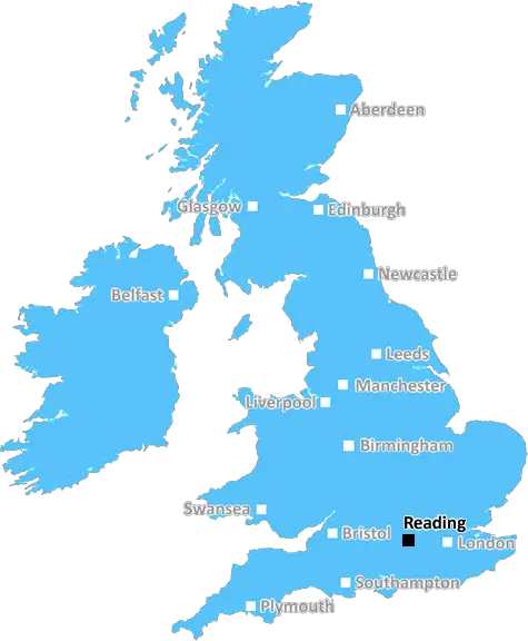
Reading (RG8)
The RG8 postcode area is located in the Reading postcode town region, within the county of Oxfordshire, and contains a total of 1269 individual postcodes.
There are 40 electoral wards in the RG8 postcode area, including Basingstoke, Bracknell, Crowthorne, Henley-On-Thames, Hook, Hungerford, Newbury, Reading, Tadley, Thatcham, Whitchurch, Wokingham which come under the local authority of the South Oxfordshire Council.
Combining the whole postcode region, 46% of people in RG8 are classed as having an AB social grade, (i.e. 'white-collar' middle-upper class), compared to 27% across the UK.
This does not mean that the people of RG8 are wealthier - or higher class - than average, but it can be an indication that the area may be prospering and desirable to live in.
The RG8 postcode lies in the south of Reading, Berkshire, on the border with the county of Oxfordshire. It covers areas including Goring, Whitchurch-on-Thames, Pangbourne and Streatley, within a radial point of around 11.5 miles from the centre of Reading.
RG8 is a rural area, with its villages situated near the River Thames, in well-wooded countryside. Whitchurch-on-Thames provides many opportunities for leisure activities such as sailing, paddle-boarding and fishing. The village of Goring is home to a number of independent shops and a railway station, providing direct access to Reading, London Paddington and other locations in the Thames Valley.
Educationencompassing the postcode include The Oratory in Woodcote, St Nicholas' CE Primary School in Goring, Theale Green School and The School of St Helen and St Katharine in Abingdon. For higher education, Reading's universities and colleges in Oxford and Wallingford provide an alternative.
Transportation links within RG8 include regular bus routes through the villages, a railway station with direct services to Reading, Oxford, London Paddington, Bristol Temple Meads, and a number of junctions onto the nearby M4 motorway.
The RG8 postcode is characterised by its mix of picturesque villages, rural landscape and easy access to major cities, meaning it attracts a range of residential populations. It's particularly popular with young families, couples and retirees. Increasingly, commuters take advantage of the good transport links to and from the area.
For shopping, Priceham and Stroud's Farm Shop in Whitchurch-on-Thames, Pangbourne Home and Garden Centre, and Goring's village stores are popular choices. Additionally, there are many pubs, restaurants and cafes scattered throughout the villages in RG8, including The Bull and The Pot Kiln in Goring, and The Whitchurch in Whitchurch-on-Thames.

Demographics

Oxfordshire

RG8 is located in the county of Oxfordshire, in England.
Oxfordshire has a total population of 683,200, making it the 35th largest county in the UK.
Oxfordshire has a total area of 1005 square miles, and a population density of 262 people per square kilometre. For comparison, Greater London has a density of 5,618 people/km2.
| Outward Code | RG8 |
| Postal Town | Reading |
| MSOA Name | South Oxfordshire 018 |
| LSOA Name | South Oxfordshire 018B |
| County | Oxfordshire |
| Region | Oxfordshire |
| Country | England |
| Local Authority | South Oxfordshire |
| Area Classification | Mainly Rural (rural including hub towns >=80%) |
RG8 Electoral Wards
The postal region of RG8, includes the local towns, villages, electoral wards and stations of:
Dig even deeper into the RG8 postcode by clicking on a postcode below:
Click on an outward postal code below for more information about the area. Each 'outward' postcode give you a comprehensive list of all postcodes within the outward code area (RG) and estimated address.
Click on an 'outward' code for more information. For example, the outward postcode page 'EC2M' will give you an alphabetical list covering all postcodes located in the region, from 'EC2M 1BB' through to 'EC2M 7YA'.
Chris H
Sunday, April 7, 2024
We don't have any views of RG8 right now. If you live in RG8 or have visited it, please help us to help others by telling others what you think of this neighbourhood.
Add your view of RG8
People need your local expertise. If you live in RG8 or have first-hand knowledge of the neighbourhood, please consider sharing your views. It's completely anonymous - all we ask is for your initials.
Please tell us what you like about the RG8 postcode area, what you don't like, and what it's like to live or work here.
| LOCAL AMENITIES | |
| FAMILY FRIENDLY | |
| PARKING | |
| GREEN SPACES |
Local News Berkshire
Villagers play 'poolette' as sewage floods streets
Residents say raw sewage has been flooding the streets of Hampstead Norreys for about three months.
BBC NewsRevamped Horlicks factory 'will be there forever'
Millions were spent restoring an iconic old building and preserving some of its original features.
BBC NewsReadings cyclists benefit from repairs at town centre stall
Cyclists can benefit from repairs and assistance in the heart of the town centre as part of an initiative that has been launched recently.
Local BerkshireNew Zia Lucia pizzeria opens in Reading Town Centre
A new family-run pizzeria has opened it's doors to the public today in Reading town centre.
Local BerkshireHow is your constituency changing?
Analysis shows the effect of the new election boundaries. Use our tool to look up your constituency.
BBC NewsFirst-time buyers account for record third of all housing sales
Hamptons' research also showsthe most popular area to a buy home for first-time buyers is Slough.
Property WeekSavills bolsters Chelmsford office with return of senior development director
Kibblewhite originally joined the agency in 1990 and spent 16 years working there.
Property WeekMilton Keynes seeks developer for 174-home scheme
The Milton Keynes site occupies 15.6 acres of land with an additional 7.2 acres of green space.
Property WeekFrom the Postcode Area blog

Deciphering Crime Rates - a Deep Dive Into UK Postcode Analysis
Ever wondered about the crime rate in your UK postcode? You're not alone. We've dug deep into the data, uncovering trends and patterns that'll make your head spin.

Death of the High Street?
The BBC reports that despite councils' attempts to kurb them, the UK's high streets have seen a huge growth in fast food outlets. Could this mark the death knell for the Great British high street, and what can we do about it to halt its decline?

Discrimination by Postcode
You really couldn't make it up, could you? Some of the country's most vulnerable people are missing out on their weekly £25 Cold Weather Payment, just because the system that's in operation is discriminating against them because payments are based on postcode, rather than geographic location.

The Redesign is Underway
Well, the current website was absolutely in dire need of a good redesign - from the ground up. So I set out to pull it all apart and get it up and running again to become the most comprehensive guide to every postcode in the UK. And it's been a long, tough job from start to finish - and quite possibly the biggest project I've ever undertaken.
SOCIAL GRADES
According to census records, 46% of people here have a social grade of AB (highest), compared to the national average of 27%.