reading RG23 Postcodes
Spending a fortune on conveyancing?

Compare instant, low-cost online quotes from trusted conveyancing solicitors.
Backed by experts, our no-obligation service searches through the best conveyancing quotes on the market to save you time and money.
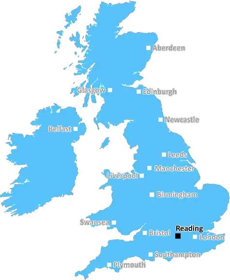
Reading (RG23)
The RG23 postcode area is located in the Reading postcode town region, within the county of Hampshire, and contains a total of 391 individual postcodes.
There are 19 electoral wards in the RG23 postcode area, including Basingstoke, Bracknell, Crowthorne, Henley-On-Thames, Hook, Hungerford, Newbury, Reading, Tadley, Thatcham, Whitchurch, Wokingham which come under the local authority of the Basingstoke and Deane Council.
Combining the whole postcode region, 30% of people in RG23 are classed as having an AB social grade, (i.e. 'white-collar' middle-upper class), compared to 27% across the UK.
This does not mean that the people of RG23 are wealthier - or higher class - than average, but it can be an indication that the area may be prospering and desirable to live in.
RG23 is a postcode located in the Borough of Reading, Berkshire, United Kingdom. It covers parts of the following neighbourhoods and villages of Basingstoke and Deane unitary district: Mortimer West End, Mortimer, Mortimer Common, Stratfield Mortimer, Riseley, Burghfield Common, Beech Hill, Three Mile Cross, Burghfield, Sulhamstead, Little London, and Sowbrooke.
RG23 postcode serves Reading, Berkshire and its surrounding areas. It is a small postcode district in the Royal Mail's postcode system within the Reading post town and comprises primarily of residential neighbourhoods and villages.
The postcode RG23 falls into the RG postcode area (Reading and its nearby towns of Wokingham, Newbury, Tadley, Hungerford, Thatcham, Didcot, Wantage, Abingdon and Wallingford). It also covers parts of Basingstoke and Deane unitary district in Hampshire.
Motorways and main roads such as the M4 Motorway, A33, A4, A4074, and A340 all traverse through the postcode and provide quick access to surrounding cities such as London, Oxford and Bath. Rail services are available from Reading railway station and Mortimer railway station.
RG23 postcode provides easy access to the Reading town centre with its shopping centre and supermarkets, leisure and entertainment facilities, fine restaurants, museums, art galleries, and pubs. The area also has plenty of recreational parks and open spaces, such as Prospect Park, King George V Playing Fields, Sulham Woods and Churchend Park, which are all popular with residents.
RG23 postcode is home to a number of schools and educational establishments, such as Mortimer St John's Primary School, Maiden Erlegh School, St. Peter's Preparatory School, Woolhampton Primary School, and Englefield Primary School. Healthcare facilities are available from The Maples Surgery, Capability Green Surgery and Grovelands Family Practice.
RG23 postcode is a highly sought-after residential area due to its convenient location; close access to motorways and rail services to and from London; excellent selection of schools, healthcare and leisure facilities; and being surrounded by varied countryside.

Demographics

Hampshire

RG23 is located in the county of Hampshire, in England.
Hampshire has a total population of 1,829,500, making it the 5th largest county in the UK.
Hampshire has a total area of 1455 square miles, and a population density of 485 people per square kilometre. For comparison, Greater London has a density of 5,618 people/km2.
| Outward Code | RG23 |
| Postal Town | Reading |
| MSOA Name | Basingstoke and Deane 015 |
| LSOA Name | Basingstoke and Deane 015D |
| County | Hampshire |
| Region | Hampshire |
| Country | England |
| Local Authority | Basingstoke and Deane |
| Area Classification | Urban with Significant Rural (rural including hub towns 26-49%) |
RG23 Electoral Wards
The postal region of RG23, includes the local towns, villages, electoral wards and stations of:
Dig even deeper into the RG23 postcode by clicking on a postcode below:
Click on an outward postal code below for more information about the area. Each 'outward' postcode give you a comprehensive list of all postcodes within the outward code area (RG) and estimated address.
Click on an 'outward' code for more information. For example, the outward postcode page 'EC2M' will give you an alphabetical list covering all postcodes located in the region, from 'EC2M 1BB' through to 'EC2M 7YA'.
Chris H
Monday, April 8, 2024
We don't have any views of RG23 right now. If you live in RG23 or have visited it, please help us to help others by telling others what you think of this neighbourhood.
Add your view of RG23
People need your local expertise. If you live in RG23 or have first-hand knowledge of the neighbourhood, please consider sharing your views. It's completely anonymous - all we ask is for your initials.
Please tell us what you like about the RG23 postcode area, what you don't like, and what it's like to live or work here.
| LOCAL AMENITIES | |
| FAMILY FRIENDLY | |
| PARKING | |
| GREEN SPACES |
Local News Hampshire
Anti-racism groups condemn Webber 'jail' comments
Anti-racism campaign groups condemn "disgraceful" comments made by ex-Norwich sporting director Stuart Webber about five black footballers.
BBC NewsRussia's neighbours urge Nato allies to bring back military service
Following Vladimir Putin's full-scale invasion of Ukraine, conscription is being rebooted and expanded across Europe.
BBC NewsMoxon saves point for Portsmouth against Derby
Owen Moxon's stunning strike rescues a point for Portsmouth in an entertaining draw with League One promotion rivals Derby.
BBC NewsHistoric hotel set to become student housing
Southampton's Grade II listed Dolphin Hotel has recently provided accommodation for asylum seekers.
BBC NewsPeterborough United 0-1 Portsmouth
Portsmouth take another big step towards the League One title with a vital 1-0 victory at promotion rivals Peterborough.
BBC NewsColden Common man banned from driving for two years for drink driving
A COLDEN Common man has been banned from the road for two years for being almost three times the drink drive limit.
Hampshire ChronicleReview: Circus Extreme in Hampshire - 'jaw-dropping'
Circus Extreme brings its unbelievable jaw-dropping world-class show to Hampshire
Hampshire Chronicle5 Spring activities that could lead to legal issues
The University of Law has warned Brits over 5 'innocent' Spring activities that could land you legal trouble.
Hampshire ChronicleFrom the Postcode Area blog

Deciphering Crime Rates - a Deep Dive Into UK Postcode Analysis
Ever wondered about the crime rate in your UK postcode? You're not alone. We've dug deep into the data, uncovering trends and patterns that'll make your head spin.

Death of the High Street?
The BBC reports that despite councils' attempts to kurb them, the UK's high streets have seen a huge growth in fast food outlets. Could this mark the death knell for the Great British high street, and what can we do about it to halt its decline?

Discrimination by Postcode
You really couldn't make it up, could you? Some of the country's most vulnerable people are missing out on their weekly £25 Cold Weather Payment, just because the system that's in operation is discriminating against them because payments are based on postcode, rather than geographic location.

The Redesign is Underway
Well, the current website was absolutely in dire need of a good redesign - from the ground up. So I set out to pull it all apart and get it up and running again to become the most comprehensive guide to every postcode in the UK. And it's been a long, tough job from start to finish - and quite possibly the biggest project I've ever undertaken.
SOCIAL GRADES
According to census records, 30% of people here have a social grade of AB (highest), compared to the national average of 27%.