portsmouth PO21 Postcodes
Spending a fortune on conveyancing?

Compare instant, low-cost online quotes from trusted conveyancing solicitors.
Backed by experts, our no-obligation service searches through the best conveyancing quotes on the market to save you time and money.
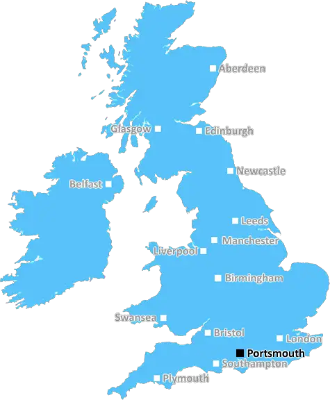
Portsmouth (PO21)
The PO21 postcode area is located in the Portsmouth postcode town region, within the county of West Sussex, and contains a total of 1725 individual postcodes.
There are 16 electoral wards in the PO21 postcode area, including Bembridge, Bognor Regis, Chichester, Cowes, East Cowes, Emsworth, Fareham, Freshwater, Gosport, Havant, Hayling Island, Lee-On-The-Solent, Newport, Portsmouth, Rowland's Castle, Ryde, Sandown, Seaview, Shanklin, Southsea, Totland Bay, Ventnor, Waterlooville, Yarmouth which come under the local authority of the Arun Council.
Combining the whole postcode region, 16% of people in PO21 are classed as having an AB social grade, (i.e. 'white-collar' middle-upper class), compared to 27% across the UK.
This does not mean that the people of PO21 are poorer than other areas, but it may give an indication that there are areas of deprivation.
PO21 is a postcode district located within the Portsmouth area of Hampshire, England. It covers the outlying north-eastern suburbs of Bognor Regis, which are within the Borough of Arun, (partly) the town of Felpham, which is within the Borough of Chichester, and parts of the civil parishes of Middleton, and Tangmere, which are within the District of Chichester.
PO21 postcode district consists of four postcode areas, PO21 1, PO21 2, PO21 3 and PO21 4.
PO21 1 covers the north-western part of Felpham, part of Middleton and part of Tangmere. PO21 2 covers part of Felpham, part of Middleton and the south-western part of Bognor Regis. PO21 3 covers the south-eastern part of Bognor Regis and PO21 4 covers part of Tangmere and an area to the north-east of Bognor Regis.
The postcode is served by two main transporters: National Express and Stagecoach South. It is also served by the Southern Railway Network from Bognor Regis station and Chichester Station.
PO21 postcode district is a popular residential area for for young professionals and is home to many education and leisure facilities. It includes several primary schools and one secondary school in Felpham, three primary schools in Bognor Regis, and one secondary school in Middleton. There are also two libraries, two major leisure centres and a sports centre.
Shopping and dining are also available in the PO21 postcode district with several supermarkets, smaller family-run grocery stores, restaurants, pubs, and coffee shops. The area is also home to a wide range of attractions such as the sandy beaches of Bognor Regis, Fishbourne Roman Palace, and the West Sussex National Motor Museum.

Demographics

West Sussex

PO21 is located in the county of West Sussex, in England.
West Sussex has a total population of 843,800, making it the 28th largest county in the UK.
West Sussex has a total area of 770 square miles, and a population density of 423 people per square kilometre. For comparison, Greater London has a density of 5,618 people/km2.
| Outward Code | PO21 |
| Postal Town | Portsmouth |
| MSOA Name | Arun 016 |
| LSOA Name | Arun 016B |
| County | West Sussex |
| Region | West Sussex |
| Country | England |
| Local Authority | Arun |
| Area Classification | Urban with City and Town |
PO21 Electoral Wards
The postal region of PO21, includes the local towns, villages, electoral wards and stations of:
Dig even deeper into the PO21 postcode by clicking on a postcode below:
Click on an outward postal code below for more information about the area. Each 'outward' postcode give you a comprehensive list of all postcodes within the outward code area (PO) and estimated address.
Click on an 'outward' code for more information. For example, the outward postcode page 'EC2M' will give you an alphabetical list covering all postcodes located in the region, from 'EC2M 1BB' through to 'EC2M 7YA'.
Chris H
Monday, April 8, 2024
We don't have any views of PO21 right now. If you live in PO21 or have visited it, please help us to help others by telling others what you think of this neighbourhood.
Add your view of PO21
People need your local expertise. If you live in PO21 or have first-hand knowledge of the neighbourhood, please consider sharing your views. It's completely anonymous - all we ask is for your initials.
Please tell us what you like about the PO21 postcode area, what you don't like, and what it's like to live or work here.
| LOCAL AMENITIES | |
| FAMILY FRIENDLY | |
| PARKING | |
| GREEN SPACES |
Local News Sussex
Arsenal beat Brighton to move top of Premier League
Arsenal maintained their pursuit of a first Premier League title for 20 years as they moved top of the table with an impressive away victory over Brighton.
BBC NewsHardest Geezer: Runner completes Africa challenge
The extreme challenge began at South Africa's most southerly point on 22 April, 2023.
BBC NewsLandslip disrupts trains to Brighton
Southern Rail says engineers are investigating the incident between Hassocks and Burgess Hill.
BBC NewsThe transmitter that beams TV to millions of homes
A "self-confessed transmitter geek" takes the BBC around one of London's tallest structures.
BBC NewsCritical incident at hospital stood down
Visiting at Chichester's St Richard's Hospital remains suspended following a norovirus outbreak.
BBC NewsConcert marks 50 years since Abba Eurovision win
A total of five Eurovision winners will perform at Brighton Dome to celebrate Abba's victory.
BBC News'Hardest Geezer' Cook completes run across Africa
Almost one year after starting, Russ Cook - more widely known as the Hardest Geezer - completes his challenge to run the length of Africa.
BBC NewsHaines ton helps Sussex hit back against Northants
Tom Haines hits 133 as Sussex reach 351-6 to all but cancel out Northants' first-innings score of 371.
BBC NewsFrom the Postcode Area blog

Deciphering Crime Rates - a Deep Dive Into UK Postcode Analysis
Ever wondered about the crime rate in your UK postcode? You're not alone. We've dug deep into the data, uncovering trends and patterns that'll make your head spin.

Death of the High Street?
The BBC reports that despite councils' attempts to kurb them, the UK's high streets have seen a huge growth in fast food outlets. Could this mark the death knell for the Great British high street, and what can we do about it to halt its decline?

Discrimination by Postcode
You really couldn't make it up, could you? Some of the country's most vulnerable people are missing out on their weekly £25 Cold Weather Payment, just because the system that's in operation is discriminating against them because payments are based on postcode, rather than geographic location.

The Redesign is Underway
Well, the current website was absolutely in dire need of a good redesign - from the ground up. So I set out to pull it all apart and get it up and running again to become the most comprehensive guide to every postcode in the UK. And it's been a long, tough job from start to finish - and quite possibly the biggest project I've ever undertaken.
SOCIAL GRADES
According to census records, 16% of people here have a social grade of AB (highest), compared to the national average of 27%.