portsmouth PO18 Postcodes
Spending a fortune on conveyancing?

Compare instant, low-cost online quotes from trusted conveyancing solicitors.
Backed by experts, our no-obligation service searches through the best conveyancing quotes on the market to save you time and money.
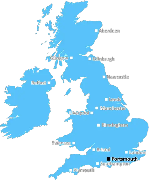
Portsmouth (PO18)
The PO18 postcode area is located in the Portsmouth postcode town region, within the county of West Sussex, and contains a total of 790 individual postcodes.
There are 90 electoral wards in the PO18 postcode area, including Bembridge, Bognor Regis, Chichester, Cowes, East Cowes, Emsworth, Fareham, Freshwater, Gosport, Havant, Hayling Island, Lee-On-The-Solent, Newport, Portsmouth, Rowland's Castle, Ryde, Sandown, Seaview, Shanklin, Southsea, Totland Bay, Ventnor, Waterlooville, Yarmouth which come under the local authority of the Chichester Council.
Combining the whole postcode region, 32% of people in PO18 are classed as having an AB social grade, (i.e. 'white-collar' middle-upper class), compared to 27% across the UK.
This does not mean that the people of PO18 are wealthier - or higher class - than average, but it can be an indication that the area may be prospering and desirable to live in.
PO18 postcode is a geographic area covering the suburbs of Portsmouth in the South-East of England. It includes four distinct areas � north, south, east and west � which are each dressed in their own unique identities.
In the north, the postcode encompasses North Baffins, Farlington, and Copnor. The industrial area of North Baffins has seen a number of new housing developments in recent years, but still retains much of its traditional character. Farlington is situated in the west of the area, and comprises of a mix of residential, commercial and industrial properties. Copnor, also in the north, is a bustling suburban area full of shops, businesses, pubs and eateries.
The southern area of PO18 encompasses two prominent neighbourhoods. Bedhampton is a residential area close to the coast that is often overlooked due to its proximity to the nearby city of Portsmouth. Hilsea is another popular area, featuring a central shopping complex and connections to the A3(M) motorway.
The eastern part includes two distinct suburbs: Paulsgrove and Cosham. Paulsgrove is a relatively new urban settlement, but Cosham is an area that dates back to the 16th century. Both are residential areas, but there are many amenities and services available for people that live there.
Finally,PO18 covers the western parts of Portsmouth such as Drayton, Tangier, and Wymering. Drayton is a well-established suburb offering good transport links, and Tangier and Wymering are residential suburbs with good access to leisure facilities, such as Cosham Park.
PO18 is part of the larger Portsmouth district, and is home to a diverse range of people and landscapes. It offers close proximity to the city of Portsmouth and other neighbouring towns, and features a variety of amenities and services that cater to a wide range of lifestyles.

Demographics
West Sussex

PO18 is located in the county of West Sussex, in England.
West Sussex has a total population of 843,800, making it the 28th largest county in the UK.
West Sussex has a total area of 770 square miles, and a population density of 423 people per square kilometre. For comparison, Greater London has a density of 5,618 people/km2.
| Outward Code | PO18 |
| Postal Town | Portsmouth |
| MSOA Name | Chichester 006 |
| LSOA Name | Chichester 006D |
| County | West Sussex |
| Region | West Sussex |
| Country | England |
| Local Authority | Chichester |
| Area Classification | Largely Rural (rural including hub towns 50-79%) |
PO18 Electoral Wards
The postal region of PO18, includes the local towns, villages, electoral wards and stations of:
Dig even deeper into the PO18 postcode by clicking on a postcode below:
Click on an outward postal code below for more information about the area. Each 'outward' postcode give you a comprehensive list of all postcodes within the outward code area (PO) and estimated address.
Click on an 'outward' code for more information. For example, the outward postcode page 'EC2M' will give you an alphabetical list covering all postcodes located in the region, from 'EC2M 1BB' through to 'EC2M 7YA'.
Chris H
Tuesday, April 9, 2024
We don't have any views of PO18 right now. If you live in PO18 or have visited it, please help us to help others by telling others what you think of this neighbourhood.
Add your view of PO18
People need your local expertise. If you live in PO18 or have first-hand knowledge of the neighbourhood, please consider sharing your views. It's completely anonymous - all we ask is for your initials.
Please tell us what you like about the PO18 postcode area, what you don't like, and what it's like to live or work here.
| LOCAL AMENITIES | |
| FAMILY FRIENDLY | |
| PARKING | |
| GREEN SPACES |
Local News Sussex
New 1m football pitch to get community funding
Funds collected from developers will complete the financing for a new 3G pitch at Three Bridges FC.
BBC News'Hardest Geezer' Cook completes run across Africa
Almost one year after starting, Russ Cook - more widely known as the Hardest Geezer - completes his challenge to run the length of Africa.
BBC NewsViews on autism services sought by county council
The authority is creating a plan to improve services and opportunities for people with autism.
BBC NewsFormer Brighton player Kinnear dies aged 77
Former Wimbledon and Newcastle United manager Joe Kinnear dies at the age of 77, his family announces.
BBC NewsProcter leads Northants batting effort at Sussex
Northamptonshire battle to 292-7 on the second day of their County Championship game against Sussex.
BBC NewsSexual harassment of NHS staff widespread - survey
A study was carried out of more than 12,200 health workers.
BBC NewsCharity making memories for sick children on stage
Forward Facing organises an event at Brighton Dome for children with life-limiting conditions.
BBC NewsNorthants hang on to deny Sussex an opening win
Northamptonshire, and bad light, deny Sussex an opening County Championship Division Two victory at Hove.
BBC NewsFrom the Postcode Area blog

Deciphering Crime Rates - a Deep Dive Into UK Postcode Analysis
Ever wondered about the crime rate in your UK postcode? You're not alone. We've dug deep into the data, uncovering trends and patterns that'll make your head spin.

Death of the High Street?
The BBC reports that despite councils' attempts to kurb them, the UK's high streets have seen a huge growth in fast food outlets. Could this mark the death knell for the Great British high street, and what can we do about it to halt its decline?

Discrimination by Postcode
You really couldn't make it up, could you? Some of the country's most vulnerable people are missing out on their weekly £25 Cold Weather Payment, just because the system that's in operation is discriminating against them because payments are based on postcode, rather than geographic location.

The Redesign is Underway
Well, the current website was absolutely in dire need of a good redesign - from the ground up. So I set out to pull it all apart and get it up and running again to become the most comprehensive guide to every postcode in the UK. And it's been a long, tough job from start to finish - and quite possibly the biggest project I've ever undertaken.
SOCIAL GRADES
According to census records, 32% of people here have a social grade of AB (highest), compared to the national average of 27%.