plymouth PL30 Postcodes
Spending a fortune on conveyancing?

Compare instant, low-cost online quotes from trusted conveyancing solicitors.
Backed by experts, our no-obligation service searches through the best conveyancing quotes on the market to save you time and money.
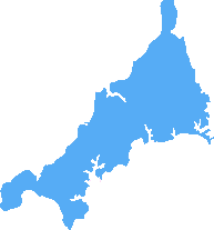
Plymouth (PL30)
The PL30 postcode area is located in the Plymouth postcode town region, within the county of Cornwall, and contains a total of 594 individual postcodes.
There are 233 electoral wards in the PL30 postcode area, including Bodmin, Boscastle, Callington, Calstock, Camelford, Delabole, Fowey, Gunnislake, Ivybridge, Launceston, Lifton, Liskeard, Looe, Lostwithiel, Padstow, Par, Plymouth, Port Isaac, Saltash, St Austell, Tavistock, Tintagel, Torpoint, Wadebridge, Yelverton which come under the local authority of the Cornwall,Isles of Scilly Council.
Combining the whole postcode region, 18% of people in PL30 are classed as having an AB social grade, (i.e. 'white-collar' middle-upper class), compared to 27% across the UK.
This does not mean that the people of PL30 are poorer than other areas, but it may give an indication that there are areas of deprivation.
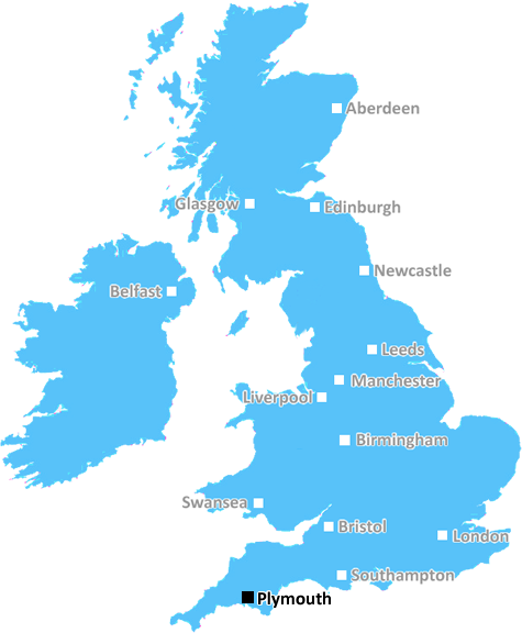
The PL30 postcode describes an area of North Cornwall in the United Kingdom, situated in the Plymouth district. It is approximately fifteen miles south west of Bodmin, six miles east of St Ives and approximately twenty-five miles north of Plymouth.
The PL30 postcode mainly consists of rural areas and hamlets with the largest village being Blisland. The other villages include Lanivet, Nanstallon and Temple. The main roads in and out of the area are the A391 and A30, which connect the area to the rest of the Cornish region.
The postcode also covers part of the larger Camel Valley, stretching out from the north of Blisland. It is renowned for its spectacular views of the Camel Estuary and the geological richness of the land.
In terms of transport links within the postcode, there are hourly buses servicing the larger towns and villages. For further afield travel, St Austell and Bodmin Parkway railway stations are approximately thirty minutes drive away.
The area is well serviced by convenience stores, pubs, restaurants, and cafes in all the larger villages. It is also popular with visitors for its archaeological sites, iconic landmarks and coastal beauty spots. These include the 15th century church of St. Blaise in Lanivet and the stunning moorland landscape and extensive woodlands around the area.
In terms of educational institutions, the postcode had a few primary schools. For further education, students are sent to secondary schools in Bodmin. There is also a further education college located in Wadebridge for those pursuing higher education.
The postcode is often associated with privacy, seclusion and low crime rates. The area is known for its high property prices due to its natural beauty and tranquillity.
The PL30 postcode is home to a close-knit community of individuals with strong ties to the natural environment. From picturesque villages to stunning views, North Cornwall offers a unique charm and a lifestyle that continues to attract locals and visitors alike.

Demographics

Cornwall
PL30 is located in the county of Cornwall, in England.
Cornwall has a total population of 556,000, making it the 40th largest county in the UK.
Cornwall has a total area of 1375 square miles, and a population density of 156 people per square kilometre. For comparison, Greater London has a density of 5,618 people/km2.
| Outward Code | PL30 |
| Postal Town | Plymouth |
| MSOA Name | Cornwall 011 |
| LSOA Name | Cornwall 011D |
| County | Cornwall |
| Region | Cornwall |
| Country | England |
| Local Authority | Cornwall,Isles of Scilly |
| Area Classification | Mainly Rural (rural including hub towns >=80%) |
PL30 Electoral Wards
The postal region of PL30, includes the local towns, villages, electoral wards and stations of:
Dig even deeper into the PL30 postcode by clicking on a postcode below:
Click on an outward postal code below for more information about the area. Each 'outward' postcode give you a comprehensive list of all postcodes within the outward code area (PL) and estimated address.
Click on an 'outward' code for more information. For example, the outward postcode page 'EC2M' will give you an alphabetical list covering all postcodes located in the region, from 'EC2M 1BB' through to 'EC2M 7YA'.
Chris H
Wednesday, April 10, 2024
We don't have any views of PL30 right now. If you live in PL30 or have visited it, please help us to help others by telling others what you think of this neighbourhood.
Add your view of PL30
People need your local expertise. If you live in PL30 or have first-hand knowledge of the neighbourhood, please consider sharing your views. It's completely anonymous - all we ask is for your initials.
Please tell us what you like about the PL30 postcode area, what you don't like, and what it's like to live or work here.
| LOCAL AMENITIES | |
| FAMILY FRIENDLY | |
| PARKING | |
| GREEN SPACES |
Local News Cornwall
Beach huts washed into the sea as storm batters Cornwall
Falmouth Coastguard had issued a warning about a combination of strong winds, spring tides and storm surges.
Cornwall LiveIncredible pictures show St Ives swamped by seawater as Coastguard issues urgent warning
More flooding is possible overnight and on Wednesday morning (April 10), sparking a poignant warning from St Ives Coastguard
Cornwall LiveVideo shows scenes of destruction after beach huts swept into sea at Falmouth
Footage emerged of the structures bobbing around in the huge waves off Castle Beach
Cornwall LiveDad who fell from St Ives hotel balcony took his own life on last day of holiday
Adrian Moon was described as a loyal, conscientious and hardworking man with his wife saying he was the 'go to' man at work and at home
Cornwall LivePerranporth dad died after breaking ankle in fall
Paul Nicholls died in Royal Cornwall Hospital after surgery to fix a fractured ankle injury sustained in a fall
Cornwall LiveMeet the new landlords taking 'leap of faith' with pub that closed over rising costs
The popular St Austell Brewery-owned pub was closed for six months before exchanging hands recently
Cornwall LiveEvery 'act now' flood warning in Cornwall as huge waves and 75mph winds batter country
Flooding is expected across the north and south Cornwall coastlines
Cornwall LiveVibrant new Porthleven restaurant Cantina promises affordable street food
The owner of Amlies in Porthleven and LULA in Gwithien is behind the brand new restaurant which opened its doors just days ago
Cornwall LiveFrom the Postcode Area blog

Deciphering Crime Rates - a Deep Dive Into UK Postcode Analysis
Ever wondered about the crime rate in your UK postcode? You're not alone. We've dug deep into the data, uncovering trends and patterns that'll make your head spin.

Death of the High Street?
The BBC reports that despite councils' attempts to kurb them, the UK's high streets have seen a huge growth in fast food outlets. Could this mark the death knell for the Great British high street, and what can we do about it to halt its decline?

Discrimination by Postcode
You really couldn't make it up, could you? Some of the country's most vulnerable people are missing out on their weekly £25 Cold Weather Payment, just because the system that's in operation is discriminating against them because payments are based on postcode, rather than geographic location.

The Redesign is Underway
Well, the current website was absolutely in dire need of a good redesign - from the ground up. So I set out to pull it all apart and get it up and running again to become the most comprehensive guide to every postcode in the UK. And it's been a long, tough job from start to finish - and quite possibly the biggest project I've ever undertaken.
SOCIAL GRADES
According to census records, 18% of people here have a social grade of AB (highest), compared to the national average of 27%.