peterborough PE34 Postcodes
Spending a fortune on conveyancing?

Compare instant, low-cost online quotes from trusted conveyancing solicitors.
Backed by experts, our no-obligation service searches through the best conveyancing quotes on the market to save you time and money.
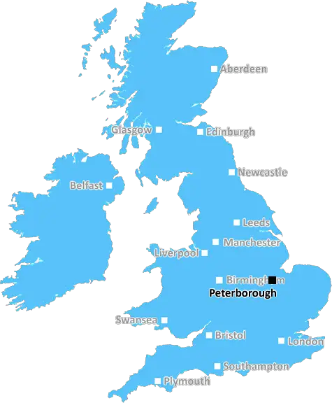
Peterborough (PE34)
The PE34 postcode area is located in the Peterborough postcode town region, within the county of Norfolk, and contains a total of 509 individual postcodes.
There are 56 electoral wards in the PE34 postcode area, including Boston, Bourne, Chatteris, Downham Market, Hunstanton, Huntingdon, King's Lynn, March, Peterborough, Sandringham, Skegness, Spalding, Spilsby, St Ives, St Neots, Stamford, Swaffham, Wisbech which come under the local authority of the King's Lynn and West Norfolk Council.
Combining the whole postcode region, 14% of people in PE34 are classed as having an AB social grade, (i.e. 'white-collar' middle-upper class), compared to 27% across the UK.
This does not mean that the people of PE34 are poorer than other areas, but it may give an indication that there are areas of deprivation.
PE34 postcode is situated in the West Norfolk district of Peterborough. It is a fairly small postcode area, spanning just 6.47 square kilometres, including the towns of Wolferton, Marshland St. James, and Snettisham, and the village of Heacham.
The majority of the postcode area consists of rural settlements, however Wolferton and Marshland St. James contain a few businesses. Wolferton is home to Bosworth's Barn, a popular farm shop, as well as a garden centre. It is also located within easy reach of the nearby town of King's Lynn, and many of the locals commute there for work.
The population, according to the 2011 census, is 4,558, with an estimate of 4,938 in 2016. The average age is 41.7, with many youthful households and a significant proportion of older people. The majority of the population are White British (84.6%), followed by those of Asian, Mixed and Black ethnicities (6.7%). Christianity is the predominant religion (66.2%) followed by no religion (30.7%).
The postcode area spans the King's Lynn and West Norfolk district council area, as well as part of the Borough of King's Lynn and West Norfolk. It is situated in the West of England region and is part of the ceremonial county of Norfolk. The nearest train station is King's Lynn, located 12 miles away, with the nearest airport (Norwich International Airport) located 26 miles away.
The local economy is largely agricultural, with a large number of farms in the area, producing crops such as cereals, potatoes and onions. Employment in agriculture is currently at 12.5%, though unemployment in the area is higher than the national average (4.8% in 2012). The Wolferton Enterprise Centre, located in Wolferton, provides affordable office space for businesses, and is geared towards encouraging economic development in the area.
The largest employer in PE34 is Colman's, the mustard and sauces manufacturer. The Wolferton site is a major part of the company's UK manufacturing operations and employs over 500 people. Other major employers include AC Rodley, Flowcrete, and Tevida Healthcare. There is a wide range of leisure activities available in the area, from boating and cycling on the Holkham Estate to birdwatching at Titchwell Marsh.

Demographics

Norfolk

PE34 is located in the county of Norfolk, in England.
Norfolk has a total population of 892,900, making it the 25th largest county in the UK.
Norfolk has a total area of 2080 square miles, and a population density of 165 people per square kilometre. For comparison, Greater London has a density of 5,618 people/km2.
| Outward Code | PE34 |
| Postal Town | Peterborough |
| MSOA Name | King's Lynn and West Norfolk 011 |
| LSOA Name | King's Lynn and West Norfolk 011D |
| County | Norfolk |
| Region | Norfolk |
| Country | England |
| Local Authority | King's Lynn and West Norfolk |
| Area Classification | Largely Rural (rural including hub towns 50-79%) |
PE34 Electoral Wards
The postal region of PE34, includes the local towns, villages, electoral wards and stations of:
Dig even deeper into the PE34 postcode by clicking on a postcode below:
Click on an outward postal code below for more information about the area. Each 'outward' postcode give you a comprehensive list of all postcodes within the outward code area (PE) and estimated address.
Click on an 'outward' code for more information. For example, the outward postcode page 'EC2M' will give you an alphabetical list covering all postcodes located in the region, from 'EC2M 1BB' through to 'EC2M 7YA'.
Chris H
Tuesday, April 9, 2024
We don't have any views of PE34 right now. If you live in PE34 or have visited it, please help us to help others by telling others what you think of this neighbourhood.
Add your view of PE34
People need your local expertise. If you live in PE34 or have first-hand knowledge of the neighbourhood, please consider sharing your views. It's completely anonymous - all we ask is for your initials.
Please tell us what you like about the PE34 postcode area, what you don't like, and what it's like to live or work here.
| LOCAL AMENITIES | |
| FAMILY FRIENDLY | |
| PARKING | |
| GREEN SPACES |
Local News Norfolk
How long to save a life?
How quickly does the East Anglian Air Ambulance get out on a call?
BBC NewsTenth-generation circus act thrilled by crowds
"My friends think it's cool to travel around the country and perform," says 17-year-old Luke Austin.
BBC NewsWells RNLI warns about tidal dangers
The RNLI crew at Wells-Next-The-Sea are warning people about its unique' tide.
BBC NewsPolice reassure fans ahead of East Anglian derby
Industrial action on the trains is expected to disrupt travel for some fans heading to Carrow Road.
BBC News'The NHS paid for my mum to go private. She died'
BBC Panorama investigates patient safety at a major private provider used by the NHS.
BBC NewsLife as an Ipswich fan in Norwich
A Norwich publican on living in the city, but supporting its biggest football rival.
BBC NewsIpswich Town fans predict derby result
As the East Anglian derby approaches, Ipswich have won more games this season than rivals Norwich.
BBC NewsCarers' support charity saved from closure
The charity, which had announced its impending closure, is saved by a partnership with an NHS trust.
BBC NewsFrom the Postcode Area blog

Deciphering Crime Rates - a Deep Dive Into UK Postcode Analysis
Ever wondered about the crime rate in your UK postcode? You're not alone. We've dug deep into the data, uncovering trends and patterns that'll make your head spin.

Death of the High Street?
The BBC reports that despite councils' attempts to kurb them, the UK's high streets have seen a huge growth in fast food outlets. Could this mark the death knell for the Great British high street, and what can we do about it to halt its decline?

Discrimination by Postcode
You really couldn't make it up, could you? Some of the country's most vulnerable people are missing out on their weekly £25 Cold Weather Payment, just because the system that's in operation is discriminating against them because payments are based on postcode, rather than geographic location.

The Redesign is Underway
Well, the current website was absolutely in dire need of a good redesign - from the ground up. So I set out to pull it all apart and get it up and running again to become the most comprehensive guide to every postcode in the UK. And it's been a long, tough job from start to finish - and quite possibly the biggest project I've ever undertaken.
SOCIAL GRADES
According to census records, 14% of people here have a social grade of AB (highest), compared to the national average of 27%.