paisley PA33 Postcodes
Spending a fortune on conveyancing?

Compare instant, low-cost online quotes from trusted conveyancing solicitors.
Backed by experts, our no-obligation service searches through the best conveyancing quotes on the market to save you time and money.
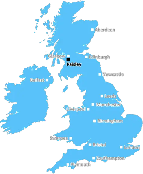
Paisley (PA33)
The PA33 postcode area is located in the Paisley postcode town region, within the county of Argyllshire, and contains a total of 44 individual postcodes.
There are 50 electoral wards in the PA33 postcode area, including Appin, Bishopton, Bridge Of Orchy, Bridge Of Weir, Cairndow, Campbeltown, Colintraive, Dalmally, Dunoon, Erskine, Gourock, Greenock, Inveraray, Isle Of Bute, Isle Of Coll, Isle Of Colonsay, Isle Of Gigha, Isle Of Iona, Isle Of Islay, Isle Of Jura, Isle Of Mull, Isle Of Tiree, Johnstone, Kilmacolm, Lochgilphead, Lochwinnoch, Oban, Paisley, Port Glasgow, Renfrew, Skelmorlie, Tarbert, Taynuilt, Tighnabruaich, Wemyss Bay which come under the local authority of the Argyll & Bute Council.
Combining the whole postcode region, 0% of people in PA33 are classed as having an AB social grade, (i.e. 'white-collar' middle-upper class), compared to 27% across the UK.
This does not mean that the people of PA33 are poorer than other areas, but it may give an indication that there are areas of deprivation.
The postcode PA33, serving parts of the Scottish county of Argyll and Bute, is a rural residential area that offers undisturbed views of the surrounding countryside.
The area is situated near the village of Connel, and is home to many small businesses, such as forestry, farming, and quarrying. In addition, residents enjoy good access to recreation areas, allowing them to pursue outdoor activities such as walking, cycling, golf and fishing.
The area is also close to a number of coastal towns, such as Oban, with its many beaches, and Benderloch, home to a large shopping centre and other amenities. The village of Connel itself features a bakery, post office, and supermarkets for those who wish to stay local.
Transport links to PA33 are provided mostly by bus, with several local bus services travelling through the area. The nearest railway station is Connel Ferry.
The area is home to a variety of architectural styles, ranging from the old to the new. Most homes were built in the late 19th or early 20th century, when the area was popular for holidaymakers, and feature traditional stone or rendered walls and slate roofs. Many buildings from this time have been maintained and are thankfully still standing today.
Various organisations are responsible for the area, such as the Argyll and Bute Council which provides services and support. The Scottish Environmental Protection Agency is also present in the area, monitoring various aspects of the environment. Argyll and Bute Police and Scottish Fire and Rescue are also on hand to respond to any incidents.
In terms of education, two primary schools serve the PA33 area, with the nearest secondary school being Dunbeg Primary School. The University of the Highlands and Islands has a campus nearby and offers degrees in a range of areas.
All things considered, PA33 is a delightful place to live, offering residents a peaceful environment, a variety of businesses and activities, and access to amenities and public services.

Demographics
Argyllshire

PA33 is located in the county of Argyllshire, in Scotland.
Argyllshire has a total population of 0, making it the largest county in the UK.
Argyllshire has a total area of square miles, and a population density of people per square kilometre. For comparison, Greater London has a density of 5,618 people/km2.
| Outward Code | PA33 |
| Postal Town | Paisley |
| MSOA Name | Loch Awe |
| LSOA Name | |
| County | Argyllshire |
| Region | Argyllshire |
| Country | Scotland |
| Local Authority | Argyll & Bute |
| Area Classification | Unclassified |
PA33 Electoral Wards
The postal region of PA33, includes the local towns, villages, electoral wards and stations of:
Dig even deeper into the PA33 postcode by clicking on a postcode below:
Click on an outward postal code below for more information about the area. Each 'outward' postcode give you a comprehensive list of all postcodes within the outward code area (PA) and estimated address.
Click on an 'outward' code for more information. For example, the outward postcode page 'EC2M' will give you an alphabetical list covering all postcodes located in the region, from 'EC2M 1BB' through to 'EC2M 7YA'.
Chris H
Wednesday, April 17, 2024
We don't have any views of PA33 right now. If you live in PA33 or have visited it, please help us to help others by telling others what you think of this neighbourhood.
Add your view of PA33
People need your local expertise. If you live in PA33 or have first-hand knowledge of the neighbourhood, please consider sharing your views. It's completely anonymous - all we ask is for your initials.
Please tell us what you like about the PA33 postcode area, what you don't like, and what it's like to live or work here.
| LOCAL AMENITIES | |
| FAMILY FRIENDLY | |
| PARKING | |
| GREEN SPACES |
From the Postcode Area blog

Deciphering Crime Rates - a Deep Dive Into UK Postcode Analysis
Ever wondered about the crime rate in your UK postcode? You're not alone. We've dug deep into the data, uncovering trends and patterns that'll make your head spin.

Death of the High Street?
The BBC reports that despite councils' attempts to kurb them, the UK's high streets have seen a huge growth in fast food outlets. Could this mark the death knell for the Great British high street, and what can we do about it to halt its decline?

Discrimination by Postcode
You really couldn't make it up, could you? Some of the country's most vulnerable people are missing out on their weekly £25 Cold Weather Payment, just because the system that's in operation is discriminating against them because payments are based on postcode, rather than geographic location.

The Redesign is Underway
Well, the current website was absolutely in dire need of a good redesign - from the ground up. So I set out to pull it all apart and get it up and running again to become the most comprehensive guide to every postcode in the UK. And it's been a long, tough job from start to finish - and quite possibly the biggest project I've ever undertaken.
SOCIAL GRADES
According to census records, 0% of people here have a social grade of AB (highest), compared to the national average of 27%.