nottingham NG5 Postcodes
Spending a fortune on conveyancing?

Compare instant, low-cost online quotes from trusted conveyancing solicitors.
Backed by experts, our no-obligation service searches through the best conveyancing quotes on the market to save you time and money.
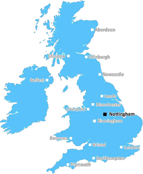
Nottingham (NG5)
The NG5 postcode area is located in the Nottingham postcode town region, within the county of Nottinghamshire, and contains a total of 2426 individual postcodes.
There are 15 electoral wards in the NG5 postcode area, including Grantham, Mansfield, Newark, Nottingham, Sleaford, Southwell, Sutton-In-Ashfield which come under the local authority of the Gedling Council.
Combining the whole postcode region, 20% of people in NG5 are classed as having an AB social grade, (i.e. 'white-collar' middle-upper class), compared to 27% across the UK.
This does not mean that the people of NG5 are poorer than other areas, but it may give an indication that there are areas of deprivation.
The NG5 postcode covers the majority of the Nottingham district (in UK post-code lingo, the letters NG stand for Nottinghamshire). It is mainly a residential area and covers about 11 square miles in the north-west of Nottingham.
The districts within the NG5 postcode include the residential neighbourhoods of: Arno Vale, Basford, Berry Hill, Berridge, Bulwell, Bulwell Forest, Chafford, Colwick, Coppice, Fairfax, Gedling, Highbury Vale, Hyson Green, Mapperley, Mapperley Plains, Netherfield, New Basford, Old Basford, Porchesterfields, Sherwood, St Ann's, The Meadows, Top Valley, and Wollaton.
The NG5 postcode is based around two main shopping centres; the Victoria Centre and the Broadmarsh Centre. There are smaller shopping parades, such as at Mapperley, Bulwell and Nottingham College, the main retail outlets being Tesco and Morrisons.
The area also boasts a wide range of leisure attractions, including several gyms, leisure and pool centres, and golf courses. There are parks and outdoor spaces like Forest Recreation Ground, Arundel Park, Wollaton Park and Highfields Park, all visitors of which fall under the NG5 postcode.
Public transport links in the NG5 postcode are also well connected with a variety of bus routes and the two main railway stations there being Nottingham Midland and Nottingham Victoria.
The area is home to a mix of housing, ranging from large detached homes to social housing estates and there is also a high number of student-occupied housing in the NG5 postcode. The area also has several places of worship, including a Mosque, an Evangelical church, and an Anglican Church.
In terms of education, NG5 postcode excels with a range of both primary and secondary schools found in the area. Primary schools include Berry Hill, Watnall, Rockburn, St Thomas and St. Matthias whilst secondary schools can be found at the Jubilee Campus and Harvey Road. Higher education facilities are also provided in the area at Nottingham Trent University, as well as the industrial estates found in Colwick and Portfrord.

Demographics

Nottinghamshire

NG5 is located in the county of Nottinghamshire, in England.
Nottinghamshire has a total population of 1,136,000, making it the 15th largest county in the UK.
Nottinghamshire has a total area of 834 square miles, and a population density of 526 people per square kilometre. For comparison, Greater London has a density of 5,618 people/km2.
| Outward Code | NG5 |
| Postal Town | Nottingham |
| MSOA Name | Gedling 006 |
| LSOA Name | Gedling 006D |
| County | Nottinghamshire |
| Region | Nottinghamshire |
| Country | England |
| Local Authority | Gedling |
| Area Classification | Urban with Minor Conurbation |
NG5 Electoral Wards
The postal region of NG5, includes the local towns, villages, electoral wards and stations of:
Dig even deeper into the NG5 postcode by clicking on a postcode below:
Click on an outward postal code below for more information about the area. Each 'outward' postcode give you a comprehensive list of all postcodes within the outward code area (NG) and estimated address.
Click on an 'outward' code for more information. For example, the outward postcode page 'EC2M' will give you an alphabetical list covering all postcodes located in the region, from 'EC2M 1BB' through to 'EC2M 7YA'.
PW, nottingham
Sunday, February 10, 2019
Generally speaking its a lovely place to live.However,there is a bit of a nosey complaining culture Also the flats would greatly benefit from having Wi-Fi.
Add your view of NG5
People need your local expertise. If you live in NG5 or have first-hand knowledge of the neighbourhood, please consider sharing your views. It's completely anonymous - all we ask is for your initials.
Please tell us what you like about the NG5 postcode area, what you don't like, and what it's like to live or work here.
| LOCAL AMENITIES | |
| FAMILY FRIENDLY | |
| PARKING | |
| GREEN SPACES |
Local News Nottinghamshire
Stalker ex-boyfriend who sent explicit images jailed
Matthew Stuart's victim suffered a "prolonged campaign of harassment", police say.
BBC NewsMansfield Town 1-4 Crawley Town
Crawley coast to a powerful statement 4-1 victory at promotion rivals Mansfield.
BBC NewsWindrush scandal campaigners mark sixth anniversary of exposure with vigil
Those fighting for justice said 'the community does not trust the Home Office'
Nottingham PostPhotos released as new neonatal unit takes shape
The new unit in Nottingham will be almost three times as big as the one it is replacing.
BBC NewsYoung Nottinghamshire man took his own life after health services failed to react to doctor's plea
Alexander Lyalushko, a young man living in the Gedling borough of Nottinghamshire, hanged himself in his home on January 2, 2023
Nottingham PostLitter of puppies found abandoned in woodland
An animal rescue centre is awaiting a DNA test to find out if they are a type of XL bully.
BBC NewsArrests after group in street knife fight
One teenager has been taken to hospital with a leg injury, Nottinghamshire Police say.
BBC NewsInside the new flats which have transformed landmark Nottinghamshire town building
The building was originally a wool warehouse and was left empty for years
Nottingham PostFrom the Postcode Area blog

Deciphering Crime Rates - a Deep Dive Into UK Postcode Analysis
Ever wondered about the crime rate in your UK postcode? You're not alone. We've dug deep into the data, uncovering trends and patterns that'll make your head spin.

Death of the High Street?
The BBC reports that despite councils' attempts to kurb them, the UK's high streets have seen a huge growth in fast food outlets. Could this mark the death knell for the Great British high street, and what can we do about it to halt its decline?

Discrimination by Postcode
You really couldn't make it up, could you? Some of the country's most vulnerable people are missing out on their weekly £25 Cold Weather Payment, just because the system that's in operation is discriminating against them because payments are based on postcode, rather than geographic location.

The Redesign is Underway
Well, the current website was absolutely in dire need of a good redesign - from the ground up. So I set out to pull it all apart and get it up and running again to become the most comprehensive guide to every postcode in the UK. And it's been a long, tough job from start to finish - and quite possibly the biggest project I've ever undertaken.
SOCIAL GRADES
According to census records, 20% of people here have a social grade of AB (highest), compared to the national average of 27%.