nottingham NG4 Postcodes
Spending a fortune on conveyancing?

Compare instant, low-cost online quotes from trusted conveyancing solicitors.
Backed by experts, our no-obligation service searches through the best conveyancing quotes on the market to save you time and money.
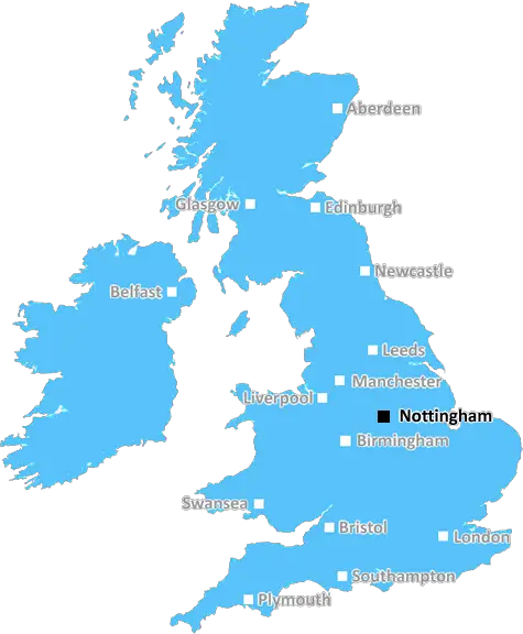
Nottingham (NG4)
The NG4 postcode area is located in the Nottingham postcode town region, within the county of Nottinghamshire, and contains a total of 1138 individual postcodes.
There are 7 electoral wards in the NG4 postcode area, including Grantham, Mansfield, Newark, Nottingham, Sleaford, Southwell, Sutton-In-Ashfield which come under the local authority of the Gedling Council.
Combining the whole postcode region, 19% of people in NG4 are classed as having an AB social grade, (i.e. 'white-collar' middle-upper class), compared to 27% across the UK.
This does not mean that the people of NG4 are poorer than other areas, but it may give an indication that there are areas of deprivation.
The NG4 postcode covers a large part of Nottingham, including parts of Sherwood, Carlton, Netherfield, Colwick, and Gedling. It includes both urban and rural areas and is divided into ten different delivery areas.
The NG4 postcode consists mostly of suburban areas with a small amount of countryside. Sherwood is a densely populated area with many high-rise buildings and is home to the famous Nottingham Castle. Netherfield is made up of mainly housing developments, with a few industrial estates. Carlton and Colwick are mostly residential areas, but there are also plenty of green spaces such as Colwick Park and Carlton Hill, as well as some industrial estates located around Netherfield. Gedling includes the village of Arnold, where the Grade I listed manor house Averham Park is situated.
The majority of shops, amenities, and services in the NG4 postcode are located in the nearby towns of Arnold, Sherwood, and Netherfield, where residents have access to supermarkets, health services, cafes and restaurants, recreational facilities, and public transport links.
The area is home to several educational institutions, including The University of Nottingham, Nottingham Trent University, Nottingham Academy, Nottingham High School, and Private Schools Nottingham.
The Nottinghamshire county council are responsible for the administration of the postcode area and the provision of services such as policing, rubbish collection, and roads and pavements maintenance, while Nottingham City Council are responsible for local elections and prosecuting crime.
Other key organisations located within the postcode area include the Nottingham Urban Area Partnership, Nottinghamshire County Council's Waste Management Department, Nottinghamshire Healthcare, and various housing associations.
NG4 is well served by the East Midlands Trains line, which runs from Nottingham to Sheffield, connecting Nottingham with the rest of the East Midlands area. The postcode is close to junction 26 of the M1 motorway, providing easy access to Derby and Leicester.

Demographics

Nottinghamshire

NG4 is located in the county of Nottinghamshire, in England.
Nottinghamshire has a total population of 1,136,000, making it the 15th largest county in the UK.
Nottinghamshire has a total area of 834 square miles, and a population density of 526 people per square kilometre. For comparison, Greater London has a density of 5,618 people/km2.
| Outward Code | NG4 |
| Postal Town | Nottingham |
| MSOA Name | Gedling 014 |
| LSOA Name | Gedling 014C |
| County | Nottinghamshire |
| Region | Nottinghamshire |
| Country | England |
| Local Authority | Gedling |
| Area Classification | Urban with Minor Conurbation |
NG4 Electoral Wards
The postal region of NG4, includes the local towns, villages, electoral wards and stations of:
Dig even deeper into the NG4 postcode by clicking on a postcode below:
Click on an outward postal code below for more information about the area. Each 'outward' postcode give you a comprehensive list of all postcodes within the outward code area (NG) and estimated address.
Click on an 'outward' code for more information. For example, the outward postcode page 'EC2M' will give you an alphabetical list covering all postcodes located in the region, from 'EC2M 1BB' through to 'EC2M 7YA'.
Chris H
Saturday, April 6, 2024
We don't have any views of NG4 right now. If you live in NG4 or have visited it, please help us to help others by telling others what you think of this neighbourhood.
Add your view of NG4
People need your local expertise. If you live in NG4 or have first-hand knowledge of the neighbourhood, please consider sharing your views. It's completely anonymous - all we ask is for your initials.
Please tell us what you like about the NG4 postcode area, what you don't like, and what it's like to live or work here.
| LOCAL AMENITIES | |
| FAMILY FRIENDLY | |
| PARKING | |
| GREEN SPACES |
Local News Nottinghamshire
Man admits murdering his dad at home
Peter McGarry is facing a life sentence for killing his 76-year-old father, a judge said.
BBC NewsUniversity students prioritising money for taxis over food after Nottingham attacks
Officers for the student union said the deaths of Grace O'Malley-Kumar and Barnaby Webber has 'left a massive trauma and loss on the student community'
Nottingham Post10k reward to find suspected violent burglar
Police say the victims were chosen due to their vulnerability and some were left "traumatised".
BBC NewsStalker ex-boyfriend who sent explicit images jailed
Matthew Stuart's victim suffered a "prolonged campaign of harassment", police say.
BBC NewsWorker diverted council cash into her own pocket
Sinead Johnson took funds from 61 accounts for vulnerable people over four years, a court hears.
BBC NewsNotts have to hit ground running - Moores
Head coach Peter Moores says Nottinghamshire are better prepared after a "shock" return to Division One last season.
BBC NewsArrests after group in street knife fight
One teenager has been taken to hospital with a leg injury, Nottinghamshire Police say.
BBC NewsNottingham City Council apologises to staff after late payment put NCT bus passes at risk
The council's lack of payment came despite the fact that the authority takes money to pay for the passes out of the wages of participating employees each month
Nottingham PostFrom the Postcode Area blog

Deciphering Crime Rates - a Deep Dive Into UK Postcode Analysis
Ever wondered about the crime rate in your UK postcode? You're not alone. We've dug deep into the data, uncovering trends and patterns that'll make your head spin.

Death of the High Street?
The BBC reports that despite councils' attempts to kurb them, the UK's high streets have seen a huge growth in fast food outlets. Could this mark the death knell for the Great British high street, and what can we do about it to halt its decline?

Discrimination by Postcode
You really couldn't make it up, could you? Some of the country's most vulnerable people are missing out on their weekly £25 Cold Weather Payment, just because the system that's in operation is discriminating against them because payments are based on postcode, rather than geographic location.

The Redesign is Underway
Well, the current website was absolutely in dire need of a good redesign - from the ground up. So I set out to pull it all apart and get it up and running again to become the most comprehensive guide to every postcode in the UK. And it's been a long, tough job from start to finish - and quite possibly the biggest project I've ever undertaken.
SOCIAL GRADES
According to census records, 19% of people here have a social grade of AB (highest), compared to the national average of 27%.