nottingham NG33 Postcodes
Spending a fortune on conveyancing?

Compare instant, low-cost online quotes from trusted conveyancing solicitors.
Backed by experts, our no-obligation service searches through the best conveyancing quotes on the market to save you time and money.
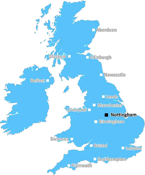
Nottingham (NG33)
The NG33 postcode area is located in the Nottingham postcode town region, within the county of Lincolnshire, and contains a total of 503 individual postcodes.
There are 56 electoral wards in the NG33 postcode area, including Grantham, Mansfield, Newark, Nottingham, Sleaford, Southwell, Sutton-In-Ashfield which come under the local authority of the South Kesteven Council.
Combining the whole postcode region, 28% of people in NG33 are classed as having an AB social grade, (i.e. 'white-collar' middle-upper class), compared to 27% across the UK.
This does not mean that the people of NG33 are wealthier - or higher class - than average, but it can be an indication that the area may be prospering and desirable to live in.
NG33 is a postcode in the Nottingham district of England, UK. It covers an area to the north of the city and borders the city and county of Nottinghamshire.
The NG33 postcode area covers a population of approximately 23,400 people and consists of the suburbs of Burton Joyce, Gunthorpe, Lambley, Lowdham, Thurgaton, and Woodborough. The area is well-connected, with a network of public transport links and excellent road infrastructure.
The area offers plenty of green spaces and recreational activities, such as walking, horse riding, and cycling routes. Visitors and locals can enjoy attractions such as Colwick Country Park, Holme Pierrepont Country Park, and Rushcliffe Country Park. Local leisure amenities include bowling greens, golf courses, and fishing opportunities.
The NG33 postcode has a wide range of housing, ranging from terraced houses, bungalows, and detached properties, to semi-detached dwellings. There is a selection of schools, including primary, secondary, and special educational needs, as well as several universities, making it well-suited for families and students.
The area is also home to several business parks, industrial sites, retail parks, and large shopping complexes. Local companies in the NG33 postcode area contribute to the economically active population, from multinational brands to independent businesses in industries such as manufacturing, engineering, and technology.
The NG33 postcode boasts a wide range of local amenities, including sports clubs, pubs, restaurants, and bars, all within easy access of Nottingham city centre. Whether it's for shopping, leisure, or just for a day out, there's something for everyone in this postcode area.

Demographics

Lincolnshire

NG33 is located in the county of Lincolnshire, in England.
Lincolnshire has a total population of 1,073,300, making it the 18th largest county in the UK.
Lincolnshire has a total area of 2693 square miles, and a population density of 153 people per square kilometre. For comparison, Greater London has a density of 5,618 people/km2.
| Outward Code | NG33 |
| Postal Town | Nottingham |
| MSOA Name | South Kesteven 007 |
| LSOA Name | South Kesteven 007E |
| County | Lincolnshire |
| Region | Lincolnshire |
| Country | England |
| Local Authority | South Kesteven |
| Area Classification | Largely Rural (rural including hub towns 50-79%) |
NG33 Electoral Wards
The postal region of NG33, includes the local towns, villages, electoral wards and stations of:
Dig even deeper into the NG33 postcode by clicking on a postcode below:
Click on an outward postal code below for more information about the area. Each 'outward' postcode give you a comprehensive list of all postcodes within the outward code area (NG) and estimated address.
Click on an 'outward' code for more information. For example, the outward postcode page 'EC2M' will give you an alphabetical list covering all postcodes located in the region, from 'EC2M 1BB' through to 'EC2M 7YA'.
Chris H
Saturday, April 6, 2024
We don't have any views of NG33 right now. If you live in NG33 or have visited it, please help us to help others by telling others what you think of this neighbourhood.
Add your view of NG33
People need your local expertise. If you live in NG33 or have first-hand knowledge of the neighbourhood, please consider sharing your views. It's completely anonymous - all we ask is for your initials.
Please tell us what you like about the NG33 postcode area, what you don't like, and what it's like to live or work here.
| LOCAL AMENITIES | |
| FAMILY FRIENDLY | |
| PARKING | |
| GREEN SPACES |
Local News Lincolnshire
New homes plan approved despite local concerns
Twenty homes will be built in Stallingborough despite some residents' concerns.
BBC NewsCarlisle United 1-3 Lincoln City
Lincoln continue their late play-off charge with a 3-1 victory over relegation-threatened Carlisle.
BBC NewsPlanning inspector to probe level crossing closure
North Lincolnshire Council says the closure by Network Rail denies access to a historical footpath.
BBC NewsBus services double in Skegness with more routes and areas covered
Stagecoach and the council has made improvements to some of its services
Lincolnshire LiveMan, 24, dies after crash involving motorbike and Mini near Market Deeping
Police are appealing for information
Lincolnshire LiveLincoln's historic Glory Hole footpath to reopen
A local business says it has spent the past year in a "survival process".
BBC NewsCouncil sells Skegness seafront land for 1
A hotel and coffee shop will be built on the site.
BBC NewsUnexploded bombs and gases found at RAF Scampton
The site, near Lincoln, is due to house up to 800 asylum seekers under Home Office plans.
BBC NewsFrom the Postcode Area blog

Deciphering Crime Rates - a Deep Dive Into UK Postcode Analysis
Ever wondered about the crime rate in your UK postcode? You're not alone. We've dug deep into the data, uncovering trends and patterns that'll make your head spin.

Death of the High Street?
The BBC reports that despite councils' attempts to kurb them, the UK's high streets have seen a huge growth in fast food outlets. Could this mark the death knell for the Great British high street, and what can we do about it to halt its decline?

Discrimination by Postcode
You really couldn't make it up, could you? Some of the country's most vulnerable people are missing out on their weekly £25 Cold Weather Payment, just because the system that's in operation is discriminating against them because payments are based on postcode, rather than geographic location.

The Redesign is Underway
Well, the current website was absolutely in dire need of a good redesign - from the ground up. So I set out to pull it all apart and get it up and running again to become the most comprehensive guide to every postcode in the UK. And it's been a long, tough job from start to finish - and quite possibly the biggest project I've ever undertaken.
SOCIAL GRADES
According to census records, 28% of people here have a social grade of AB (highest), compared to the national average of 27%.