nottingham NG13 Postcodes
Spending a fortune on conveyancing?

Compare instant, low-cost online quotes from trusted conveyancing solicitors.
Backed by experts, our no-obligation service searches through the best conveyancing quotes on the market to save you time and money.
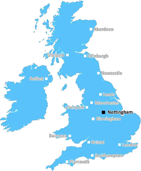
Nottingham (NG13)
The NG13 postcode area is located in the Nottingham postcode town region, within the county of Leicestershire, and contains a total of 761 individual postcodes.
There are 52 electoral wards in the NG13 postcode area, including Grantham, Mansfield, Newark, Nottingham, Sleaford, Southwell, Sutton-In-Ashfield which come under the local authority of the Melton Council.
Combining the whole postcode region, 34% of people in NG13 are classed as having an AB social grade, (i.e. 'white-collar' middle-upper class), compared to 27% across the UK.
This does not mean that the people of NG13 are wealthier - or higher class - than average, but it can be an indication that the area may be prospering and desirable to live in.
The NG13 postcode is located in the Nottingham district of England. It covers the villages of Bottesford, Muston, Plungar, Harby, Redmile, Saxondale, and the civil parish of Aslockton. It contains a total of 12,648 postcodes, with an estimated population of 22,355 people as of 2018.
The area is dominated by rural villages and hamlets. There are a number of small, family-owned businesses located in the NG13 postcode, including farms, pubs, and convenience stores. There are also a few small industrial estates such as the Draycott Lane Industrial Estate.
The primary transport link is the A46, which connects the postcode to the rest of Nottinghamshire. From this road, many of the villages can be accessed via the A606, which connects the postcode to the centre of Nottingham. Local bus routes also run throughout the postcode.
The postcode is serviced by one primary school (Bottesford Primary School) and one secondary school (Harby Primary School). It is located in close proximity to a number of universities such as Nottingham Trent University and the University of Leicester. There are also several libraries located throughout the postcode, in addition to Leisure Centres, community centres, and healthcare facilities.
The largest nearby town is Melton Mowbray, known for its wide range of independent stores, boutiques and art galleries. It is also home to a number of market stalls, as well as the National Space Centre. Other nearby attractions include the Nottinghamshire County Show, Nottingham Racecourse, and the Belvoir Castle.
In terms of geographical features, the area is characterised by low plains to the East and rolling hills to the West. It is well known for its picturesque valleys and woodlands, as well as its rich history. Several churches, stately homes and monuments are located in the area. The River Trent, which runs through the postcode, is a popular spot for fishing, boating and walking.
TheNG13 postcode is known for its quaint rural villages, independent businesses, historical landmarks, and natural beauty. The area is also brimming with activities, ranging from outdoor adventures to cultural events, and provides a unique balance between urban and rural life.

Demographics

Leicestershire

NG13 is located in the county of Leicestershire, in England.
Leicestershire has a total population of 1,031,300, making it the 21st largest county in the UK.
Leicestershire has a total area of 832 square miles, and a population density of 478 people per square kilometre. For comparison, Greater London has a density of 5,618 people/km2.
| Outward Code | NG13 |
| Postal Town | Nottingham |
| MSOA Name | Melton 001 |
| LSOA Name | Melton 001B |
| County | Leicestershire |
| Region | Leicestershire |
| Country | England |
| Local Authority | Melton |
| Area Classification | Mainly Rural (rural including hub towns >=80%) |
NG13 Electoral Wards
The postal region of NG13, includes the local towns, villages, electoral wards and stations of:
Dig even deeper into the NG13 postcode by clicking on a postcode below:
Click on an outward postal code below for more information about the area. Each 'outward' postcode give you a comprehensive list of all postcodes within the outward code area (NG) and estimated address.
Click on an 'outward' code for more information. For example, the outward postcode page 'EC2M' will give you an alphabetical list covering all postcodes located in the region, from 'EC2M 1BB' through to 'EC2M 7YA'.
Chris H
Monday, April 8, 2024
We don't have any views of NG13 right now. If you live in NG13 or have visited it, please help us to help others by telling others what you think of this neighbourhood.
Add your view of NG13
People need your local expertise. If you live in NG13 or have first-hand knowledge of the neighbourhood, please consider sharing your views. It's completely anonymous - all we ask is for your initials.
Please tell us what you like about the NG13 postcode area, what you don't like, and what it's like to live or work here.
| LOCAL AMENITIES | |
| FAMILY FRIENDLY | |
| PARKING | |
| GREEN SPACES |
Local News Nottinghamshire
Photos released as new neonatal unit takes shape
The new unit in Nottingham will be almost three times as big as the one it is replacing.
BBC NewsRealistic human organ models used to train surgeons
They are created at Nottingham Trent University using data from real CT scans.
BBC News3 beautiful waterside Airbnb properties perfect for a Nottinghamshire 'staycation'
Whether you want to go glamping, fishing or sightseeing, there is something for you.
Nottingham PostStrength and unity: Families of the Nottingham attacks victims celebrate the wedding of James Coates
James and his wife tied the knot in recent days and Emma and David Webber were there to show love and friendship
Nottingham PostNCT's brand new electric buses ready to start taking passengers
NCT is introducing 24 of the new electric buses into service
Nottingham PostSmart meter customers who had them installed months ago in line for compensation
Energy firms are set to pay out an additional 200,000 in compensation after forceful prepayment meter installations, with 1,000 more customers in line for a payout
Nottingham PostGo-ahead for return of ancient-style burial mounds
The three barrows are said to be the first in the East Midlands "in thousands of years".
BBC NewsNotts County 3-0 Harrogate Town
Notts County win at Meadow Lane for the first time in 2024 as they comfortably beat Harrogate 3-0.
BBC NewsFrom the Postcode Area blog

Deciphering Crime Rates - a Deep Dive Into UK Postcode Analysis
Ever wondered about the crime rate in your UK postcode? You're not alone. We've dug deep into the data, uncovering trends and patterns that'll make your head spin.

Death of the High Street?
The BBC reports that despite councils' attempts to kurb them, the UK's high streets have seen a huge growth in fast food outlets. Could this mark the death knell for the Great British high street, and what can we do about it to halt its decline?

Discrimination by Postcode
You really couldn't make it up, could you? Some of the country's most vulnerable people are missing out on their weekly £25 Cold Weather Payment, just because the system that's in operation is discriminating against them because payments are based on postcode, rather than geographic location.

The Redesign is Underway
Well, the current website was absolutely in dire need of a good redesign - from the ground up. So I set out to pull it all apart and get it up and running again to become the most comprehensive guide to every postcode in the UK. And it's been a long, tough job from start to finish - and quite possibly the biggest project I've ever undertaken.
SOCIAL GRADES
According to census records, 34% of people here have a social grade of AB (highest), compared to the national average of 27%.