norwich NR25 Postcodes
Spending a fortune on conveyancing?

Compare instant, low-cost online quotes from trusted conveyancing solicitors.
Backed by experts, our no-obligation service searches through the best conveyancing quotes on the market to save you time and money.
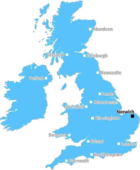
Norwich (NR25)
The NR25 postcode area is located in the Norwich postcode town region, within the county of Norfolk, and contains a total of 551 individual postcodes.
There are 27 electoral wards in the NR25 postcode area, including Attleborough, Beccles, Bungay, Cromer, Dereham, Fakenham, Great Yarmouth, Holt, Lowestoft, Melton Constable, North Walsham, Norwich, Sheringham, Walsingham, Wells-Next-The-Sea, Wymondham which come under the local authority of the North Norfolk Council.
Combining the whole postcode region, 24% of people in NR25 are classed as having an AB social grade, (i.e. 'white-collar' middle-upper class), compared to 27% across the UK.
This does not mean that the people of NR25 are poorer than other areas, but it may give an indication that there are areas of deprivation.
The NR25 postcode is located in the Norfolk county in the East of England. It covers a wide area from Cromer in the north to Blakeney in the south and includes the towns of Wells-next-the-Sea, Holt, Sheringham and Fakenham. It is bordered by the North Sea and smaller estuaries such as the Glaven, Stiffkey and Blakeney.
Much of the area is rural, with significant areas of coastal marsh, heathland and rolling hills. Sand dunes line much of the coastline which is also great for bird watching given the wide variety of birdlife.
The area has a long history; the town of Holt for example is mentioned as far back as Anglo-Saxon times. Wells-next-the-Sea is an important trading port and coastal town with an interesting mix of Georgian, Victorian and Edwardian architecture, with the famous beach huts dotting the sand dunes. There are some great attractions in the area, from the Holt Country Park to the Moore Nature Reserve and the Parrot Zoo.
The area also offers a wealth of great places to stay. There is a choice of rural self-catering accommodation, as well as caravan and camping parks, a wide range of hotels and excellent value bed and breakfast establishments. Whether you're looking to relax or explore, there's something for everyone here in NR25.
The area is known for its seafood too, and the quay areas of Cromer and Wells-next-the-Sea have an array of vendors selling freshly caught fish, crab and lobster. Cromer is well known for its famous crabs, which are renowned for offering a succulent and flavourful experience. The area is also home to the popular �Redstone Sands' beach which is well-known among kitesurfers and sailboarders.
For those interested in outdoor activities NR25 also offers some excellent possibilities including cycling, fishing, sailing, walking and bird watching. For the more adventurous there is also an abundance of surfing and kitesurfing spots. Other attractions include golf courses, churches, museums and nurseries.
Finally, the area is serviced by a number of bus services which offer great links to local towns and villages. it is an area that offers something for everyone and can be easily explored by foot, bicycle or public transport.

Demographics

Norfolk

NR25 is located in the county of Norfolk, in England.
Norfolk has a total population of 892,900, making it the 25th largest county in the UK.
Norfolk has a total area of 2080 square miles, and a population density of 165 people per square kilometre. For comparison, Greater London has a density of 5,618 people/km2.
| Outward Code | NR25 |
| Postal Town | Norwich |
| MSOA Name | North Norfolk 004 |
| LSOA Name | North Norfolk 004C |
| County | Norfolk |
| Region | Norfolk |
| Country | England |
| Local Authority | North Norfolk |
| Area Classification | Mainly Rural (rural including hub towns >=80%) |
NR25 Electoral Wards
The postal region of NR25, includes the local towns, villages, electoral wards and stations of:
Dig even deeper into the NR25 postcode by clicking on a postcode below:
Click on an outward postal code below for more information about the area. Each 'outward' postcode give you a comprehensive list of all postcodes within the outward code area (NR) and estimated address.
Click on an 'outward' code for more information. For example, the outward postcode page 'EC2M' will give you an alphabetical list covering all postcodes located in the region, from 'EC2M 1BB' through to 'EC2M 7YA'.
Chris H
Wednesday, April 10, 2024
We don't have any views of NR25 right now. If you live in NR25 or have visited it, please help us to help others by telling others what you think of this neighbourhood.
Add your view of NR25
People need your local expertise. If you live in NR25 or have first-hand knowledge of the neighbourhood, please consider sharing your views. It's completely anonymous - all we ask is for your initials.
Please tell us what you like about the NR25 postcode area, what you don't like, and what it's like to live or work here.
| LOCAL AMENITIES | |
| FAMILY FRIENDLY | |
| PARKING | |
| GREEN SPACES |
Local News Norfolk
Proposed quarry 'like a gun to our heads' - villagers
If approved, the gravel pit would be bigger than the village itself.
BBC NewsSunken boats on The Broads more than doubles
The Broads Authority says recent extreme weather conditions led to the rise in the number of wrecks.
BBC NewsLifeboat crew rescues group cut off by the tide
Two people and a child are rescued after being stranded on a foreshore.
BBC NewsExpats warm up for Far East Anglian derby party
About 30 Ipswich and Norwich football fans are expected to crowd around a television in Singapore.
BBC NewsNorwich beat Ipswich in East Anglian derby
Ipswich Town are overtaken by Leicester at the top of the Championship following defeat by Norwich City in the East Anglian derby.
BBC NewsDriver aged in 70s killed in A47 crash
Police say the victim died at the scene of the crash, which saw the road closed for three hours.
BBC NewsHaddiscoe man: Has this quarry come to haunt me?'
After leaving quarry work behind, Daryl Packer is concerned about new quarry proposals.
BBC NewsTheatre producer agrees to demolish top of home
Adam Spiegel, who works in the West End, has been locked in a planning dispute for 12 years.
BBC NewsFrom the Postcode Area blog

Deciphering Crime Rates - a Deep Dive Into UK Postcode Analysis
Ever wondered about the crime rate in your UK postcode? You're not alone. We've dug deep into the data, uncovering trends and patterns that'll make your head spin.

Death of the High Street?
The BBC reports that despite councils' attempts to kurb them, the UK's high streets have seen a huge growth in fast food outlets. Could this mark the death knell for the Great British high street, and what can we do about it to halt its decline?

Discrimination by Postcode
You really couldn't make it up, could you? Some of the country's most vulnerable people are missing out on their weekly £25 Cold Weather Payment, just because the system that's in operation is discriminating against them because payments are based on postcode, rather than geographic location.

The Redesign is Underway
Well, the current website was absolutely in dire need of a good redesign - from the ground up. So I set out to pull it all apart and get it up and running again to become the most comprehensive guide to every postcode in the UK. And it's been a long, tough job from start to finish - and quite possibly the biggest project I've ever undertaken.
SOCIAL GRADES
According to census records, 24% of people here have a social grade of AB (highest), compared to the national average of 27%.