northampton NN9 Postcodes
Spending a fortune on conveyancing?

Compare instant, low-cost online quotes from trusted conveyancing solicitors.
Backed by experts, our no-obligation service searches through the best conveyancing quotes on the market to save you time and money.
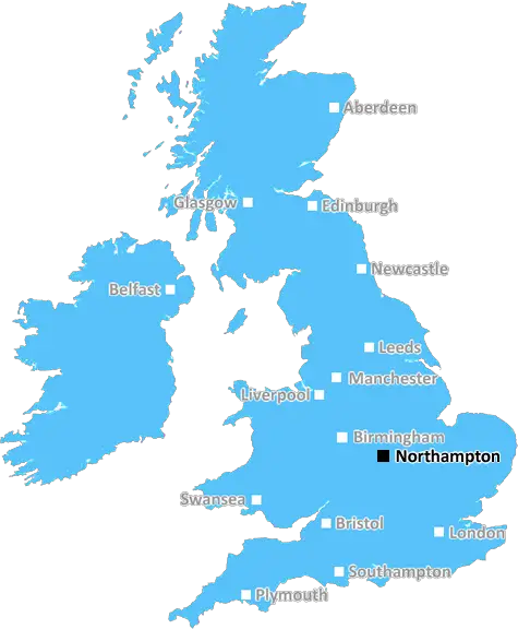
Northampton (NN9)
The NN9 postcode area is located in the Northampton postcode town region, within the county of Northamptonshire, and contains a total of 1104 individual postcodes.
There are 30 electoral wards in the NN9 postcode area, including Brackley, Corby, Daventry, Kettering, Northampton, Rushden, Towcester, Wellingborough which come under the local authority of the Wellingborough Council.
Combining the whole postcode region, 22% of people in NN9 are classed as having an AB social grade, (i.e. 'white-collar' middle-upper class), compared to 27% across the UK.
This does not mean that the people of NN9 are poorer than other areas, but it may give an indication that there are areas of deprivation.
NN9 is a postcode district in the Northampton district of England. It includes the towns and villages of Isham, Kettering, Little Harrowden, Great Harrowden, Burton Latimer, Barton Seagrave, Broughton, Mawsley, Burton Hastings and Pytchley. In terms of location, it is bordered to the North by NN10 and NN14 postcodes, to the East by NN2 postcode, to the South by NN6 postcode and to the West by LE16 postcode.
The main population centres within the NN9 postcode district include the towns of Kettering, Little Harrowden and Great Harrowden. Kettering is a large, vibrant market town and the administrative centre of the district, having a host of historical buildings, a vibrant music and arts scene, popular shops and eateries and lovely green spaces. Little Harrowden and Great Harrowden are both small, quaint villages, and together they are home to Harrowden Hall, a stunning country house which has been newly renovated and is popular for hosting weddings and other events.
Other villages within the NN9 postcode district include the villages of Burton Latimer, Barton Seagrave, Broughton, Mawsley, Burton Hastings and Pytchley. Burton Latimer is a pleasant village located south of Kettering, and it is home to The Church of St Mary the Virgin which dates back to the 13th century. Barton Seagrave is a small village located south-west of Kettering, and it is home to Park Farm, a now-converted manor house that was mentioned in the Domesday Book of 1086. Broughton is a small village located just north of Kettering, that is notable for its thatched cottages and a half-timbered house which dates back to the 16th century. Mawsley is a small village located just east of Kettering, and it is home to The Church of St Peter. Burton Hastings is a small village located just south-west of Kettering, and is home to Wycliffe Hall, a 12th century fortified manor house. Pytchley is a small village located west of Kettering, and it is home to the Grade II listed Pytchley School, a former grammar school dating back to the 16th century.
TheNN9 postcode district is a beautiful and diverse area, offering a range of cultural, historical and leisure attractions, within a unique mix of tranquil villages and bustling towns.

Demographics

Northamptonshire

NN9 is located in the county of Northamptonshire, in England.
Northamptonshire has a total population of 733,100, making it the 33rd largest county in the UK.
Northamptonshire has a total area of 913 square miles, and a population density of 310 people per square kilometre. For comparison, Greater London has a density of 5,618 people/km2.
| Outward Code | NN9 |
| Postal Town | Northampton |
| MSOA Name | Wellingborough 001 |
| LSOA Name | Wellingborough 001D |
| County | Northamptonshire |
| Region | Northamptonshire |
| Country | England |
| Local Authority | Wellingborough |
| Area Classification | Urban with Significant Rural (rural including hub towns 26-49%) |
NN9 Electoral Wards
The postal region of NN9, includes the local towns, villages, electoral wards and stations of:
Dig even deeper into the NN9 postcode by clicking on a postcode below:
Click on an outward postal code below for more information about the area. Each 'outward' postcode give you a comprehensive list of all postcodes within the outward code area (NN) and estimated address.
Click on an 'outward' code for more information. For example, the outward postcode page 'EC2M' will give you an alphabetical list covering all postcodes located in the region, from 'EC2M 1BB' through to 'EC2M 7YA'.
Chris H
Saturday, April 6, 2024
We don't have any views of NN9 right now. If you live in NN9 or have visited it, please help us to help others by telling others what you think of this neighbourhood.
Add your view of NN9
People need your local expertise. If you live in NN9 or have first-hand knowledge of the neighbourhood, please consider sharing your views. It's completely anonymous - all we ask is for your initials.
Please tell us what you like about the NN9 postcode area, what you don't like, and what it's like to live or work here.
| LOCAL AMENITIES | |
| FAMILY FRIENDLY | |
| PARKING | |
| GREEN SPACES |
Local News Northamptonshire
Can Surrey be beaten as County Championship returns?
With the new County Championship season starting on Friday, can anyone prevent Surrey winning a third straight title?
BBC NewsThe Zutons: 'Northampton crowds are amazing'
Abi and Sean from The Zutons talk about playing Northampton and working with Nile Rodgers
BBC NewsReading 1-0 Northampton Town
Reading eased their League One relegation fears with a hard-earned home victory over mid-table Northampton.
BBC NewsClinical Saints see off Sarries to extend lead
James Ramm scores twice as Northampton see off Saracens at Franklin's Gardens to extend their Premiership lead.
BBC NewsDerek from Northants: 'I lived with armed bandits'
Northampton born Derek Adams has spent his life trekking the world for charity
BBC NewsWestwood exhibition has 'something for everybody'
The "vast" private collection amassed by Lee Price spans the punk era to recent times.
BBC NewsMan arrested in 16,000 phone fraud probe
At least three people are talked into sending parcels of cash through the post.
BBC NewsNorthampton Great Escaper left us this treasure...
A 'swagger stick' owned by Marcel Zillessen who escaped Stalag Luft III is up for auction
BBC NewsFrom the Postcode Area blog

Deciphering Crime Rates - a Deep Dive Into UK Postcode Analysis
Ever wondered about the crime rate in your UK postcode? You're not alone. We've dug deep into the data, uncovering trends and patterns that'll make your head spin.

Death of the High Street?
The BBC reports that despite councils' attempts to kurb them, the UK's high streets have seen a huge growth in fast food outlets. Could this mark the death knell for the Great British high street, and what can we do about it to halt its decline?

Discrimination by Postcode
You really couldn't make it up, could you? Some of the country's most vulnerable people are missing out on their weekly £25 Cold Weather Payment, just because the system that's in operation is discriminating against them because payments are based on postcode, rather than geographic location.

The Redesign is Underway
Well, the current website was absolutely in dire need of a good redesign - from the ground up. So I set out to pull it all apart and get it up and running again to become the most comprehensive guide to every postcode in the UK. And it's been a long, tough job from start to finish - and quite possibly the biggest project I've ever undertaken.
SOCIAL GRADES
According to census records, 22% of people here have a social grade of AB (highest), compared to the national average of 27%.