newcastle-upon-tyne NE3 Postcodes
Spending a fortune on conveyancing?

Compare instant, low-cost online quotes from trusted conveyancing solicitors.
Backed by experts, our no-obligation service searches through the best conveyancing quotes on the market to save you time and money.
Newcastle Upon Tyne (NE3)
The NE3 postcode area is located in the Newcastle Upon Tyne postcode town region, within the county of Tyne and Wear, and contains a total of 1713 individual postcodes.
There are 8 electoral wards in the NE3 postcode area, including Alnwick, Ashington, Bamburgh, Bedlington, Belford, Blaydon-On-Tyne, Blyth, Boldon Colliery, Chathill, Choppington, Corbridge, Cramlington, East Boldon, Gateshead, Haltwhistle, Hebburn, Hexham, Jarrow, Morpeth, Newbiggin-By-The-Sea, Newcastle Upon Tyne, North Shields, Prudhoe, Riding Mill, Rowlands Gill, Ryton, Seahouses, South Shields, Stocksfield, Wallsend, Washington, Whitley Bay, Wooler, Wylam which come under the local authority of the Newcastle upon Tyne Council.
Combining the whole postcode region, 33% of people in NE3 are classed as having an AB social grade, (i.e. 'white-collar' middle-upper class), compared to 27% across the UK.
This does not mean that the people of NE3 are wealthier - or higher class - than average, but it can be an indication that the area may be prospering and desirable to live in.
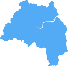
The NE3 postcode is a postcode district of the Tyne and Wear post town in the NE England postcode area. It covers an area of 11.09 square miles, straddling the boroughs of South Tyneside and Newcastle upon Tyne. It has a population of over 34,000 people, as of 2019. The centre of the region is the suburb of Gosforth and the postcode region's main industrial area is at the junction of Redburn Road and Cowgate.
The area is predominantly residential, with many family homes in suburbs like Fawdon, Kenton, Coxlodge, Westerhope and South Gosforth. It also has a vibrant urban centre, with many shops, caf�s and restaurants to enjoy.
There are two universities located in NE3 - Northumbria University and Newcastle University. Northumbria has a campus and several faculties and university buildings located in the area, while Newcastle University's main campus is located in NE1.
The region has excellent transport links, with several major and minor roads, as well as both Newcastle and Newcastle Airport located nearby. The area is served by three railway stations � Gosforth, Three Mile Bridge and Manors. Bus services operate in the area with local operators providing regular services, while Metro commuter rail links are also available.
There are several parks and green spaces located in NE3, with the largest being Leazes Park, a Victorian-era public park which is located in the centre of Newcastle and offers a variety of activities for visitors and locals alike. Other parks in the area include Armstrong Park and Arthur's Hill park, both of which offer picturesque views of the city and provide a great place to take a break from the hustle and bustle of city life.
In addition to the parks, the area is also home to a range of leisure facilities and attractions, such as the iconic St James' Park, home of Newcastle United Football Club, as well as the Laing Art Gallery, a popular art space with multiple collections. The area also hosts a range of events throughout the year, from community and charity events to music festivals and markets.

Demographics

Tyne and Wear
NE3 is located in the county of Tyne and Wear, in England.
Tyne and Wear has a total population of 1,128,800, making it the 16th largest county in the UK.
Tyne and Wear has a total area of 210 square miles, and a population density of 2090 people per square kilometre. For comparison, Greater London has a density of 5,618 people/km2.

| Outward Code | NE3 |
| Postal Town | Newcastle Upon Tyne |
| MSOA Name | Newcastle upon Tyne 006 |
| LSOA Name | Newcastle upon Tyne 006E |
| County | Tyne and Wear |
| Region | Tyne and Wear |
| Country | England |
| Local Authority | Newcastle upon Tyne |
| Area Classification | Urban with Major Conurbation |
NE3 Electoral Wards
The postal region of NE3, includes the local towns, villages, electoral wards and stations of:
Dig even deeper into the NE3 postcode by clicking on a postcode below:
Click on an outward postal code below for more information about the area. Each 'outward' postcode give you a comprehensive list of all postcodes within the outward code area (NE) and estimated address.
Click on an 'outward' code for more information. For example, the outward postcode page 'EC2M' will give you an alphabetical list covering all postcodes located in the region, from 'EC2M 1BB' through to 'EC2M 7YA'.
Chris H
Sunday, April 7, 2024
We don't have any views of NE3 right now. If you live in NE3 or have visited it, please help us to help others by telling others what you think of this neighbourhood.
Add your view of NE3
People need your local expertise. If you live in NE3 or have first-hand knowledge of the neighbourhood, please consider sharing your views. It's completely anonymous - all we ask is for your initials.
Please tell us what you like about the NE3 postcode area, what you don't like, and what it's like to live or work here.
| LOCAL AMENITIES | |
| FAMILY FRIENDLY | |
| PARKING | |
| GREEN SPACES |
Local News Northumberland
Director banned after unlawful care home scheme saw investors lose 57m
The scheme promised investors unachievable returns and put their funds at risk.
Property WeekAdderstone Living's North East housing scheme first to secure nutrient neutrality credits
Developer Adderstone Living has secured planning permission for an affordable housing scheme in County Durham, in what it claimed will be the first such development using Natural England's nutrient ne&hellip
Property WeekDurham City Innovation District seeks JV investment partner for 250m campus
Durham County Council, Durham University and Avison Young are seeking ajoint venture investment partner to help fund a250m research and development campusat Aykley Heads, as part of their wider Du&hellip
Property WeekPrimark to significantly upsize Metrocentre store
The enlarged anchor premises will cover nearly 80,000 sq ft.
Property WeekMilton's administrators to put 25 North East and Yorkshire pubs up for sale
Administrators to property firm Milton Portfolio Op Co 3 plan to puta portfolio of 25 pubs across North East and Yorkshire up for sale early next year.
Property WeekJames Corden's Fulwell 73 and Cain International propose 450m Sunderland film studio
FulwellCain Studios, a joint venture between actor and TV presenter James Corden's entertainment company Fulwell 73 and Cain International, has unveiled plans for a 450m film industry hub in Sunderla&hellip
Property WeekHumber Freeport moves forward with 200-heactare Goole site
Humber Freeport has submitted formal boundary map plans to the government for 200 hectares of undeveloped land in Goole, East Yorkshire, where it plans to establish a freeport tax site.
Property WeekGo Outdoors signs new letting at former Wilko store in Metrocentre
The outdoor clothing and equipment retailer will open the new store later this year.
Property WeekFrom the Postcode Area blog

Deciphering Crime Rates - a Deep Dive Into UK Postcode Analysis
Ever wondered about the crime rate in your UK postcode? You're not alone. We've dug deep into the data, uncovering trends and patterns that'll make your head spin.

Death of the High Street?
The BBC reports that despite councils' attempts to kurb them, the UK's high streets have seen a huge growth in fast food outlets. Could this mark the death knell for the Great British high street, and what can we do about it to halt its decline?

Discrimination by Postcode
You really couldn't make it up, could you? Some of the country's most vulnerable people are missing out on their weekly £25 Cold Weather Payment, just because the system that's in operation is discriminating against them because payments are based on postcode, rather than geographic location.

The Redesign is Underway
Well, the current website was absolutely in dire need of a good redesign - from the ground up. So I set out to pull it all apart and get it up and running again to become the most comprehensive guide to every postcode in the UK. And it's been a long, tough job from start to finish - and quite possibly the biggest project I've ever undertaken.
SOCIAL GRADES
According to census records, 33% of people here have a social grade of AB (highest), compared to the national average of 27%.