newcastle-upon-tyne NE13 Postcodes
Spending a fortune on conveyancing?

Compare instant, low-cost online quotes from trusted conveyancing solicitors.
Backed by experts, our no-obligation service searches through the best conveyancing quotes on the market to save you time and money.
Newcastle Upon Tyne (NE13)
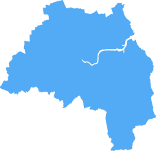
The NE13 postcode area is located in the Newcastle Upon Tyne postcode town region, within the county of Tyne and Wear, and contains a total of 459 individual postcodes.
There are 15 electoral wards in the NE13 postcode area, including Alnwick, Ashington, Bamburgh, Bedlington, Belford, Blaydon-On-Tyne, Blyth, Boldon Colliery, Chathill, Choppington, Corbridge, Cramlington, East Boldon, Gateshead, Haltwhistle, Hebburn, Hexham, Jarrow, Morpeth, Newbiggin-By-The-Sea, Newcastle Upon Tyne, North Shields, Prudhoe, Riding Mill, Rowlands Gill, Ryton, Seahouses, South Shields, Stocksfield, Wallsend, Washington, Whitley Bay, Wooler, Wylam which come under the local authority of the North Tyneside Council.
Combining the whole postcode region, 27% of people in NE13 are classed as having an AB social grade, (i.e. 'white-collar' middle-upper class), compared to 27% across the UK.
This does not mean that the people of NE13 are wealthier - or higher class - than average, but it can be an indication that the area may be prospering and desirable to live in.
The NE13 postcode is in the northern part of Newcastle upon Tyne, a large city in the North East of England. It includes the Chopwell, Throckley, and Lemington residential areas, all of which have good transport links into the city centre.
The NE13 postcode is mostly made up of older houses, some of which date back to the Victorian era, as well as more established middle-class houses built in the 1960s. There is a good quantity of local amenities such as shops, restaurants, and pubs in the local area.
The area is home to three primary schools: Throckley Primary School, Lemington Riverside Primary School, and Kenneth Gibson's Primary School. The nearest secondary school is Walbottle Campus, located in the neighbouring postcode area.
The local area offers excellent natural beauty from the Chopwell Woods, as well as a variety of recreational facilities, such as tennis courts, football pitches, and bowling greens. In addition, the local area has two golf courses � the On-Course Country Inn and Golf Centre and the Ouseburn Golf driving range.
The NE13 postcode has easy access to Newcastle city centre by road and public transport. The Tyne and Wear Metro system also serves the area, with a number of stations located in the postcode. The Metro also links the area to wider transport links, with connections to Sunderland, Gateshead, and South Shields.
This postcode is also close to Gosforth, Jesmond, and Heaton, giving easy access to the shopping district and other major amenities. The neighbouring postcode area of NE15 is also home to St. James' Park, the home of Newcastle United Football Club.
This postcode is ideal for commuters to Newcastle and the surrounding area, with excellent transport links and plenty of local amenities.

Demographics

Tyne and Wear
NE13 is located in the county of Tyne and Wear, in England.
Tyne and Wear has a total population of 1,128,800, making it the 16th largest county in the UK.
Tyne and Wear has a total area of 210 square miles, and a population density of 2090 people per square kilometre. For comparison, Greater London has a density of 5,618 people/km2.

| Outward Code | NE13 |
| Postal Town | Newcastle Upon Tyne |
| MSOA Name | North Tyneside 004 |
| LSOA Name | North Tyneside 004B |
| County | Tyne and Wear |
| Region | Tyne and Wear |
| Country | England |
| Local Authority | North Tyneside |
| Area Classification | Urban with Major Conurbation |
NE13 Electoral Wards
The postal region of NE13, includes the local towns, villages, electoral wards and stations of:
Dig even deeper into the NE13 postcode by clicking on a postcode below:
Click on an outward postal code below for more information about the area. Each 'outward' postcode give you a comprehensive list of all postcodes within the outward code area (NE) and estimated address.
Click on an 'outward' code for more information. For example, the outward postcode page 'EC2M' will give you an alphabetical list covering all postcodes located in the region, from 'EC2M 1BB' through to 'EC2M 7YA'.
Chris H
Monday, April 8, 2024
We don't have any views of NE13 right now. If you live in NE13 or have visited it, please help us to help others by telling others what you think of this neighbourhood.
Add your view of NE13
People need your local expertise. If you live in NE13 or have first-hand knowledge of the neighbourhood, please consider sharing your views. It's completely anonymous - all we ask is for your initials.
Please tell us what you like about the NE13 postcode area, what you don't like, and what it's like to live or work here.
| LOCAL AMENITIES | |
| FAMILY FRIENDLY | |
| PARKING | |
| GREEN SPACES |
Local News Northumberland
Fresh plans submitted for former Colgate-Palmolive factory
The Soapworksproposals include450 new homes and more than 145,000 sq ft ofoffice space.
Property WeekHadrian Industrial Estates snaps up Durham portfolio for 1.28m
Hadrian Industrial Estates, part of Hadrian Land, has snapped up three multi-let industrial estates in County Durham for a combined 1.28m from commercial property investor Snowlarch.
Property WeekPlans submitted to transform Liverpool TV and film campus for Hollywood of the North'
Developer Capital&Centric has submitted a detailed planning application for its transformation of the iconic art deco Littlewoods Building into a TV and film campus, as Liverpool aims to become the 'H&hellip
Property WeekEY in talks with other interested parties' over fresh takeover of Britishvolt
The company's administrators are still chasing money from selected Australian buyer Recharge Industries.
Property WeekBeal Homes secures planning approval to complete 210m development
Housebuilder Beal Homes has secured full planning permission to complete a 210m development for 600 homes in Goole, East Yorkshire.
Property WeekLendlease appointed to deliver The Sage International Conference Centre in Gateshead
Australia-based property and construction giant Lendlease has been appointed by Gateshead Council's development partner Ask:PATRIZIA to deliver The Sage International Conference Centre at Gateshead Qu&hellip
Property WeekAvant Homes acquires Durham site for 40m resi development
Housebuilder Avant Homes has acquired a site in Willington, Durham, for the development of a 43.6m residential scheme with 200 new homes.
Property WeekCouncil calls action on 450m Sunderland film studio
FullwellCainwill begin developing the 1.7m sq site this year.
Property WeekFrom the Postcode Area blog

Deciphering Crime Rates - a Deep Dive Into UK Postcode Analysis
Ever wondered about the crime rate in your UK postcode? You're not alone. We've dug deep into the data, uncovering trends and patterns that'll make your head spin.

Death of the High Street?
The BBC reports that despite councils' attempts to kurb them, the UK's high streets have seen a huge growth in fast food outlets. Could this mark the death knell for the Great British high street, and what can we do about it to halt its decline?

Discrimination by Postcode
You really couldn't make it up, could you? Some of the country's most vulnerable people are missing out on their weekly £25 Cold Weather Payment, just because the system that's in operation is discriminating against them because payments are based on postcode, rather than geographic location.

The Redesign is Underway
Well, the current website was absolutely in dire need of a good redesign - from the ground up. So I set out to pull it all apart and get it up and running again to become the most comprehensive guide to every postcode in the UK. And it's been a long, tough job from start to finish - and quite possibly the biggest project I've ever undertaken.
SOCIAL GRADES
According to census records, 27% of people here have a social grade of AB (highest), compared to the national average of 27%.