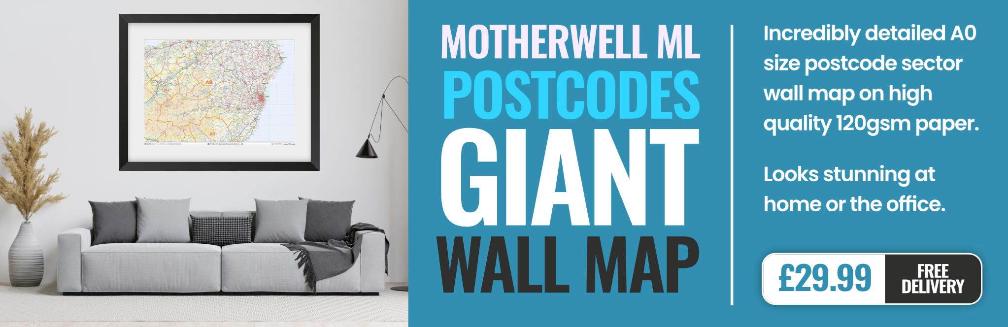
motherwell ML9 Postcodes
Spending a fortune on conveyancing?

Compare instant, low-cost online quotes from trusted conveyancing solicitors.
Backed by experts, our no-obligation service searches through the best conveyancing quotes on the market to save you time and money.
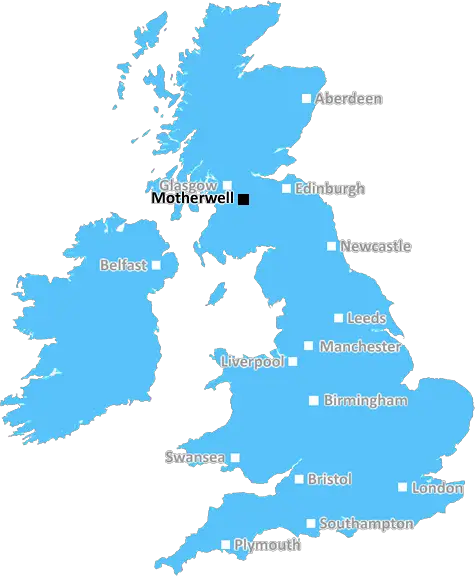
Motherwell (ML9)
The ML9 postcode area is located in the Motherwell postcode town region, within the county of Lanarkshire, and contains a total of 741 individual postcodes.
There are 24 electoral wards in the ML9 postcode area, including Airdrie, Bellshill, Biggar, Carluke, Coatbridge, Hamilton, Lanark, Larkhall, Motherwell, Shotts, Strathaven, Wishaw which come under the local authority of the South Lanarkshire Council.
Combining the whole postcode region, 0% of people in ML9 are classed as having an AB social grade, (i.e. 'white-collar' middle-upper class), compared to 27% across the UK.
This does not mean that the people of ML9 are poorer than other areas, but it may give an indication that there are areas of deprivation.
ML9 postcode covers the neighbourhoods of Motherwell, Belhaven, Carfin, and New Stevenston in the town of Motherwell in North Lanarkshire, Scotland. It is the largest and most populated postcode district within the town.
Motherwell is a former industrial town, and the ML9 postcode district covers an area of around 11 square miles. It runs along the River Clyde, and is home to a number of historical sites and landmarks. These include the Byres monuments, Struthers Castle and the site of the former Ravenscraig Steelworks.
The ML9 postcode region is well-served by direct road and rail links to the city of Glasgow. This includes Glasgow Central, the nearest rail station to Motherwell. The area is also well-connected to the roads and motorways of the region, including the M74, M77 and M8, which provide quick access to the cities of Edinburgh and Stirling.
The population of this area is around 17,000, consisting of a mix of elderly and young people, as well as a diverse range of ethnicities. Motherwell is also the home of the world-famous Motherwell Football Club, and the ML9 postcode is located within the club's Loudoun Castle Stadium.
The district is predominantly residential, with a range of housing options including detached, terraced and semi-detached properties. As well as numerous local shops, there are also supermarkets, banks, and other services located in ML9.
Education is an important part of the area, with a range of primary, secondary, and further education options available. The postcode is also home to The University of Strathclyde Motherwell Campus, which specialises in computing and mathematics.
A range of leisure activities and attractions are also on offer in the ML9 postcode area, such as Strathclyde Country Park and a choice of museums and art galleries. The town is also home to the National Museum of Rural Life at nearby Gretna Green.

Demographics
Lanarkshire

ML9 is located in the county of Lanarkshire, in Scotland.
Lanarkshire has a total population of 0, making it the largest county in the UK.
Lanarkshire has a total area of square miles, and a population density of people per square kilometre. For comparison, Greater London has a density of 5,618 people/km2.
| Outward Code | ML9 |
| Postal Town | Motherwell |
| MSOA Name | Larkhall Central, Raploch, Millheugh and Burnhead |
| LSOA Name | |
| County | Lanarkshire |
| Region | Lanarkshire |
| Country | Scotland |
| Local Authority | South Lanarkshire |
| Area Classification | Unclassified |
ML9 Electoral Wards
The postal region of ML9, includes the local towns, villages, electoral wards and stations of:
Dig even deeper into the ML9 postcode by clicking on a postcode below:
Click on an outward postal code below for more information about the area. Each 'outward' postcode give you a comprehensive list of all postcodes within the outward code area (ML) and estimated address.
Click on an 'outward' code for more information. For example, the outward postcode page 'EC2M' will give you an alphabetical list covering all postcodes located in the region, from 'EC2M 1BB' through to 'EC2M 7YA'.
Chris H
Monday, April 8, 2024
We don't have any views of ML9 right now. If you live in ML9 or have visited it, please help us to help others by telling others what you think of this neighbourhood.
Add your view of ML9
People need your local expertise. If you live in ML9 or have first-hand knowledge of the neighbourhood, please consider sharing your views. It's completely anonymous - all we ask is for your initials.
Please tell us what you like about the ML9 postcode area, what you don't like, and what it's like to live or work here.
| LOCAL AMENITIES | |
| FAMILY FRIENDLY | |
| PARKING | |
| GREEN SPACES |
From the Postcode Area blog

Deciphering Crime Rates - a Deep Dive Into UK Postcode Analysis
Ever wondered about the crime rate in your UK postcode? You're not alone. We've dug deep into the data, uncovering trends and patterns that'll make your head spin.

Death of the High Street?
The BBC reports that despite councils' attempts to kurb them, the UK's high streets have seen a huge growth in fast food outlets. Could this mark the death knell for the Great British high street, and what can we do about it to halt its decline?

Discrimination by Postcode
You really couldn't make it up, could you? Some of the country's most vulnerable people are missing out on their weekly £25 Cold Weather Payment, just because the system that's in operation is discriminating against them because payments are based on postcode, rather than geographic location.

The Redesign is Underway
Well, the current website was absolutely in dire need of a good redesign - from the ground up. So I set out to pull it all apart and get it up and running again to become the most comprehensive guide to every postcode in the UK. And it's been a long, tough job from start to finish - and quite possibly the biggest project I've ever undertaken.
SOCIAL GRADES
According to census records, 0% of people here have a social grade of AB (highest), compared to the national average of 27%.