motherwell ML5 Postcodes
Spending a fortune on conveyancing?

Compare instant, low-cost online quotes from trusted conveyancing solicitors.
Backed by experts, our no-obligation service searches through the best conveyancing quotes on the market to save you time and money.
Motherwell (ML5)
The ML5 postcode area is located in the Motherwell postcode town region, within the county of Lanarkshire, and contains a total of 1234 individual postcodes.
There are 25 electoral wards in the ML5 postcode area, including Airdrie, Bellshill, Biggar, Carluke, Coatbridge, Hamilton, Lanark, Larkhall, Motherwell, Shotts, Strathaven, Wishaw which come under the local authority of the North Lanarkshire Council.
Combining the whole postcode region, 0% of people in ML5 are classed as having an AB social grade, (i.e. 'white-collar' middle-upper class), compared to 27% across the UK.
This does not mean that the people of ML5 are poorer than other areas, but it may give an indication that there are areas of deprivation.
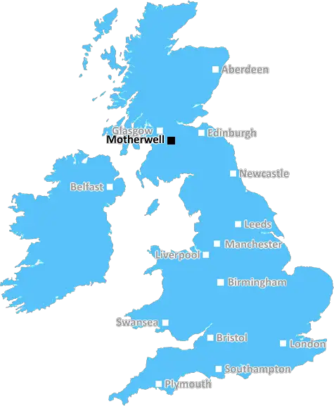
ML5 is a postcode for the Motherwell district in Scotland, United Kingdom.
The ML5 postcode originates from the old ML (Motherwell) postal area and is part of the ML postcode area, which is divided into thirteen postcode districts covering 32 post towns. The town of Motherwell falls within the ML5 postcode district.
The ML5 postcode district is bounded to the north by the ML4 postcode district, to the east by ML11 postcode district, to the south by G72 postcode district and to the west by the ML1 postcode district. It runs from Ravenscraig to Coltness and from Airdrie to Larkhall, covering an area of 32.02 km2.
The ML5 postcode has a population of around 35,000 people and covers a range of suburban residential, industrial and commercial areas. It also includes the M & D's theme park and the Strathclyde Country Park.
The ML5 postcode is served by two railway stations: Motherwell and Holytown and is also served by the M8 motorway which links the towns of Motherwell and Airdrie with the city of Glasgow.
The ML5 postcode offers a variety of retail outlets, from small independent shops to larger, nationally-known retail outlets. The region also boasts several places to eat and drink as well as a range of leisure and entertainment venues including cinemas, theatres, night clubs and sports facilities.
Education for all ages is provided by a range of schools in the area, from nurseries to universities. Additionally, the local area is home to a number of hospitals, health and social care organisations as well as emergency services.
The local economy of Motherwell and surrounding areas is based upon the traditional industries such as civil engineering, steel-making and shipbuilding, as well as more recent burgeoning high-tech industries such as renewable energy and nanotechnology.
Motherwell and the ML5 postcode district provide an attractive and vibrant mix of residential, commercial, leisure and entertainment opportunities.

Demographics
Lanarkshire

ML5 is located in the county of Lanarkshire, in Scotland.
Lanarkshire has a total population of 0, making it the largest county in the UK.
Lanarkshire has a total area of square miles, and a population density of people per square kilometre. For comparison, Greater London has a density of 5,618 people/km2.
| Outward Code | ML5 |
| Postal Town | Motherwell |
| MSOA Name | Coatbridge West |
| LSOA Name | |
| County | Lanarkshire |
| Region | Lanarkshire |
| Country | Scotland |
| Local Authority | North Lanarkshire |
| Area Classification | Unclassified |
ML5 Electoral Wards
The postal region of ML5, includes the local towns, villages, electoral wards and stations of:
Dig even deeper into the ML5 postcode by clicking on a postcode below:
Click on an outward postal code below for more information about the area. Each 'outward' postcode give you a comprehensive list of all postcodes within the outward code area (ML) and estimated address.
Click on an 'outward' code for more information. For example, the outward postcode page 'EC2M' will give you an alphabetical list covering all postcodes located in the region, from 'EC2M 1BB' through to 'EC2M 7YA'.
Chris H
Tuesday, April 9, 2024
We don't have any views of ML5 right now. If you live in ML5 or have visited it, please help us to help others by telling others what you think of this neighbourhood.
Add your view of ML5
People need your local expertise. If you live in ML5 or have first-hand knowledge of the neighbourhood, please consider sharing your views. It's completely anonymous - all we ask is for your initials.
Please tell us what you like about the ML5 postcode area, what you don't like, and what it's like to live or work here.
| LOCAL AMENITIES | |
| FAMILY FRIENDLY | |
| PARKING | |
| GREEN SPACES |
From the Postcode Area blog

Deciphering Crime Rates - a Deep Dive Into UK Postcode Analysis
Ever wondered about the crime rate in your UK postcode? You're not alone. We've dug deep into the data, uncovering trends and patterns that'll make your head spin.

Death of the High Street?
The BBC reports that despite councils' attempts to kurb them, the UK's high streets have seen a huge growth in fast food outlets. Could this mark the death knell for the Great British high street, and what can we do about it to halt its decline?

Discrimination by Postcode
You really couldn't make it up, could you? Some of the country's most vulnerable people are missing out on their weekly £25 Cold Weather Payment, just because the system that's in operation is discriminating against them because payments are based on postcode, rather than geographic location.

The Redesign is Underway
Well, the current website was absolutely in dire need of a good redesign - from the ground up. So I set out to pull it all apart and get it up and running again to become the most comprehensive guide to every postcode in the UK. And it's been a long, tough job from start to finish - and quite possibly the biggest project I've ever undertaken.
SOCIAL GRADES
According to census records, 0% of people here have a social grade of AB (highest), compared to the national average of 27%.