milton-keynes MK6 Postcodes
Spending a fortune on conveyancing?

Compare instant, low-cost online quotes from trusted conveyancing solicitors.
Backed by experts, our no-obligation service searches through the best conveyancing quotes on the market to save you time and money.
Milton Keynes (MK6)
The MK6 postcode area is located in the Milton Keynes postcode town region, within the county of Buckinghamshire, and contains a total of 877 individual postcodes.
There are 13 electoral wards in the MK6 postcode area, including Bedford, Buckingham, Milton Keynes, Newport Pagnell, Olney which come under the local authority of the Milton Keynes Council.
Combining the whole postcode region, 16% of people in MK6 are classed as having an AB social grade, (i.e. 'white-collar' middle-upper class), compared to 27% across the UK.
This does not mean that the people of MK6 are poorer than other areas, but it may give an indication that there are areas of deprivation.
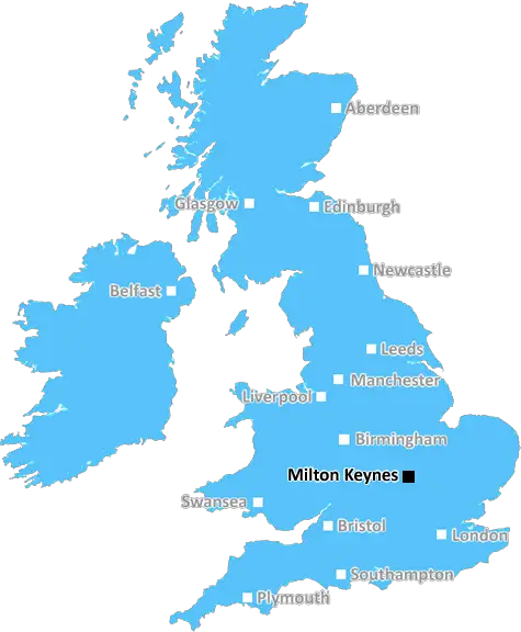
The MK6 postcode covers the areas of Shenley, Denbigh, Emerson Valley and Tattenhoe in Milton Keynes, a city located approximately 45 miles northwest of London.
The area is well connected to the centre of Milton Keynes with the A5 just minutes away, with easy access to MK Dons Stadium and Central Milton Keynes Shopping Centre. Further to this, Milton Keynes Central Railway Station is a 20-minute drive away. The area also benefits from being close to the M1 and A421 roads.
MK6 is full of parks and green open spaces, such as Howbury Park, Monks Park and Emerson Valley Local Nature Reserve. The area is bustling with shops and cafes such as Terra Caf� & Coffee House, Monks Park Farm Shop and Emerson Valley Allotment Shop, amongst many others.
The area has a range of schools suitable for all ages, including North Crawley VC Lower School, Denbigh Lower School and Emerson Valley School for primary education, and Shenley Brook End School and The Radcliffe School for secondary education. Further to this, there are two Special Educational Needs and Disabilities (SEND) schools, Ousedale School and Shenley Brook End School.
It has the largest and most iconic leisure facility in the entire district; the famed Xscape. Here, you can find an adventure centre, a cinema, a skiing centre and a variety of shops and restaurants. Meanwhile, Denbigh North Community Centre, located in Emerson Valley, provides a venue for local events, classes and activities.
MK6 is a place full of culture. The Milton Keynes African Caribbean Festival is hosted annually in the area, bringing with it an all-round fun weekend of various African Caribbean art, food, music and activities. Further to this, throughout the year various arts and craft experience days are held at the Christmas Experience in Denbigh.
There is something for everyone in MK6; from local amenities, breathtaking parks, all the way to leisure facilities and cultural events, the area is definitely worth a visit.

Demographics
Buckinghamshire

MK6 is located in the county of Buckinghamshire, in England.
Buckinghamshire has a total population of 799,200, making it the 30th largest county in the UK.
Buckinghamshire has a total area of 723 square miles, and a population density of 426 people per square kilometre. For comparison, Greater London has a density of 5,618 people/km2.
| Outward Code | MK6 |
| Postal Town | Milton Keynes |
| MSOA Name | Milton Keynes 021 |
| LSOA Name | Milton Keynes 021C |
| County | Buckinghamshire |
| Region | Buckinghamshire |
| Country | England |
| Local Authority | Milton Keynes |
| Area Classification | Urban with City and Town |
MK6 Electoral Wards
The postal region of MK6, includes the local towns, villages, electoral wards and stations of:
Dig even deeper into the MK6 postcode by clicking on a postcode below:
Click on an outward postal code below for more information about the area. Each 'outward' postcode give you a comprehensive list of all postcodes within the outward code area (MK) and estimated address.
Click on an 'outward' code for more information. For example, the outward postcode page 'EC2M' will give you an alphabetical list covering all postcodes located in the region, from 'EC2M 1BB' through to 'EC2M 7YA'.
Chris H
Monday, April 8, 2024
We don't have any views of MK6 right now. If you live in MK6 or have visited it, please help us to help others by telling others what you think of this neighbourhood.
Add your view of MK6
People need your local expertise. If you live in MK6 or have first-hand knowledge of the neighbourhood, please consider sharing your views. It's completely anonymous - all we ask is for your initials.
Please tell us what you like about the MK6 postcode area, what you don't like, and what it's like to live or work here.
| LOCAL AMENITIES | |
| FAMILY FRIENDLY | |
| PARKING | |
| GREEN SPACES |
Local News Buckinghamshire
Bruntwood SciTech gets go ahead for 250m revamp of Cambridgeshire life science park
The masterplan for the site includes nearly 400,000 sq ft of space and six new buildings.
Property Week'Losing my legs changed my life for the better'
A former footballer says he would not change a thing after a hit-and-run driver ran him over.
BBC NewsHotel refugees 'gone by end of June', says MP
MP Andrew Selous says the Home Office has terminated its contract with the hotel.
BBC NewsFormer Luton manager Kinnear dies aged 77
Former Wimbledon and Newcastle United manager Joe Kinnear dies at the age of 77, his family announces.
BBC NewsSellar gets green light for Hertfordshire media facility
The developer has designed the scheme to appeal to the media sector, as well as being appropriate for logistics, warehousing and data centre uses.
Property WeekMan taken to hospital after serious crash
The man is taken to Luton and Dunstable Hospital for further treatment.
BBC NewsStarbucks partner signs lease at Prologis Park Hemel Hempstead
Food Service Logisticshas agreed a 15-year lease at the161,134 sq ftdistribution centre.
Property WeekTT Group sells Southampton industrial units for 5.7m
The 1.85-acre siteis split into two self-contained units, one let to Sentry Self Storage and the other to Active Freight Management.
Property WeekFrom the Postcode Area blog

Deciphering Crime Rates - a Deep Dive Into UK Postcode Analysis
Ever wondered about the crime rate in your UK postcode? You're not alone. We've dug deep into the data, uncovering trends and patterns that'll make your head spin.

Death of the High Street?
The BBC reports that despite councils' attempts to kurb them, the UK's high streets have seen a huge growth in fast food outlets. Could this mark the death knell for the Great British high street, and what can we do about it to halt its decline?

Discrimination by Postcode
You really couldn't make it up, could you? Some of the country's most vulnerable people are missing out on their weekly £25 Cold Weather Payment, just because the system that's in operation is discriminating against them because payments are based on postcode, rather than geographic location.

The Redesign is Underway
Well, the current website was absolutely in dire need of a good redesign - from the ground up. So I set out to pull it all apart and get it up and running again to become the most comprehensive guide to every postcode in the UK. And it's been a long, tough job from start to finish - and quite possibly the biggest project I've ever undertaken.
SOCIAL GRADES
According to census records, 16% of people here have a social grade of AB (highest), compared to the national average of 27%.