medway ME6 Postcodes
Spending a fortune on conveyancing?

Compare instant, low-cost online quotes from trusted conveyancing solicitors.
Backed by experts, our no-obligation service searches through the best conveyancing quotes on the market to save you time and money.
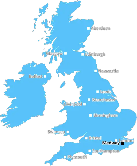
Medway (ME6)
The ME6 postcode area is located in the Medway postcode town region, within the county of Kent, and contains a total of 449 individual postcodes.
There are 19 electoral wards in the ME6 postcode area, including Aylesford, Chatham, Faversham, Gillingham, Maidstone, Queenborough, Rochester, Sheerness, Sittingbourne, Snodland, West Malling which come under the local authority of the Tonbridge and Malling Council.
Combining the whole postcode region, 21% of people in ME6 are classed as having an AB social grade, (i.e. 'white-collar' middle-upper class), compared to 27% across the UK.
This does not mean that the people of ME6 are poorer than other areas, but it may give an indication that there are areas of deprivation.
ME6 is a postcode district in the Medway area of Kent, England, covering parts of Snodland, Larkfield, Birling and Cuxton. It is managed by Royal Mail and lies between the ME7 and ME5 postcode districts.
The ME6 postcode district has two main postal towns - Snodland and Larkfield. It has a total population of around 18,500; and covers an area of 6.52 square miles.
Snodland is an historic market town located on the banks of the River Medway. It has a population of approximately 8,000 and is home to an international railway station. There are numerous restaurants, pubs, shops, churches, a library, and a leisure centre. Snodland is also located close to the M20 motorway, and a number of major roads link it to London and the surrounding areas.
Larkfield is a large village located to the south of Snodland. It has a population of around 10,000 and is home to a number of churches, pubs, shops, and a leisure centre. Larkfield also has a railway station and a number of major roads link it to London and the surrounding areas.
Birling and Cuxton are both small, rural villages located within the ME6 postcode district. Birling has a population of approximately 800 and comprises mainly of farmland, while Cuxton has a population of around 3,800 and is home to a 12th century church, pub, and hotel.
The ME6 postcode district has 10 small hamlets within it, including East Malling, New Hythe, Leybourne, Wrotham Heath, Eccles, East Barming, Every, Wouldham, Halling, and Walderslade. All of these hamlets are largely agricultural and contain pubs, churches, and small convenience stores.
TheME6 postcode district is a diverse area with a wide range of amenities and attractions, situated close to the M20 motorway, and with easy transport links to London and the surrounding areas.

Demographics

Kent

ME6 is located in the county of Kent, in England.
Kent has a total population of 1,820,400, making it the 6th largest county in the UK.
Kent has a total area of 1443 square miles, and a population density of 486 people per square kilometre. For comparison, Greater London has a density of 5,618 people/km2.
| Outward Code | ME6 |
| Postal Town | Medway |
| MSOA Name | Tonbridge and Malling 002 |
| LSOA Name | Tonbridge and Malling 002G |
| County | Kent |
| Region | Kent |
| Country | England |
| Local Authority | Tonbridge and Malling |
| Area Classification | Urban with Significant Rural (rural including hub towns 26-49%) |
ME6 Electoral Wards
The postal region of ME6, includes the local towns, villages, electoral wards and stations of:
Dig even deeper into the ME6 postcode by clicking on a postcode below:
Click on an outward postal code below for more information about the area. Each 'outward' postcode give you a comprehensive list of all postcodes within the outward code area (ME) and estimated address.
Click on an 'outward' code for more information. For example, the outward postcode page 'EC2M' will give you an alphabetical list covering all postcodes located in the region, from 'EC2M 1BB' through to 'EC2M 7YA'.
Chris H
Wednesday, April 10, 2024
We don't have any views of ME6 right now. If you live in ME6 or have visited it, please help us to help others by telling others what you think of this neighbourhood.
Add your view of ME6
People need your local expertise. If you live in ME6 or have first-hand knowledge of the neighbourhood, please consider sharing your views. It's completely anonymous - all we ask is for your initials.
Please tell us what you like about the ME6 postcode area, what you don't like, and what it's like to live or work here.
| LOCAL AMENITIES | |
| FAMILY FRIENDLY | |
| PARKING | |
| GREEN SPACES |
Local News Kent
Fire crews tackle garage fire
Firefighters urged residents to close windows and doors as they tackled a garage fire.
Kent OnlineMixed-use London freehold to lead Allsop's March residential auction
Thefreeholdbuilding in Hampstead is guided at 2.5m-plus.
Property WeekMosque serves thousands of meals during Ramadan
The building has recently been extended from a four-bedroom house into a Mosque that hosts hundreds.
BBC NewsOwl sanctuary home to Paul O'Grady's pets under threat
Bosses at an owl sanctuary which looks after two of Paul O'Grady's pets are appealing for help as the site comes under threat of closure.
Kent OnlinePlaces for People acquires Rosewood Housing
The affordable homes provider was previously owned by housing developer Inland Homes.
Property WeekUK Space Agency primed for Harwell Campus landing
The government agency has taken around 10,500 sq ft of space in the Quad Two building.
Property WeekAward-winning visitor centre to shut due to rising costs'
An award-winning visitor centre is to close due to rising costs and falling visitor numbers, bosses say.
Kent OnlineJohnson & Johnson signs lease at Tempo in Maidenhead
The pharmaceuticals giantwill move staff from its Thames Valley campuses in High Wycombe and Pinewood to the L&G-owned building.
Property WeekFrom the Postcode Area blog

Deciphering Crime Rates - a Deep Dive Into UK Postcode Analysis
Ever wondered about the crime rate in your UK postcode? You're not alone. We've dug deep into the data, uncovering trends and patterns that'll make your head spin.

Death of the High Street?
The BBC reports that despite councils' attempts to kurb them, the UK's high streets have seen a huge growth in fast food outlets. Could this mark the death knell for the Great British high street, and what can we do about it to halt its decline?

Discrimination by Postcode
You really couldn't make it up, could you? Some of the country's most vulnerable people are missing out on their weekly £25 Cold Weather Payment, just because the system that's in operation is discriminating against them because payments are based on postcode, rather than geographic location.

The Redesign is Underway
Well, the current website was absolutely in dire need of a good redesign - from the ground up. So I set out to pull it all apart and get it up and running again to become the most comprehensive guide to every postcode in the UK. And it's been a long, tough job from start to finish - and quite possibly the biggest project I've ever undertaken.
SOCIAL GRADES
According to census records, 21% of people here have a social grade of AB (highest), compared to the national average of 27%.