manchester M30 Postcodes
Spending a fortune on conveyancing?

Compare instant, low-cost online quotes from trusted conveyancing solicitors.
Backed by experts, our no-obligation service searches through the best conveyancing quotes on the market to save you time and money.
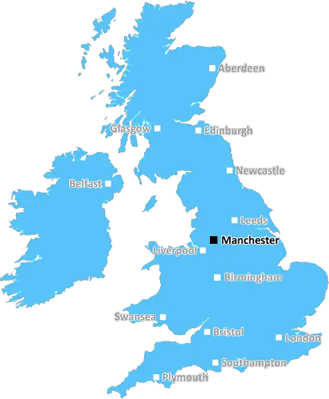
Manchester (M30)
The M30 postcode area is located in the Manchester postcode town region, within the county of Greater Manchester, and contains a total of 1437 individual postcodes.
There are 17 electoral wards in the M30 postcode area, including Manchester, Sale, Salford which come under the local authority of the Salford Council.
Combining the whole postcode region, 16% of people in M30 are classed as having an AB social grade, (i.e. 'white-collar' middle-upper class), compared to 27% across the UK.
This does not mean that the people of M30 are poorer than other areas, but it may give an indication that there are areas of deprivation.
The M30 postcode district is located in the North West of England in the Metropolitan Borough of Trafford and encompasses the towns of Urmston, Partington, Flixton and Davyhulme. It also includes the industrial areas of Trafford Park, which is home to a large number of multinational companies, and Barton Airfield.
The area is home to Urmston town centre, which features a bustling market and the Lowry outlet mall, which offers entertainment for all the family. Partington is a small town to the west of M30 which offers a good selection of shops and amenities for locals.
Flixton is found to the east of the postcode and is well known for the Flixton and Urmston Golf Club, which dates back to the early 1900s and remains popular with locals and visitors. It also includes the popular Flixton Park and the gardens of Victoria Park and Britannia Park.
Davyhulme is a former fishing settlement which has become a residential area in recent years and is home to the popular Stretford Leisure Centre, which includes a swimming pool, gym, sauna and steam room.
The M30 postcode district is served by Patricroft and Flixton Station, with direct links to Manchester Piccadilly, throughout the week. There are also regular buses that run through the area and connect to nearby towns such as Trafford Park and Davyhulme, giving people easy access to the rest of Manchester. The M60, M62 and M56 motorways provide travel links to other parts of the region.
The district has many green spaces, including the extensive and beautiful Babdury Nature Reserve, and also boasts a great selection of caf�s, restaurants, pubs and shops, meaning there is something for everyone living in the area.
The M30 postcode district is renowned for its traditional markets and shops, with regular flea markets and second-hand shops, and is growing in popularity due to its close proximity to the city centre, making it an ideal location for young professionals and commuters.
The area is served by several local primary and secondary schools and is known for its friendly community spirit, with a sense of nostalgia still held by a lot of the original inhabitants of the area.
The M30 postcode district in Manchester is an ideal place to live for both young professionals and families alike due to its amenities, diversity and transport links. With its combination of traditional living and modernised establishments, this district has something to offer for everyone.

Demographics

Greater Manchester

M30 is located in the county of Greater Manchester, in England.
Greater Manchester has a total population of 2,782,100, making it the 3rd largest county in the UK.
Greater Manchester has a total area of 492 square miles, and a population density of 2180 people per square kilometre. For comparison, Greater London has a density of 5,618 people/km2.
| Outward Code | M30 |
| Postal Town | Manchester |
| MSOA Name | Salford 026 |
| LSOA Name | Salford 026A |
| County | Greater Manchester |
| Region | Greater Manchester |
| Country | England |
| Local Authority | Salford |
| Area Classification | Urban with Major Conurbation |
M30 Electoral Wards
The postal region of M30, includes the local towns, villages, electoral wards and stations of:
Dig even deeper into the M30 postcode by clicking on a postcode below:
Click on an outward postal code below for more information about the area. Each 'outward' postcode give you a comprehensive list of all postcodes within the outward code area (M) and estimated address.
Click on an 'outward' code for more information. For example, the outward postcode page 'EC2M' will give you an alphabetical list covering all postcodes located in the region, from 'EC2M 1BB' through to 'EC2M 7YA'.
Chris H
Sunday, April 7, 2024
We don't have any views of M30 right now. If you live in M30 or have visited it, please help us to help others by telling others what you think of this neighbourhood.
Add your view of M30
People need your local expertise. If you live in M30 or have first-hand knowledge of the neighbourhood, please consider sharing your views. It's completely anonymous - all we ask is for your initials.
Please tell us what you like about the M30 postcode area, what you don't like, and what it's like to live or work here.
| LOCAL AMENITIES | |
| FAMILY FRIENDLY | |
| PARKING | |
| GREEN SPACES |
From the Postcode Area blog

Deciphering Crime Rates - a Deep Dive Into UK Postcode Analysis
Ever wondered about the crime rate in your UK postcode? You're not alone. We've dug deep into the data, uncovering trends and patterns that'll make your head spin.

Death of the High Street?
The BBC reports that despite councils' attempts to kurb them, the UK's high streets have seen a huge growth in fast food outlets. Could this mark the death knell for the Great British high street, and what can we do about it to halt its decline?

Discrimination by Postcode
You really couldn't make it up, could you? Some of the country's most vulnerable people are missing out on their weekly £25 Cold Weather Payment, just because the system that's in operation is discriminating against them because payments are based on postcode, rather than geographic location.

The Redesign is Underway
Well, the current website was absolutely in dire need of a good redesign - from the ground up. So I set out to pull it all apart and get it up and running again to become the most comprehensive guide to every postcode in the UK. And it's been a long, tough job from start to finish - and quite possibly the biggest project I've ever undertaken.
SOCIAL GRADES
According to census records, 16% of people here have a social grade of AB (highest), compared to the national average of 27%.