llandudno LL38 Postcodes
Spending a fortune on conveyancing?

Compare instant, low-cost online quotes from trusted conveyancing solicitors.
Backed by experts, our no-obligation service searches through the best conveyancing quotes on the market to save you time and money.
Llandudno (LL38)
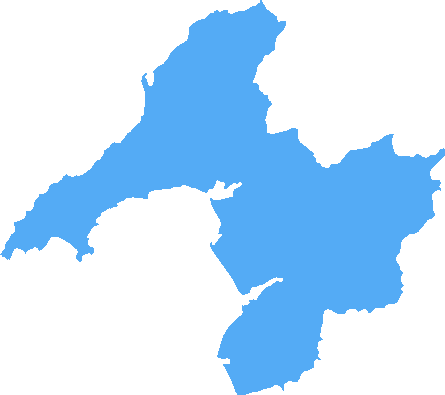
The LL38 postcode area is located in the Llandudno postcode town region, within the county of Gwynedd, and contains a total of 52 individual postcodes.
There are 2 electoral wards in the LL38 postcode area, including Aberdovey, Abergele, Amlwch, Arthog, Bala, Bangor, Barmouth, Beaumaris, Betws-Y-Coed, Blaenau Ffestiniog, Bodorgan, Brynteg, Caernarfon, Cemaes Bay, Colwyn Bay, Conwy, Corwen, Criccieth, Denbigh, Dolgellau, Dolwyddelan, Dulas, Dyffryn Ardudwy, Fairbourne, Gaerwen, Garndolbenmaen, Harlech, Holyhead, Llanbedr, Llanbedrgoch, Llandudno, Llandudno Junction, Llanerchymedd, Llanfairfechan, Llanfairpwllgwyngyll, Llangefni,Llangollen, Llanrwst, Llwyngwril, Marianglas, Menai Bridge, Moelfre, Penmaenmawr, Penrhyndeudraeth, Pentraeth, Penysarn, Porthmadog, Prestatyn, Pwllheli, Rhosgoch, Rhosneigr, Rhyl, Ruthin, St Asaph, Talsarnau, Talybont, Trefriw, Ty Croes, Tyn-Y-Gongl, Tywyn, Wrexham, Y Felinheli which come under the local authority of the Gwynedd Council.
Combining the whole postcode region, 16% of people in LL38 are classed as having an AB social grade, (i.e. 'white-collar' middle-upper class), compared to 27% across the UK.
This does not mean that the people of LL38 are poorer than other areas, but it may give an indication that there are areas of deprivation.
The LL38 postcode covers the Llandudno district of Wales, lying on the northern coast between the Irish Sea and Conwy Estuary. Alongside its neighbouring town of Colwyn Bay it's the largest coastal resort in Wales, and being part of Conwy county borough is an iconic symbol of Welsh seaside life. LL38 covers the suburbs of Craig y Don, Gloddaeth, Bryn Euryn, Tower Hill and Lower Hodnot. It's known primarily as a residential area with properties generally of mid to high value, many of which have beautiful views out over the sea. There's a variety of architectural styles within the postcode, from victorian and Edwardian terraces to modern housing built in the mid-2000s. Asides from housing, there's also a number of historical attractions and alluring outdoor spaces that make LL38 an attractive area to live. The recently renovated Conwy Castle and the renowned Marine Drive are two of these, as well as the coastal walks of Bryn Euryn Hill with its sweeping views and narrow paths. Shopping within the postcode mostly consists of small independent retailers, though it does have two medium-sized supermarkets and some interesting Victorian arcades. There's a few pubs and restaurants too, providing a range of dining options. Llandudno itself acts as a regional hub and comes with an array of entertainment and activities, from its several acclaimed theatres and pier, to its renowned North Walian beach. All of these amenities make the LL38 postcode an affluent and desirable place to live, giving its residents the best of seaside and countryside life without having to travel too far.

Demographics

Gwynedd
LL38 is located in the county of Gwynedd, in Wales.
Gwynedd has a total population of 123,600, making it the 14th largest county in the UK.
Gwynedd has a total area of 984 square miles, and a population density of 48 people per square kilometre. For comparison, Greater London has a density of 5,618 people/km2.

| Outward Code | LL38 |
| Postal Town | Llandudno |
| MSOA Name | Gwynedd 017 |
| LSOA Name | Gwynedd 017C |
| County | Gwynedd |
| Region | Gwynedd |
| Country | Wales |
| Local Authority | Gwynedd |
| Area Classification | Unclassified |
LL38 Electoral Wards
The postal region of LL38, includes the local towns, villages, electoral wards and stations of:
Dig even deeper into the LL38 postcode by clicking on a postcode below:
Click on an outward postal code below for more information about the area. Each 'outward' postcode give you a comprehensive list of all postcodes within the outward code area (LL) and estimated address.
Click on an 'outward' code for more information. For example, the outward postcode page 'EC2M' will give you an alphabetical list covering all postcodes located in the region, from 'EC2M 1BB' through to 'EC2M 7YA'.
Chris H
Wednesday, April 17, 2024
We don't have any views of LL38 right now. If you live in LL38 or have visited it, please help us to help others by telling others what you think of this neighbourhood.
Add your view of LL38
People need your local expertise. If you live in LL38 or have first-hand knowledge of the neighbourhood, please consider sharing your views. It's completely anonymous - all we ask is for your initials.
Please tell us what you like about the LL38 postcode area, what you don't like, and what it's like to live or work here.
| LOCAL AMENITIES | |
| FAMILY FRIENDLY | |
| PARKING | |
| GREEN SPACES |
From the Postcode Area blog

Deciphering Crime Rates - a Deep Dive Into UK Postcode Analysis
Ever wondered about the crime rate in your UK postcode? You're not alone. We've dug deep into the data, uncovering trends and patterns that'll make your head spin.

Death of the High Street?
The BBC reports that despite councils' attempts to kurb them, the UK's high streets have seen a huge growth in fast food outlets. Could this mark the death knell for the Great British high street, and what can we do about it to halt its decline?

Discrimination by Postcode
You really couldn't make it up, could you? Some of the country's most vulnerable people are missing out on their weekly £25 Cold Weather Payment, just because the system that's in operation is discriminating against them because payments are based on postcode, rather than geographic location.

The Redesign is Underway
Well, the current website was absolutely in dire need of a good redesign - from the ground up. So I set out to pull it all apart and get it up and running again to become the most comprehensive guide to every postcode in the UK. And it's been a long, tough job from start to finish - and quite possibly the biggest project I've ever undertaken.
SOCIAL GRADES
According to census records, 16% of people here have a social grade of AB (highest), compared to the national average of 27%.