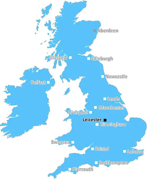
leicester LE14 Postcodes
Spending a fortune on conveyancing?

Compare instant, low-cost online quotes from trusted conveyancing solicitors.
Backed by experts, our no-obligation service searches through the best conveyancing quotes on the market to save you time and money.
Leicester (LE14)
The LE14 postcode area is located in the Leicester postcode town region, within the county of Leicestershire, and contains a total of 759 individual postcodes.
There are 112 electoral wards in the LE14 postcode area, including Ashby-De-La-Zouch, Coalville, Hinckley, Ibstock, Leicester, Loughborough, Lutterworth, Market Harborough, Markfield, Melton Mowbray, Oakham, Wigston which come under the local authority of the Melton Council.
Combining the whole postcode region, 31% of people in LE14 are classed as having an AB social grade, (i.e. 'white-collar' middle-upper class), compared to 27% across the UK.
This does not mean that the people of LE14 are wealthier - or higher class - than average, but it can be an indication that the area may be prospering and desirable to live in.
Le14 is a postcode in the United Kingdom, covering Leicestershire, Rutland, and parts of Nottinghamshire. The postcode serves a variety of areas in the UK, including Melton Mowbray, Spittal and Hallaton, parts of Oakham, and many other villages and hamlets across Leicestershire and Rutland.
In terms of geography, Le14 lies in the East Midlands region of England and is one of the postcodes within the East Midlands County region. It is bordered by the postcodes LE13 to the north and east, NG32 to the south and NG25 to the west. The postcode is also close to other postcodes in the county such as LE9 and NG32, including the outskirts of Nottingham.
The postcode covers a total of 72 square kilometres and is located at an average altitude of 66 metres above sea level. It lies within the Broxe and East Washladies Production Landscape, and is also near the area of the Leicestershire and Rutland Wildlife Trust.
Le14 is well known for its rural areas, market towns and traditional villages, which make it a popular destination for those seeking a tranquil trip within Leicestershire. The area is predominantly predominated by rural agriculture, woodland and water, although there are some domestic dwellings in some areas. It is also a popular region for walkers and cyclists due to the many pathways and green spaces available.
The postcode area includes the major town of Melton Mowbray, best known for its pork pies, which are popular throughout the world. There are many other attractions in the area, including the famous Rutland Water leisure destination, as well as the National Bowl near Market Harborough, and as such it is a popular tourist area.
Le14 also contains many historical sites, including Hallaton Bottle Kicking, which is an annual event that has its origins in the early 19th century. The Bottledale and Hallaton Museums are also worth a visit and the annual Mowbray Pie Fair takes place each year in Melton Mowbray to celebrate the town's famous dish.
The postcode is served by the Melton Mowbray railway station, which is the main station in the area and links Le14 to other areas of the Midlands. There is also a coach transport network available, which allows passengers to travel to other parts of Leicestershire and beyond.
Leicestershire is known for its motorway links, with the M1 motorway running through Le14 postcode. This makes the area attractive to commuters coming from neighbouring Nottinghamshire and other parts of the Midlands.
Le14 is an attractive postcode in Leicestershire, offering visitors picturesque countryside scenery, a wealth of historic sites, and convenient public transport options. The region also boasts plenty of leisure facilities and activities, making it the perfect destination for those looking to explore the Swedish countryside.

Demographics

Leicestershire

LE14 is located in the county of Leicestershire, in England.
Leicestershire has a total population of 1,031,300, making it the 21st largest county in the UK.
Leicestershire has a total area of 832 square miles, and a population density of 478 people per square kilometre. For comparison, Greater London has a density of 5,618 people/km2.
| Outward Code | LE14 |
| Postal Town | Leicester |
| MSOA Name | Melton 006 |
| LSOA Name | Melton 006D |
| County | Leicestershire |
| Region | Leicestershire |
| Country | England |
| Local Authority | Melton |
| Area Classification | Mainly Rural (rural including hub towns >=80%) |
LE14 Electoral Wards
The postal region of LE14, includes the local towns, villages, electoral wards and stations of:
Dig even deeper into the LE14 postcode by clicking on a postcode below:
Click on an outward postal code below for more information about the area. Each 'outward' postcode give you a comprehensive list of all postcodes within the outward code area (LE) and estimated address.
Click on an 'outward' code for more information. For example, the outward postcode page 'EC2M' will give you an alphabetical list covering all postcodes located in the region, from 'EC2M 1BB' through to 'EC2M 7YA'.
Chris H
Monday, April 8, 2024
We don't have any views of LE14 right now. If you live in LE14 or have visited it, please help us to help others by telling others what you think of this neighbourhood.
Add your view of LE14
People need your local expertise. If you live in LE14 or have first-hand knowledge of the neighbourhood, please consider sharing your views. It's completely anonymous - all we ask is for your initials.
Please tell us what you like about the LE14 postcode area, what you don't like, and what it's like to live or work here.
| LOCAL AMENITIES | |
| FAMILY FRIENDLY | |
| PARKING | |
| GREEN SPACES |
Local News Leicestershire
Can Surrey be beaten as County Championship returns?
With the new County Championship season starting on Friday, can anyone prevent Surrey winning a third straight title?
BBC NewsBody in caravan thought to be wanted sex offender
Police said Richard Scatchard had links to Leicestershire and was on prison recall.
BBC NewsWork to repair landslip-hit railway line begins
The site, used to test new trains and technology, has been closed since last year.
BBC NewsLeicester beat Birmingham to go top of table
Leicester City go top of the Championship with late win against Birmingham City at the King Power Stadium.
BBC NewsCommunity rallies to help fire-damaged pub reopen
The Leicestershire pub was badly damaged by a fire more than a year ago.
BBC NewsKeenan returns for Leinster's Tigers rematch
Hugo Keenan is passed fit for Leinster's Champions Cup last-16 tie against Leicester Tigers on Saturday.
BBC NewsWarning to 'stay on guard' after cyber-attack
The council says work is ongoing to find out the amount and nature of data which was taken.
BBC NewsBaby whose heart works at 20% reaches first birthday
Doctors feared Willow, who has dilated cardiomyopathy, would not survive but she defied the odds.
BBC NewsFrom the Postcode Area blog

Deciphering Crime Rates - a Deep Dive Into UK Postcode Analysis
Ever wondered about the crime rate in your UK postcode? You're not alone. We've dug deep into the data, uncovering trends and patterns that'll make your head spin.

Death of the High Street?
The BBC reports that despite councils' attempts to kurb them, the UK's high streets have seen a huge growth in fast food outlets. Could this mark the death knell for the Great British high street, and what can we do about it to halt its decline?

Discrimination by Postcode
You really couldn't make it up, could you? Some of the country's most vulnerable people are missing out on their weekly £25 Cold Weather Payment, just because the system that's in operation is discriminating against them because payments are based on postcode, rather than geographic location.

The Redesign is Underway
Well, the current website was absolutely in dire need of a good redesign - from the ground up. So I set out to pull it all apart and get it up and running again to become the most comprehensive guide to every postcode in the UK. And it's been a long, tough job from start to finish - and quite possibly the biggest project I've ever undertaken.
SOCIAL GRADES
According to census records, 31% of people here have a social grade of AB (highest), compared to the national average of 27%.