kingston-upon-thames KT14 Postcodes
Spending a fortune on conveyancing?

Compare instant, low-cost online quotes from trusted conveyancing solicitors.
Backed by experts, our no-obligation service searches through the best conveyancing quotes on the market to save you time and money.
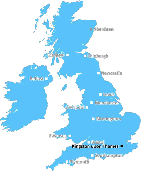
Kingston Upon Thames (KT14)
The KT14 postcode area is located in the Kingston Upon Thames postcode town region, within the county of Surrey, and contains a total of 612 individual postcodes.
There are 6 electoral wards in the KT14 postcode area, including Addlestone, Ashtead, Chertsey, Chessington, Cobham, East Molesey, Epsom, Esher, Kingston Upon Thames, Leatherhead, New Malden, Surbiton, Tadworth, Thames Ditton, Walton-On-Thames, West Byfleet, West Molesey, Weybridge, Worcester Park which come under the local authority of the Woking Council.
Combining the whole postcode region, 39% of people in KT14 are classed as having an AB social grade, (i.e. 'white-collar' middle-upper class), compared to 27% across the UK.
This does not mean that the people of KT14 are wealthier - or higher class - than average, but it can be an indication that the area may be prospering and desirable to live in.
KT14 postcode is a postcode district in the Surrey, located on the far north-west side of the county border. It belongs to the Guildford post town.
KT14 postcode district covers the villages of West Byfleet, Pyrford and portions of Byfleet. These villages are part of the Woking post town. It also includes various smaller hamlets and areas such as: West Byfleet, Knaphill, Brookwood, Pyrford, Rydens, Rydings, Mayford, Bisley, Old Woking, Hook Heath, and Sheerwater.
The KT14 postcode district is located on the outskirts of the county of Surrey, in the southwest of the London metropolitan area. The area is generally surrounded by greenbelt, with many areas of recreational open space and green space, including: Basingstoke Canal, Pains Hill Park, Milford Common, Eashing Meadows, River Wey, Newlands Corner and Horsell Common.
The postcode district is served by Surrey County Council's Woking Local Authority and is under Surrey Heath for local governance.
Transport links from the KT14 area include: National Rail from West Byfleet Station on the Kingston Loop Line which goes to Shepperton, Chessington South, Epsom, Dorking, Leatherhead and other areas of the Kingston Loop Line, as well as Woking Station which has direct links to Guildford, Ascot, Reading and London Waterloo.
The area is served by the A245 which connects to the M25 and M3 motorways, and provides access to the airports at Heathrow and Gatwick. Additionally, on-street parking is available in many of the villages within the postcode district.
In terms of education, the postcode district is served by five primary schools in West Byfleet, Pyrford, Mayford, Rydens and Sheerwater. There are two secondary schools, The Winston Churchill School in Woking, and The West Byfleet School, both of which offer comprehensive and enrichment provisions, along with an array of extra-curricular activities.
In terms of healthcare, the postcode district is served by two local GP surgeries at West Byfleet and Pyrford. There is also an NHS Walk In centre in West Byfleet, a community dental centre and an optician.
The KT14 postcode district always something for everyone. It is home to numerous restaurants, pubs and caf�s including those in West Byfleet Village Centre as well as independent outlets like Alchemy Coffee. There is also a local cinema, theatre, bowling, and various activities like golf and fishing in nearby locations.

Demographics

Surrey

KT14 is located in the county of Surrey, in England.
Surrey has a total population of 1,176,500, making it the 13th largest county in the UK.
Surrey has a total area of 642 square miles, and a population density of 707 people per square kilometre. For comparison, Greater London has a density of 5,618 people/km2.
| Outward Code | KT14 |
| Postal Town | Kingston Upon Thames |
| MSOA Name | Woking 002 |
| LSOA Name | Woking 002C |
| County | Surrey |
| Region | Surrey |
| Country | England |
| Local Authority | Woking |
| Area Classification | Urban with Major Conurbation |
KT14 Electoral Wards
The postal region of KT14, includes the local towns, villages, electoral wards and stations of:
Dig even deeper into the KT14 postcode by clicking on a postcode below:
Click on an outward postal code below for more information about the area. Each 'outward' postcode give you a comprehensive list of all postcodes within the outward code area (KT) and estimated address.
Click on an 'outward' code for more information. For example, the outward postcode page 'EC2M' will give you an alphabetical list covering all postcodes located in the region, from 'EC2M 1BB' through to 'EC2M 7YA'.
Chris H
Sunday, April 7, 2024
We don't have any views of KT14 right now. If you live in KT14 or have visited it, please help us to help others by telling others what you think of this neighbourhood.
Add your view of KT14
People need your local expertise. If you live in KT14 or have first-hand knowledge of the neighbourhood, please consider sharing your views. It's completely anonymous - all we ask is for your initials.
Please tell us what you like about the KT14 postcode area, what you don't like, and what it's like to live or work here.
| LOCAL AMENITIES | |
| FAMILY FRIENDLY | |
| PARKING | |
| GREEN SPACES |
Local News Surrey
Surrey company fined 15k after illegally chopping down 100 protected trees
Two firms were fined almost 20,000 after pleading guilty to felling more than 100 protected tress
Get SurreyLeisure centre awarded 86k from swimming pool fund
Guildford Borough Council says the funds will be used to improve the pool's energy efficiency.
BBC NewsNew plans for beauty spot near Surrey branded 'huge disappointment'
The 'Hyde Park sized' conservation area, which was planned to act as a haven for at-risk wildlife, has been subject to much controversy
Get SurreyDorking Wanderers 0-0 Altrincham
Dorking secure a valuable point in their relegation fight by holding promotion-chasing Altrincham to a draw.
BBC NewsWoking 3-2 Dagenham & Redbridge
Woking edge five points clear of the National League drop zone with a win over Dagenham.
BBC NewsCrackdown on boat owners moored on River Thames
The Environment Agency brought civil trespass proceedings against long-stay boaters in West Molesey.
BBC NewsDriver injured in M25 crash remains critical
Police appealed for witnesses following the crash which closed part of the M25 for several hours.
BBC NewsM25 driver rushed to hospital after car crashed into barrier and rolled down embankment closing motorway
There is currently a full closure of all four lanes of the M25 anticlockwise between J6 and J5.
Get SurreyFrom the Postcode Area blog

Deciphering Crime Rates - a Deep Dive Into UK Postcode Analysis
Ever wondered about the crime rate in your UK postcode? You're not alone. We've dug deep into the data, uncovering trends and patterns that'll make your head spin.

Death of the High Street?
The BBC reports that despite councils' attempts to kurb them, the UK's high streets have seen a huge growth in fast food outlets. Could this mark the death knell for the Great British high street, and what can we do about it to halt its decline?

Discrimination by Postcode
You really couldn't make it up, could you? Some of the country's most vulnerable people are missing out on their weekly £25 Cold Weather Payment, just because the system that's in operation is discriminating against them because payments are based on postcode, rather than geographic location.

The Redesign is Underway
Well, the current website was absolutely in dire need of a good redesign - from the ground up. So I set out to pull it all apart and get it up and running again to become the most comprehensive guide to every postcode in the UK. And it's been a long, tough job from start to finish - and quite possibly the biggest project I've ever undertaken.
SOCIAL GRADES
According to census records, 39% of people here have a social grade of AB (highest), compared to the national average of 27%.