kingston-upon-thames KT1 Postcodes
Spending a fortune on conveyancing?

Compare instant, low-cost online quotes from trusted conveyancing solicitors.
Backed by experts, our no-obligation service searches through the best conveyancing quotes on the market to save you time and money.
Kingston Upon Thames (KT1)
The KT1 postcode area is located in the Kingston Upon Thames postcode town region, within the county of Greater London, and contains a total of 1420 individual postcodes.
There are 2 electoral wards in the KT1 postcode area, including Addlestone, Ashtead, Chertsey, Chessington, Cobham, East Molesey, Epsom, Esher, Kingston Upon Thames, Leatherhead, New Malden, Surbiton, Tadworth, Thames Ditton, Walton-On-Thames, West Byfleet, West Molesey, Weybridge, Worcester Park which come under the local authority of the Kingston upon Thames Council.
Combining the whole postcode region, 38% of people in KT1 are classed as having an AB social grade, (i.e. 'white-collar' middle-upper class), compared to 27% across the UK.
This does not mean that the people of KT1 are wealthier - or higher class - than average, but it can be an indication that the area may be prospering and desirable to live in.
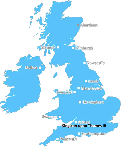
The KT1 postcode area is situated in the Borough of Kingston upon Thames, located southwest of London in Greater London. The postcode is often referred to by its regional Twickenham postal district number, which is TW1.
KT1 is predominately made up of residential properties, many of which are independent houses, terraced townhouses, and detached homes. However, it also contains student residences, offices and retail outlets.
The postcode includes Kingston upon Thames town centre, Kingston University's Penrhyn Road campus, and the area of Norbiton which has many restaurants, shops, and pubs including The Fighting Cocks, one of Kingston's oldest pubs. It also includes St John's Hill and Cambridge Road, famous for being home to antiques shops.
KT1 covers some of the most vibrant areas of Kingston town centre such as Fairfield North and South, the Ancient Market Place, and Eden Street which have some beautiful buildings, shops and caf�s such as the Old London Fishmongers. It also includes the area around the market such as the Bentall Centre which is the town's largest shopping centre and a popular destination for visitors and locals alike.
The area is well-served by public transport links with two railway stations: Norbiton Station on the London Waterloo line and Kingston Station on the South Western main line. In addition, there are numerous bus routes which cover the area, making it easy to get around Kingston.
KT1 is a popular area for students, families, professionals and international visitors due to its close proximity to central London and the Kingston University's main Penrhyn Road Campus. Furthermore, the nearby River Thames is a magnet for tourists wanting to take in the sights and sounds of this part of London, as is the ancient market place which hosts a number of weekly markets, fayres and activities year-round.

Demographics

Greater London

KT1 is located in the county of Greater London, in England.
Greater London has a total population of 8,778,500, making it the 1st largest county in the UK.
Greater London has a total area of 606 square miles, and a population density of 5594 people per square kilometre. For comparison, Greater London has a density of 5,618 people/km2.
| Outward Code | KT1 |
| Postal Town | Kingston Upon Thames |
| MSOA Name | Kingston upon Thames 009 |
| LSOA Name | Kingston upon Thames 009C |
| County | Greater London |
| Region | Greater London |
| Country | England |
| Local Authority | Kingston upon Thames |
| Area Classification | Urban with Major Conurbation |
KT1 Electoral Wards
The postal region of KT1, includes the local towns, villages, electoral wards and stations of:
Dig even deeper into the KT1 postcode by clicking on a postcode below:
Click on an outward postal code below for more information about the area. Each 'outward' postcode give you a comprehensive list of all postcodes within the outward code area (KT) and estimated address.
Click on an 'outward' code for more information. For example, the outward postcode page 'EC2M' will give you an alphabetical list covering all postcodes located in the region, from 'EC2M 1BB' through to 'EC2M 7YA'.
Chris H
Saturday, April 6, 2024
We don't have any views of KT1 right now. If you live in KT1 or have visited it, please help us to help others by telling others what you think of this neighbourhood.
Add your view of KT1
People need your local expertise. If you live in KT1 or have first-hand knowledge of the neighbourhood, please consider sharing your views. It's completely anonymous - all we ask is for your initials.
Please tell us what you like about the KT1 postcode area, what you don't like, and what it's like to live or work here.
| LOCAL AMENITIES | |
| FAMILY FRIENDLY | |
| PARKING | |
| GREEN SPACES |
Local News Surrey
M25 traffic blocked after driver crashed into barrier and tumbled down embankment - as it happened
An M25 driver was rushed to hospital after their car crashed into a barrier
Get SurreyDriver injured in M25 crash remains critical
Police appealed for witnesses following the crash which closed part of the M25 for several hours.
BBC NewsSurrey weather latest as 'mini heatwave' forecast this weekend with temperature of 19C
Guildford, Dorking and Staines to see temperatures in the high teens
Get SurreyCCTV appeal after gang steal 3k of perfume from Reigate Jo Malone shop
Police have released CCTV images of three men they want to identify as part of the investigation
Get SurreyInside the stunning 1.5m Dorking barn with garden that looks like tropical resort
The property is nestled within the countryside
Get SurreyGirl, 13, missing from Horley for two days with police concerned for her safety
Gabija was last seen on Tuesday 2 April at her home address, Surrey Police said
Get SurreyThe cheapest Surrey postcode to buy a home which is still 100k more than UK average
Nowhere in Surrey had an average house price that was equal to or less than the UK average
Get SurreyCrackdown on boat owners moored on River Thames
The Environment Agency brought civil trespass proceedings against long-stay boaters in West Molesey.
BBC NewsFrom the Postcode Area blog

Deciphering Crime Rates - a Deep Dive Into UK Postcode Analysis
Ever wondered about the crime rate in your UK postcode? You're not alone. We've dug deep into the data, uncovering trends and patterns that'll make your head spin.

Death of the High Street?
The BBC reports that despite councils' attempts to kurb them, the UK's high streets have seen a huge growth in fast food outlets. Could this mark the death knell for the Great British high street, and what can we do about it to halt its decline?

Discrimination by Postcode
You really couldn't make it up, could you? Some of the country's most vulnerable people are missing out on their weekly £25 Cold Weather Payment, just because the system that's in operation is discriminating against them because payments are based on postcode, rather than geographic location.

The Redesign is Underway
Well, the current website was absolutely in dire need of a good redesign - from the ground up. So I set out to pull it all apart and get it up and running again to become the most comprehensive guide to every postcode in the UK. And it's been a long, tough job from start to finish - and quite possibly the biggest project I've ever undertaken.
SOCIAL GRADES
According to census records, 38% of people here have a social grade of AB (highest), compared to the national average of 27%.