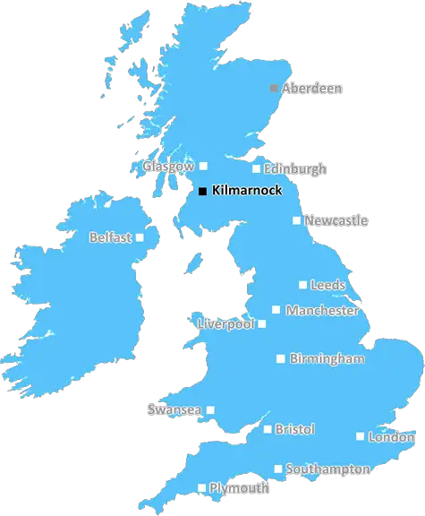
kilmarnock KA21 Postcodes
Spending a fortune on conveyancing?

Compare instant, low-cost online quotes from trusted conveyancing solicitors.
Backed by experts, our no-obligation service searches through the best conveyancing quotes on the market to save you time and money.
Kilmarnock (KA21)
The KA21 postcode area is located in the Kilmarnock postcode town region, within the county of Ayrshire, and contains a total of 414 individual postcodes.
There are 2 electoral wards in the KA21 postcode area, including Ardrossan, Ayr, Beith, Cumnock, Dalry, Darvel, Galston, Girvan, Irvine, Isle Of Arran, Isle Of Cumbrae, Kilbirnie, Kilmarnock, Kilwinning, Largs, Mauchline, Maybole, Newmilns, Prestwick, Saltcoats, Stevenston, Troon, West Kilbride which come under the local authority of the North Ayrshire Council.
Combining the whole postcode region, 0% of people in KA21 are classed as having an AB social grade, (i.e. 'white-collar' middle-upper class), compared to 27% across the UK.
This does not mean that the people of KA21 are poorer than other areas, but it may give an indication that there are areas of deprivation.
The KA21 postcode is located in the Kilmarnock district of East Ayrshire in Scotland, and is one of the 33 postcodes in the area. It covers an area of around 5.34 square miles, including both urban and rural locations.
KA21 is primarily residential, with most homes located in smaller hamlets such as Girdle Toll. The area is home to a number of local attractions, including Dean Castle Country Park, The Heads of Ayr farm park, and Loudoun Castle Theme Park. There are also several traditional pubs nearby, and a collection of eateries for those looking for a bite to eat.
The town of Kilmarnock is located with the KA21 postcode, and is one of Scotland's oldest Royal Burghs. It is home to one of the oldest football clubs in Scotland, and holds a number of festivals and events throughout the year. The town centre contains a number of independent and chain shops, and the Kilmarnock College offers a range of educational opportunities for local residents.
Outlying areas of the KA21 postcode include small villages such as Crosshouse and Bellfield Exchange. Several attractive parks are located close by, as are a number of golf courses. With its proximity to Glasgow and Edinburgh, the KA21 postcode is a desirable place to live for those looking for a commuter lifestyle.
There is also an abundance of outdoor activities to be enjoyed in the area, with many sites of natural beauty such as Dumfries House Estate on the edge of Ayrshire, as well as a number of small woodland walks. Various water sports, such as kayaking and sailing, are also available along the nearby coastline. Residents of the KA21 postcode have the opportunity to visit a selection of nearby beaches, with many great restaurants, bars, and cafes to visit along the coast.

Demographics

Ayrshire

KA21 is located in the county of Ayrshire, in Scotland.
Ayrshire has a total population of 0, making it the largest county in the UK.
Ayrshire has a total area of square miles, and a population density of people per square kilometre. For comparison, Greater London has a density of 5,618 people/km2.
| Outward Code | KA21 |
| Postal Town | Kilmarnock |
| MSOA Name | Saltcoats North West |
| LSOA Name | |
| County | Ayrshire |
| Region | Ayrshire |
| Country | Scotland |
| Local Authority | North Ayrshire |
| Area Classification | Unclassified |
KA21 Electoral Wards
The postal region of KA21, includes the local towns, villages, electoral wards and stations of:
Dig even deeper into the KA21 postcode by clicking on a postcode below:
Click on an outward postal code below for more information about the area. Each 'outward' postcode give you a comprehensive list of all postcodes within the outward code area (KA) and estimated address.
Click on an 'outward' code for more information. For example, the outward postcode page 'EC2M' will give you an alphabetical list covering all postcodes located in the region, from 'EC2M 1BB' through to 'EC2M 7YA'.
Chris H
Wednesday, April 10, 2024
We don't have any views of KA21 right now. If you live in KA21 or have visited it, please help us to help others by telling others what you think of this neighbourhood.
Add your view of KA21
People need your local expertise. If you live in KA21 or have first-hand knowledge of the neighbourhood, please consider sharing your views. It's completely anonymous - all we ask is for your initials.
Please tell us what you like about the KA21 postcode area, what you don't like, and what it's like to live or work here.
| LOCAL AMENITIES | |
| FAMILY FRIENDLY | |
| PARKING | |
| GREEN SPACES |
From the Postcode Area blog

Deciphering Crime Rates - a Deep Dive Into UK Postcode Analysis
Ever wondered about the crime rate in your UK postcode? You're not alone. We've dug deep into the data, uncovering trends and patterns that'll make your head spin.

Death of the High Street?
The BBC reports that despite councils' attempts to kurb them, the UK's high streets have seen a huge growth in fast food outlets. Could this mark the death knell for the Great British high street, and what can we do about it to halt its decline?

Discrimination by Postcode
You really couldn't make it up, could you? Some of the country's most vulnerable people are missing out on their weekly £25 Cold Weather Payment, just because the system that's in operation is discriminating against them because payments are based on postcode, rather than geographic location.

The Redesign is Underway
Well, the current website was absolutely in dire need of a good redesign - from the ground up. So I set out to pull it all apart and get it up and running again to become the most comprehensive guide to every postcode in the UK. And it's been a long, tough job from start to finish - and quite possibly the biggest project I've ever undertaken.
SOCIAL GRADES
According to census records, 0% of people here have a social grade of AB (highest), compared to the national average of 27%.