ipswich IP2 Postcodes
Spending a fortune on conveyancing?

Compare instant, low-cost online quotes from trusted conveyancing solicitors.
Backed by experts, our no-obligation service searches through the best conveyancing quotes on the market to save you time and money.
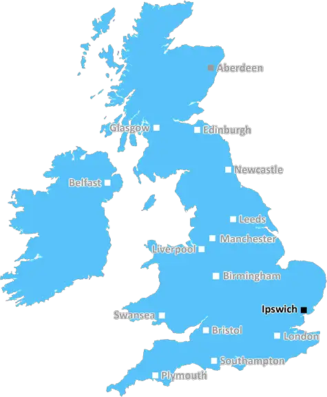
Ipswich (IP2)
The IP2 postcode area is located in the Ipswich postcode town region, within the county of Suffolk, and contains a total of 880 individual postcodes.
There are 6 electoral wards in the IP2 postcode area, including Aldeburgh, Brandon, Bury St Edmunds, Diss, Eye, Felixstowe, Halesworth, Harleston, Ipswich, Leiston, Saxmundham, Southwold, Stowmarket, Thetford, Woodbridge which come under the local authority of the Ipswich Council.
Combining the whole postcode region, 14% of people in IP2 are classed as having an AB social grade, (i.e. 'white-collar' middle-upper class), compared to 27% across the UK.
This does not mean that the people of IP2 are poorer than other areas, but it may give an indication that there are areas of deprivation.
The IP2 postcode is located in the Ipswich area of Suffolk, within the East of England region of the United Kingdom. It consists of mainly residential areas and covers the towns of Kesgrave, Rushmere St Andrew, Martlesham, Warren Heath and Brightwell.
Kesgrave is a large town just 4 miles east of Ipswich's town centre. The area is home to many industrial and commercial businesses, businesses and is known for its shopping facilities compared to other areas in Suffolk. Rushmere St Andrew is a nearby smaller village, and has two primary schools and Rushmere Golf Club. Warren Heath is a small residential village, and Brightwell is a hamlet to the south-west of Kesgrave with views over the Gipping Valley.
IP2 postcode area is served by three buses operated by First in Suffolk operating between Stowmarket and Ipswich. There are good local roads in the area that provide easy access to the nearby towns of Hadleigh, Stowmarket and St. Helens.
The postcode has direct access to several nice local parks, including Chase Wood and Animal Park, Belstead Brook Country Park, and St. Helens Park. The area also provides green open spaces, such as Heathlands Park and Long Common Park, which are mainly used for dog walking and picnics.
IP2 is also home to several leisure facilities, including Pinewood Leisure Centre, Kesgrave Community Centre, Martlesham Leisure Centre and Rushmere Hall.
Besides leisure activities, the IP2 postcode also has a range of education and health facilities. This includes from primary schools such as Kingsfleet Primary School, Bealings School and Kesgrave High School to secondary establishments including Chantry High School and Woodbridge School. There are a number of surgeries in the area, including Martlesham Surgery and Rushmere Surgery, and community centres such as Trinity Park Community Centre.

Demographics

Suffolk

IP2 is located in the county of Suffolk, in England.
Suffolk has a total population of 745,300, making it the 32nd largest county in the UK.
Suffolk has a total area of 1500 square miles, and a population density of 196 people per square kilometre. For comparison, Greater London has a density of 5,618 people/km2.
| Outward Code | IP2 |
| Postal Town | Ipswich |
| MSOA Name | Ipswich 010 |
| LSOA Name | Ipswich 010B |
| County | Suffolk |
| Region | Suffolk |
| Country | England |
| Local Authority | Ipswich |
| Area Classification | Urban with City and Town |
IP2 Electoral Wards
The postal region of IP2, includes the local towns, villages, electoral wards and stations of:
Dig even deeper into the IP2 postcode by clicking on a postcode below:
Click on an outward postal code below for more information about the area. Each 'outward' postcode give you a comprehensive list of all postcodes within the outward code area (IP) and estimated address.
Click on an 'outward' code for more information. For example, the outward postcode page 'EC2M' will give you an alphabetical list covering all postcodes located in the region, from 'EC2M 1BB' through to 'EC2M 7YA'.
Chris H
Monday, April 8, 2024
We don't have any views of IP2 right now. If you live in IP2 or have visited it, please help us to help others by telling others what you think of this neighbourhood.
Add your view of IP2
People need your local expertise. If you live in IP2 or have first-hand knowledge of the neighbourhood, please consider sharing your views. It's completely anonymous - all we ask is for your initials.
Please tell us what you like about the IP2 postcode area, what you don't like, and what it's like to live or work here.
| LOCAL AMENITIES | |
| FAMILY FRIENDLY | |
| PARKING | |
| GREEN SPACES |
Local News Suffolk
Ipswich legends beat rivals on the golf course
Former footballers swap their boots for golf clubs as they battle it out ahead of Saturday's clash.
BBC NewsAppeal to rehome more than 40 feral cats
A charity is appealing for urgent help because of a land sale in Suffolk.
BBC NewsHead teachers locked SEND pupils in rooms - report
Odran Doran and Simon Black are banned from teaching as allegations against them are proven.
BBC NewsFootball club passes ground grading inspection
Ipswich Wanderers retain their step 4 status in the football pyramid after upgrades are approved.
BBC NewsVillage plans for vehicle recycling centre refused
Councillors heard there were 105 objections to the plans from residents living near Stanton.
BBC NewsThe fans don't know the full story - Downes
Flynn Downes shares his frustrations after being booed by his former club's supporters.
BBC NewsHospital trust reveals plan to privatise jobs
Staff are being "thrown to the wolves" by the outsourcing of roles, a union representative claims.
BBC NewsNew cinema opens with chocolate and sci-fi films
The new cinema is the first in town for 50 years and has taken three months to get ready.
BBC NewsFrom the Postcode Area blog

Deciphering Crime Rates - a Deep Dive Into UK Postcode Analysis
Ever wondered about the crime rate in your UK postcode? You're not alone. We've dug deep into the data, uncovering trends and patterns that'll make your head spin.

Death of the High Street?
The BBC reports that despite councils' attempts to kurb them, the UK's high streets have seen a huge growth in fast food outlets. Could this mark the death knell for the Great British high street, and what can we do about it to halt its decline?

Discrimination by Postcode
You really couldn't make it up, could you? Some of the country's most vulnerable people are missing out on their weekly £25 Cold Weather Payment, just because the system that's in operation is discriminating against them because payments are based on postcode, rather than geographic location.

The Redesign is Underway
Well, the current website was absolutely in dire need of a good redesign - from the ground up. So I set out to pull it all apart and get it up and running again to become the most comprehensive guide to every postcode in the UK. And it's been a long, tough job from start to finish - and quite possibly the biggest project I've ever undertaken.
SOCIAL GRADES
According to census records, 14% of people here have a social grade of AB (highest), compared to the national average of 27%.