ipswich IP13 Postcodes
Spending a fortune on conveyancing?

Compare instant, low-cost online quotes from trusted conveyancing solicitors.
Backed by experts, our no-obligation service searches through the best conveyancing quotes on the market to save you time and money.
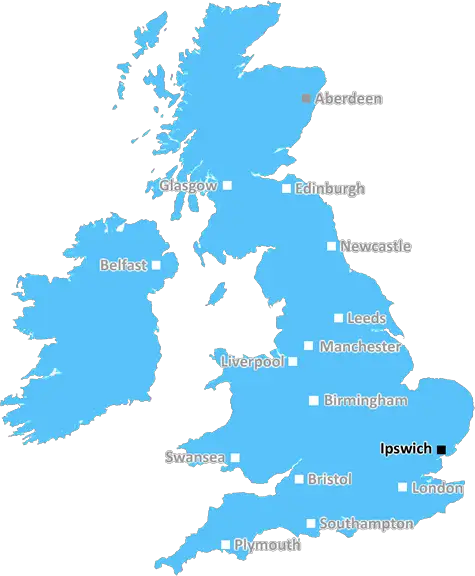
Ipswich (IP13)
The IP13 postcode area is located in the Ipswich postcode town region, within the county of Suffolk, and contains a total of 1231 individual postcodes.
There are 85 electoral wards in the IP13 postcode area, including Aldeburgh, Brandon, Bury St Edmunds, Diss, Eye, Felixstowe, Halesworth, Harleston, Ipswich, Leiston, Saxmundham, Southwold, Stowmarket, Thetford, Woodbridge which come under the local authority of the Suffolk Coastal Council.
Combining the whole postcode region, 31% of people in IP13 are classed as having an AB social grade, (i.e. 'white-collar' middle-upper class), compared to 27% across the UK.
This does not mean that the people of IP13 are wealthier - or higher class - than average, but it can be an indication that the area may be prospering and desirable to live in.
The IP13 postcode in the Ipswich district is a postcode for parts of the town of Woodbridge in Suffolk, England. Located to the east of the River Deben, it covers the western part of the town, as well as a number of villages in the area.
The postcode is made up of two parts; the outcode (IP) and the inward code (13). The IP13 postcode is served by the Woodbridge postal office, located in the town centre.
The IP13 postcode covers a large area, taking in the suburban area of Rushley Green, as well as the villages of Kesgrave, Martlesham Heath, Rushmere St Andrew, Playford, Sutton, Martlesham, Melton, Wickham Market and Hollesley.
The area includes a variety of shops, businesses and leisure facilities, as well as charming rural villages with historic woods and former market towns. Woodbridge marks the start point of the River Deben and has a long-standing history as an important trading port.
Walking, cycling and cycling paths are abundant in the hills and countryside, and the nearby Rendlesham Forest provides the perfect opportunity for outdoor activities.
The local schools in the Woodbridge area attract strong demand from families and its golf course, swimming pool, bowling club, tennis club and sailing club all provide recreational facilities for the younger generations.
In addition, the area is well-served by a number of bus routes, as well as a railway line running from Ipswich to Woodbridge, and from Saxmundham to Lowestoft.
Finally, the scenery around the IP13 postcode is particularly scenic, taking in the picturesque River Deben as it flows past the postcode, and the nearby Aldeburgh coastline which is well-known for its diverse wildlife and beauty.

Demographics

Suffolk

IP13 is located in the county of Suffolk, in England.
Suffolk has a total population of 745,300, making it the 32nd largest county in the UK.
Suffolk has a total area of 1500 square miles, and a population density of 196 people per square kilometre. For comparison, Greater London has a density of 5,618 people/km2.
| Outward Code | IP13 |
| Postal Town | Ipswich |
| MSOA Name | Suffolk Coastal 002 |
| LSOA Name | Suffolk Coastal 002E |
| County | Suffolk |
| Region | Suffolk |
| Country | England |
| Local Authority | Suffolk Coastal |
| Area Classification | Largely Rural (rural including hub towns 50-79%) |
IP13 Electoral Wards
The postal region of IP13, includes the local towns, villages, electoral wards and stations of:
Dig even deeper into the IP13 postcode by clicking on a postcode below:
Click on an outward postal code below for more information about the area. Each 'outward' postcode give you a comprehensive list of all postcodes within the outward code area (IP) and estimated address.
Click on an 'outward' code for more information. For example, the outward postcode page 'EC2M' will give you an alphabetical list covering all postcodes located in the region, from 'EC2M 1BB' through to 'EC2M 7YA'.
Chris H
Sunday, April 7, 2024
We don't have any views of IP13 right now. If you live in IP13 or have visited it, please help us to help others by telling others what you think of this neighbourhood.
Add your view of IP13
People need your local expertise. If you live in IP13 or have first-hand knowledge of the neighbourhood, please consider sharing your views. It's completely anonymous - all we ask is for your initials.
Please tell us what you like about the IP13 postcode area, what you don't like, and what it's like to live or work here.
| LOCAL AMENITIES | |
| FAMILY FRIENDLY | |
| PARKING | |
| GREEN SPACES |
Local News Suffolk
A New(market) Cinema
Josh Schunmann of Newmarket Charitable Foundation tells us about Newmarket's new cinema.
BBC NewsMan planting vegetables digs up WW2 grenade
Residents are advised to say indoors after Harry Fox unearths the rusty device.
BBC NewsFormer British speedway Champion dies aged 82
The former Ipswich Witches rider and "legend" John "Tiger" Louis has died, the club says.
BBC NewsHead teachers locked SEND pupils in rooms - report
Odran Doran and Simon Black are banned from teaching as allegations against them are proven.
BBC NewsEFL: Leicester go top; Leeds lose to Coventry; wins for Hull and Owls
Follow live text commentary from the EFL after Norwich beat Championship leaders Ipswich in derby.
BBC NewsAppeal to rehome more than 40 feral cats
A charity is appealing for urgent help because of a land sale in Suffolk.
BBC NewsLeaders Ipswich go 'head-on' in derby at Norwich
Championship leaders Ipswich travel to play-off chasing Norwich for the East Anglian derby, with both sides eyeing promotion.
BBC NewsMan in court accused of 14 child sex offences
Kevin Brett is released on bail until his next hearing in May.
BBC NewsFrom the Postcode Area blog

Deciphering Crime Rates - a Deep Dive Into UK Postcode Analysis
Ever wondered about the crime rate in your UK postcode? You're not alone. We've dug deep into the data, uncovering trends and patterns that'll make your head spin.

Death of the High Street?
The BBC reports that despite councils' attempts to kurb them, the UK's high streets have seen a huge growth in fast food outlets. Could this mark the death knell for the Great British high street, and what can we do about it to halt its decline?

Discrimination by Postcode
You really couldn't make it up, could you? Some of the country's most vulnerable people are missing out on their weekly £25 Cold Weather Payment, just because the system that's in operation is discriminating against them because payments are based on postcode, rather than geographic location.

The Redesign is Underway
Well, the current website was absolutely in dire need of a good redesign - from the ground up. So I set out to pull it all apart and get it up and running again to become the most comprehensive guide to every postcode in the UK. And it's been a long, tough job from start to finish - and quite possibly the biggest project I've ever undertaken.
SOCIAL GRADES
According to census records, 31% of people here have a social grade of AB (highest), compared to the national average of 27%.