hull HU13 Postcodes
Spending a fortune on conveyancing?

Compare instant, low-cost online quotes from trusted conveyancing solicitors.
Backed by experts, our no-obligation service searches through the best conveyancing quotes on the market to save you time and money.
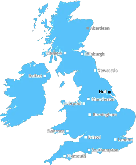
Hull (HU13)
The HU13 postcode area is located in the Hull postcode town region, within the county of Yorkshire, and contains a total of 502 individual postcodes.
There are 1 electoral wards in the HU13 postcode area, including Beverley, Brough, Cottingham, Hessle, Hornsea, Hull, North Ferriby, Withernsea which come under the local authority of the East Riding of Yorkshire Council.
Combining the whole postcode region, 21% of people in HU13 are classed as having an AB social grade, (i.e. 'white-collar' middle-upper class), compared to 27% across the UK.
This does not mean that the people of HU13 are poorer than other areas, but it may give an indication that there are areas of deprivation.
The HU13 postcode district is a district of Hull, in the East Riding of Yorkshire in the Northern region of England. It is located near to the city centre and covers the North Hull area, including the Holderness Road and Beverley Road areas. It includes a number of residential neighbourhoods and some commercial premises.
The district is bordered by the HU10 District to the west, the HU4 District to the south, the HU12 District to the east and the X12 District in the North East. The HU postcode area is made up of eight other postcode districts including HU1, HU2, HU3, HU4, HU5, HU6, HU7 and HU8.
Historically, the district has a strong affinity with Hull City Football Club and the region is home to many of the team's supporters. Hull City was actually founded as �Hull City Association Football and Athletic Club' in 1904 and later changed its name to Hull City Afc in 1914.
Residents in the district have access to shopping, leisure and entertainment venues on the lower half of Holderness Road and Beverley Road. Among these are Trinity Shopping Centre, Trinity Market and St Stephens Shopping Centre. The area around these shopping locations also offers a range of cinemas, pubs and bars as well as independent eateries, restaurants and caf�s.
Hull University is found within the district as well as Hessle High School and the Endeavour Learning and Skills Centre plus a range of primary schools. It is served by a number of bus services running through the district to the Hull Interchange for further transport links.
The HU13 District is home to a wealth of green spaces and parks, such as Avenues Park located on the site of a disused railway line. Other parks in the locality include Southcoates Lane Park and Steven's Park; both spacious and offering sports pitches, play areas, footpaths and plenty of grassed areas for recreation.
The HU13 district has plenty of amenities for its residents. With its close proximity to the city centre, there are excellent transport links, shops, leisure facilities, parks and a vibrant, supportive community. It's a great place to live, work and explore.

Demographics
Yorkshire

HU13 is located in the county of Yorkshire, in England.
Yorkshire has a total population of 0, making it the largest county in the UK.
Yorkshire has a total area of square miles, and a population density of people per square kilometre. For comparison, Greater London has a density of 5,618 people/km2.
| Outward Code | HU13 |
| Postal Town | Hull |
| MSOA Name | East Riding of Yorkshire 034 |
| LSOA Name | East Riding of Yorkshire 034B |
| County | Yorkshire |
| Region | Yorkshire |
| Country | England |
| Local Authority | East Riding of Yorkshire |
| Area Classification | Largely Rural (rural including hub towns 50-79%) |
HU13 Electoral Wards
The postal region of HU13, includes the local towns, villages, electoral wards and stations of:
Dig even deeper into the HU13 postcode by clicking on a postcode below:
Click on an outward postal code below for more information about the area. Each 'outward' postcode give you a comprehensive list of all postcodes within the outward code area (HU) and estimated address.
Click on an 'outward' code for more information. For example, the outward postcode page 'EC2M' will give you an alphabetical list covering all postcodes located in the region, from 'EC2M 1BB' through to 'EC2M 7YA'.
Chris H
Sunday, April 7, 2024
We don't have any views of HU13 right now. If you live in HU13 or have visited it, please help us to help others by telling others what you think of this neighbourhood.
Add your view of HU13
People need your local expertise. If you live in HU13 or have first-hand knowledge of the neighbourhood, please consider sharing your views. It's completely anonymous - all we ask is for your initials.
Please tell us what you like about the HU13 postcode area, what you don't like, and what it's like to live or work here.
| LOCAL AMENITIES | |
| FAMILY FRIENDLY | |
| PARKING | |
| GREEN SPACES |
From the Postcode Area blog

Deciphering Crime Rates - a Deep Dive Into UK Postcode Analysis
Ever wondered about the crime rate in your UK postcode? You're not alone. We've dug deep into the data, uncovering trends and patterns that'll make your head spin.

Death of the High Street?
The BBC reports that despite councils' attempts to kurb them, the UK's high streets have seen a huge growth in fast food outlets. Could this mark the death knell for the Great British high street, and what can we do about it to halt its decline?

Discrimination by Postcode
You really couldn't make it up, could you? Some of the country's most vulnerable people are missing out on their weekly £25 Cold Weather Payment, just because the system that's in operation is discriminating against them because payments are based on postcode, rather than geographic location.

The Redesign is Underway
Well, the current website was absolutely in dire need of a good redesign - from the ground up. So I set out to pull it all apart and get it up and running again to become the most comprehensive guide to every postcode in the UK. And it's been a long, tough job from start to finish - and quite possibly the biggest project I've ever undertaken.
SOCIAL GRADES
According to census records, 21% of people here have a social grade of AB (highest), compared to the national average of 27%.