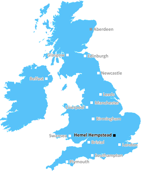
hemel-hempstead Postcodes
 Contains Ordnance Survey and Royal Mail data © Crown copyright and database right.
The Hemel Hempstead postcode region (HP) contains 24 unique 'outward' codes. Hemel Hempstead is the main postal town/district for this region, with all postcodes starting with the following outward codes.
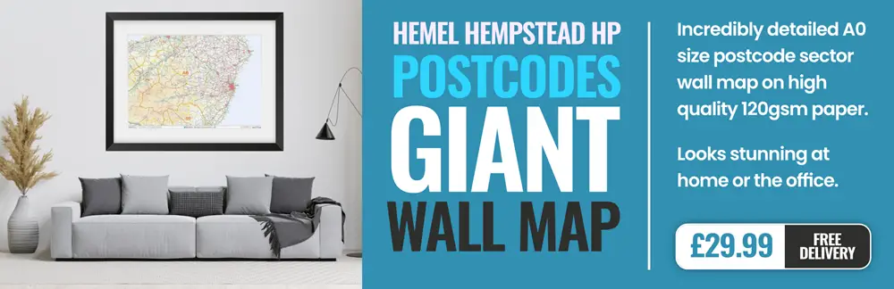
This page contains a list of postcodes for Hemel Hempstead area. Select a postcode to see the map location, demographics, house prices, local information, tourist guides and statistics:
Local demographics, guides and information
There's plenty of local information, guides and useful data to browse and explore, whether you're a Hemel Hempstead resident or a visitor to the area.
Scroll down to discover all you need to know about the Hemel Hempstead postcode area.
The HP postcode includes the following local authorities:
- Aylesbury Vale
- Central Bedfordshire
- Cherwell
- Chiltern
- Dacorum
- Luton
- South Bucks
- South Oxfordshire
- St Albans
- Three Rivers
- Wycombe
Local News Hertfordshire
No hosepipe ban, says Anglian Water
Anglian Water says it has no plans to restrict the use of hosepipes this summer.
BBC NewsRegion faces rail strike disruption
Industrial action will take place across five days affecting the Greater Anglia network.
BBC NewsFour-year-old girl and mum missing, say police
The pair were last seen at their home in February and have links to Birmingham, police say.
BBC News99 for a private ambulance in Hertfordshire
MET Medical has launched the service for St Albans, Harpenden, Hatfield and Welwyn.
BBC NewsBlackpool 0-0 Wycombe Wanderers
Blackpool were held to a 0-0 draw by Wycombe as the Seasiders' League One play-off hopes suffered a blow.
BBC NewsUniversal begins public meetings for UK theme park
The company says the public engagement does not mean the proposal is confirmed.
BBC NewsRazed speedway track cannot be revived - developers
East Herts Council is looking at "resolving planning breaches" at a former speedway racing venue.
BBC NewsGarrard to leave Boreham Wood at end of season
Luke Garrard will step down as Boreham Wood manager at the end of the season.
BBC NewsSpending a fortune on conveyancing?

Compare instant, low-cost online quotes from trusted conveyancing solicitors.
Backed by experts, our no-obligation service searches through the best conveyancing quotes on the market to save you time and money.
From the Postcode Area blog

Deciphering Crime Rates - a Deep Dive Into UK Postcode Analysis
Ever wondered about the crime rate in your UK postcode? You're not alone. We've dug deep into the data, uncovering trends and patterns that'll make your head spin.

Death of the High Street?
The BBC reports that despite councils' attempts to kurb them, the UK's high streets have seen a huge growth in fast food outlets. Could this mark the death knell for the Great British high street, and what can we do about it to halt its decline?

Discrimination by Postcode
You really couldn't make it up, could you? Some of the country's most vulnerable people are missing out on their weekly £25 Cold Weather Payment, just because the system that's in operation is discriminating against them because payments are based on postcode, rather than geographic location.

The Redesign is Underway
Well, the current website was absolutely in dire need of a good redesign - from the ground up. So I set out to pull it all apart and get it up and running again to become the most comprehensive guide to every postcode in the UK. And it's been a long, tough job from start to finish - and quite possibly the biggest project I've ever undertaken.