halifax HX6 Postcodes
Spending a fortune on conveyancing?

Compare instant, low-cost online quotes from trusted conveyancing solicitors.
Backed by experts, our no-obligation service searches through the best conveyancing quotes on the market to save you time and money.
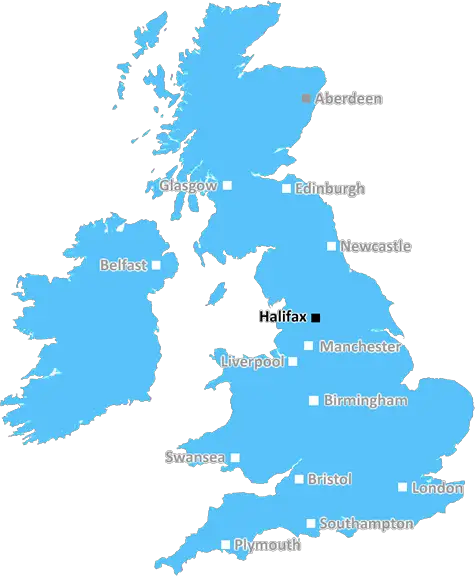
Halifax (HX6)
The HX6 postcode area is located in the Halifax postcode town region, within the county of West Yorkshire, and contains a total of 918 individual postcodes.
There are 44 electoral wards in the HX6 postcode area, including Elland, Halifax, Hebden Bridge, Sowerby Bridge which come under the local authority of the Calderdale Council.
Combining the whole postcode region, 23% of people in HX6 are classed as having an AB social grade, (i.e. 'white-collar' middle-upper class), compared to 27% across the UK.
This does not mean that the people of HX6 are poorer than other areas, but it may give an indication that there are areas of deprivation.
HX6 is a postcode district in Calderdale, West Yorkshire, England. It includes the town of Hebden Bridge, and surrounding villages including Blackshaw Head, Luddendenfoot, Midgley.
The HX6 postcode district covers a primarily rural area in the south-western part of the Calderdale borough of West Yorkshire, nestled between the valleys of the River Calder and Hebden Water. The area is rose amongst the spectacular scenery of the South Pennines. Hebden Bridge is the main settlement within the postcode district, and is well-known for its artistic and independent culture, an influx of people from across the world, and its many lovely cafes, galleries, and shops.
The postcode district is located 11 miles south-west of Halifax, and has a population of around 22,000 people across 8,500 households. Hebden Bridge is the major locality within the HX6 postal area, with the other localities being Mytholmroyd and Luddendenfoot.
The majority of the postcode district is rural and its terrain is hilly. At the highest point, in the area of Parlour Hill, 327m (1,074ft) above sea level. There is also some woodland in the district, such as Midgley Moor, Hope Wood and Male Hill, and industrial activity such as quarrying and farming.
HX6 is administered by Calderdale Council, and is an economically active area. Hebden Bridge is a centre of the local communications and data networks, being well served by road, rail and broadband links. Other services within the postcode district include schools, leisure and health services.
The district was first granted the HX6 postcode in the 1989 reorganisation of the British post system, and some postcoders span the River Calder and extend beyond the main postcode district boundary into other postcode districts such as the neighbouring HX7 and HD9.

Demographics
West Yorkshire

HX6 is located in the county of West Yorkshire, in England.
West Yorkshire has a total population of 2,299,700, making it the 4th largest county in the UK.
West Yorkshire has a total area of 783 square miles, and a population density of 1133 people per square kilometre. For comparison, Greater London has a density of 5,618 people/km2.
| Outward Code | HX6 |
| Postal Town | Halifax |
| MSOA Name | Calderdale 017 |
| LSOA Name | Calderdale 017D |
| County | West Yorkshire |
| Region | West Yorkshire |
| Country | England |
| Local Authority | Calderdale |
| Area Classification | Urban with Major Conurbation |
HX6 Electoral Wards
The postal region of HX6, includes the local towns, villages, electoral wards and stations of:
Dig even deeper into the HX6 postcode by clicking on a postcode below:
Click on an outward postal code below for more information about the area. Each 'outward' postcode give you a comprehensive list of all postcodes within the outward code area (HX) and estimated address.
Click on an 'outward' code for more information. For example, the outward postcode page 'EC2M' will give you an alphabetical list covering all postcodes located in the region, from 'EC2M 1BB' through to 'EC2M 7YA'.
Chris H
Sunday, April 7, 2024
We don't have any views of HX6 right now. If you live in HX6 or have visited it, please help us to help others by telling others what you think of this neighbourhood.
Add your view of HX6
People need your local expertise. If you live in HX6 or have first-hand knowledge of the neighbourhood, please consider sharing your views. It's completely anonymous - all we ask is for your initials.
Please tell us what you like about the HX6 postcode area, what you don't like, and what it's like to live or work here.
| LOCAL AMENITIES | |
| FAMILY FRIENDLY | |
| PARKING | |
| GREEN SPACES |
Local News West Yorkshire
Rapper Ja Rule denied UK entry ahead of Cardiff gig
The musician says his criminal record was the reason he has to shelve the British leg of his tour.
BBC NewsLeeds woman given terminal diagnosis after doctors missed tumour on scan
Leeds NHS trust says it is "deeply sorry" after Anne Shaw's cancer went undiagnosed for two years.
BBC NewsCounty Championship: Ben Mike helps Leicestershire into good position at Yorkshire
Ben Mike hits a brilliant counter-attacking 90 as Leicestershire's lower order carry their side to 354 on day two against Yorkshire.
BBC NewsHorbury: Plans to convert WW2 gas site into caf rejected
Objectors say the project would "fail to preserve the special historic interest" of the structure.
BBC NewsFebruary 29: 'Leaplings' finally get to celebrate their birthdays
Three people in Yorkshire born on 29 February can only mark their "real" birthdays every four years.
BBC NewsHalifax volunteers save 99-year-old library from closure
Volunteers say they are determined to make the library a community focal point.
BBC NewsElland waste tip to close for up to two weeks
The waste recycling centre's closure is to allow "essential drainage works" to take place.
BBC NewsPrincess Anne praises Rob Burrow for MND fundraising
The Princess Royal meets the ex-rugby league player at an event at Headingley Stadium in Leeds.
BBC NewsFrom the Postcode Area blog

Deciphering Crime Rates - a Deep Dive Into UK Postcode Analysis
Ever wondered about the crime rate in your UK postcode? You're not alone. We've dug deep into the data, uncovering trends and patterns that'll make your head spin.

Death of the High Street?
The BBC reports that despite councils' attempts to kurb them, the UK's high streets have seen a huge growth in fast food outlets. Could this mark the death knell for the Great British high street, and what can we do about it to halt its decline?

Discrimination by Postcode
You really couldn't make it up, could you? Some of the country's most vulnerable people are missing out on their weekly £25 Cold Weather Payment, just because the system that's in operation is discriminating against them because payments are based on postcode, rather than geographic location.

The Redesign is Underway
Well, the current website was absolutely in dire need of a good redesign - from the ground up. So I set out to pull it all apart and get it up and running again to become the most comprehensive guide to every postcode in the UK. And it's been a long, tough job from start to finish - and quite possibly the biggest project I've ever undertaken.
SOCIAL GRADES
According to census records, 23% of people here have a social grade of AB (highest), compared to the national average of 27%.